La Mirada in Los Angeles County, California — The American West (Pacific Coastal)
La Mirada Relay Station
Photographed by Andrew Ruppenstein, November 18, 2023
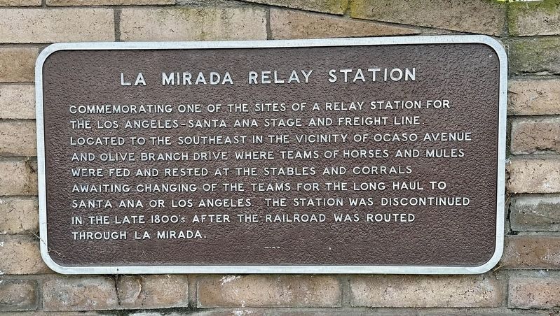
1. La Mirada Relay Station Marker
Commemorating one of the sites of a relay station for the Los Angeles-Santa Ana stage and freight line located to the southeast in the vicinity of Ocaso Avenue and Olive Branch Drive where teams of horses and mules were fed and rested at the stables and corrals awaiting changing of the teams for the long haul to Santa Ana or Los Angeles. The station was discontinued in the late 1800's after the railroad was routed through La Mirada.
Topics. This historical marker is listed in these topic lists: Industry & Commerce • Roads & Vehicles.
Location. 33° 54.957′ N, 118° 0.344′ W. Marker is in La Mirada, California, in Los Angeles County. It is at the intersection of Imperial Highway and Cordova Road, on the right when traveling east on Imperial Highway. Touch for map. Marker is at or near this postal address: 15220 Imperial Hwy, La Mirada CA 90638, United States of America. Touch for directions.

Regionally, this marker is in Greater Los Angeles and in the Transverse Ranges. It is also on the American Pacific Coast. Globally, it is in North America, on the
this page online
Other nearby markers. At least 8 other markers are within 3 miles of this marker, measured as the crow flies: Stagecoach Stop (here, next to this marker); Sutherland/Sanders Bell Tower (approx. 0.9 miles away); “Jesus Saves” Historic Replica (approx. 0.9 miles away); Zahur-ul-Haqq (approx. 0.9 miles away); La Mirada (approx. 1.8 miles away); Train Depot (approx. 1.8 miles away); West Coyote Field (approx. 2.2 miles away); First Krispy Kreme in California (approx. 2.3 miles away). Touch for a list and map of all markers in La Mirada.
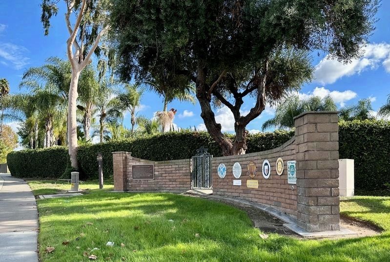
More about this marker. The marker is mounted to a decorative wall at the intersection of Cordova and Inperial Highway. Parking is not permitted on Imperial Highway.
Also see . . . Stage Coach Days in Orange County (OC Historyland). (Submitted on November 19, 2023.)
Photographed by Andrew Ruppenstein, November 18, 2023
2. La Mirada Relay Station Marker
Credits. This page was last revised on May 5, 2026. It was originally submitted on November 19, 2023, by Andrew Ruppenstein of Lamorinda, California. This page has been viewed 385 times since then and 37 times this year. Photos: 1, 2. submitted on November 19, 2023, by Andrew Ruppenstein of Lamorinda, California.
