Lower Providence Township near Eagleville in Montgomery County, Pennsylvania — The American Northeast (Mid-Atlantic)
Ira Allen
(1751 - 1814)
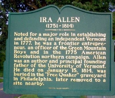
Photographed by William Fischer, Jr., July 3, 2009
1. Ira Allen Marker
Erected by The Ira Allen Society.
Topics and series. This historical marker is listed in these topic lists: Cemeteries & Burial Sites • Education • Religion & Religious Structures • War, US Revolutionary. In addition, it is included in the Quakerism series list. A significant historical month for this entry is January 1785.
Location. 40° 7.344′ N, 75° 26.121′ W. Marker is near Eagleville, Pennsylvania, in Montgomery County. It is in Lower Providence Township. It is on Audubon Road 0.1 miles east of Pawlings Road, on the right when traveling east. Marker is at the Audubon Recreation Fields. Touch for map. Marker is at or near this postal address: 2779 Audubon Rd, Norristown PA 19403, United States
this page online

Regionally, this marker is in Southeast Pennsylvania and in Greater Philadelphia. It is also in the American Northeast and in the Mid-Atlantic. Globally, it is in North America, the Western Hemisphere, the Western World, and the Anglosphere. Historically, it finds itself in what was once the Haudenosaunee (Iroquois) Confederacy and also one of the original Thirteen Colonies.
Other nearby markers. At least 8 other markers are within 2 miles of this marker, measured as the crow flies: Soldiers of Washington's Army (a few steps from this marker); Mill Grove (about 600 feet away, measured in a direct line); Timothy Matlack (approx. ¼ mile away); William White (approx. 1.2 miles away); Loyal Patriots of Valley Forge (approx. 1.2 miles away); National Patriots Bell Tower (approx. 1.2 miles away); General Lafayette (approx. 1.3 miles away); Black Patriots of the American Revolution (approx. 1.3 miles away).
Also see . . .
1. Ira Allen. (Submitted on October 25, 2009, by William Fischer, Jr. of Reynoldsburg, Ohio.)
2. Ira Allen at FindAGrave.com. (Submitted on July 20, 2011, by Mike Wintermantel of Pittsburgh, Pennsylvania.)
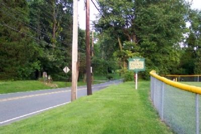
Photographed by William Fischer, Jr., July 3, 2009
2. Ira Allen Marker
Looking east along Audobon Road
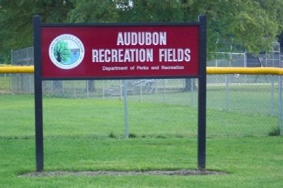
Photographed by William Fischer, Jr., July 3, 2009
3. Location of Ira Allen Marker
Credits. This page was last revised on February 7, 2023. It was originally submitted on October 25, 2009, by William Fischer, Jr. of Reynoldsburg, Ohio. This page has been viewed 1,394 times since then and 78 times this year. Photos: 1, 2, 3. submitted on October 25, 2009, by William Fischer, Jr. of Reynoldsburg, Ohio.
