
Mandells in Albuquerque in Bernalillo County, New Mexico — The American Mountains (Southwest)
McClellan Park
Photographed by J. Makali Bruton, October 23, 2023
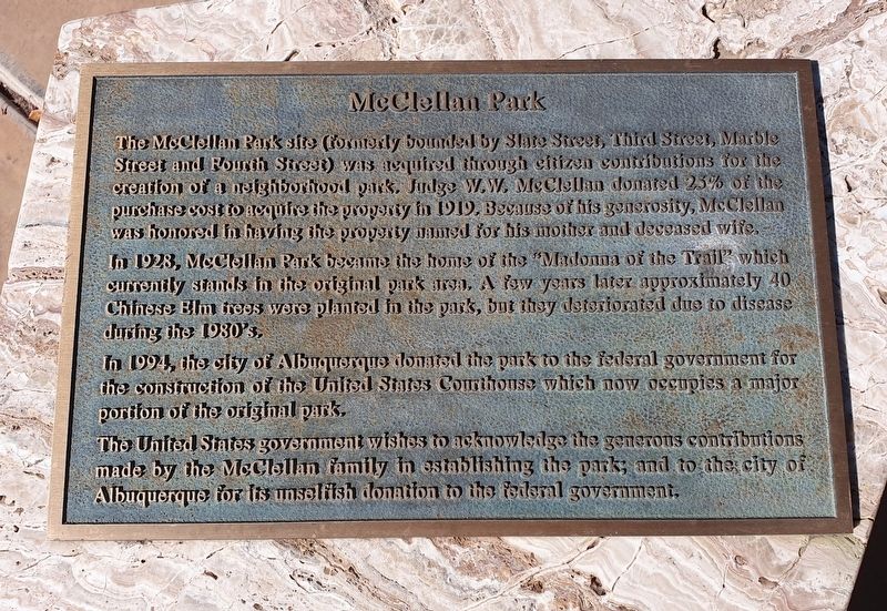
1. McClellan Park Marker
The McClellan Park site (formerly bounded by Slate Street, Third Street, Marble Street and Fourth Street) was acquired through citizen contributions for the creation of a neighborhood park, Judge W.W. McClellan donated 25% of the purchase cost to acquire the property in 1919. Because of his generosity, McClellan was honored in having the property named for his mother and deceased wife.
In 1923, McClellan Park became the home of the "Madonna of the Trail" which currently stands in the original park area. A few years later approximately 40 Chinese Elm trees were planted in the park, but they deteriorated due to disease during the 1980's.
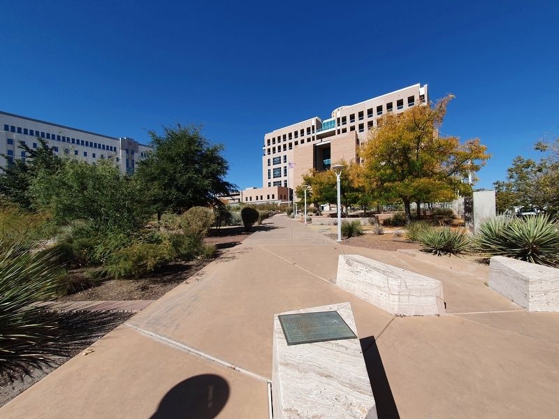
In 1994, the city of Albuquerque donated the park to the federal government for the construction of the United States Courthouse which now occupies a major portion of the original park.
The United States government wishes to acknowledge the generous contributions made by the McClellan family in establishing the park; and to the city of Albuquerque for its unselfish donation to the federal government.
Topics. This historical marker is listed in these topic lists: Charity & Public Work
this page online
Location. 35° 5.474′ N, 106° 38.96′ W. Marker is in Albuquerque, New Mexico, in Bernalillo County. It is in Mandells. It is at the intersection of Lomas Boulevard Northwest and 3rd Street Northwest, on the right when traveling west on Lomas Boulevard Northwest. The marker is duplicated at the corner of Lomas and 4th Street Northwest. Touch for map. Marker is in this post office area: Albuquerque NM 87102, United States of America. Touch for directions.

Regionally, this marker is in the American Southwest. Globally, it is in North America, the Western Hemisphere, the Western World, and the Anglosphere. Historically, it finds itself in what was once New Spain and also the Republic of Texas.
Other nearby markers. At least 8 other markers are within walking distance of this marker: Madonna of the Trail (about 600 feet away, measured in a direct line); W.E. Mauger House (approx. 0.3 miles away); Tijeras Canyon Road (approx. 0.3 miles away); Harwood School (approx. 0.3 miles away); Champion Grocery Building (approx. 0.4 miles away); Champion Grocery and Meat Market
Photographed by J. Makali Bruton, October 23, 2023
2. McClellan Park and Marker
Credits. This page was last revised on November 22, 2023. It was originally submitted on November 22, 2023, by J. Makali Bruton of Washington, District of Columbia. This page has been viewed 335 times since then and 46 times this year. Photos: 1, 2. submitted on November 22, 2023, by J. Makali Bruton of Washington, District of Columbia.
