Switzerland in St. Johns County, Florida — The American South (South Atlantic)
William Bartram Scenic Highway
Photographed by Mike Stroud, December 2, 2012
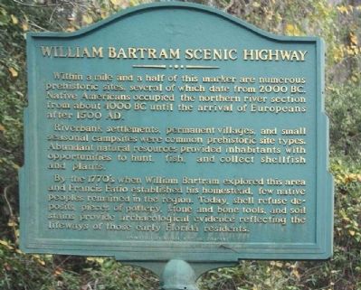
1. William Bartram Scenic Highway Marker
Within a mile and a half of this marker are numerous prehistoric sites, several of which date from 2000 BC. Native Americans occupied the northern river section from about 4000 BC until the arrival of Europeans after 1500 AD.
Riverbank settlements, permanent villages, and small seasonal campsites were common prehistoric site types. Abundant natural resources provided inhabitants with opportunities to hunt, fish and collect shellfish and plants.
By the 1770's, when William Bartram explored this area and Francis Fatio established his homestead, few native peoples remained in the region. Today, shell refuse deposits, pieces of pottery, stone and bone tools, and soil stains provide archaeological evidence reflecting the lifeways of those early Florida residents.
Erected by Sponsored By Arvida, A St. Joe Company.
Topics and series. This historical marker is listed in these topic lists: Anthropology & Archaeology • Exploration • Paleontology • Settlements & Settlers. In addition, it is included in the William Bartram Trails series list.
Location. 30° 2.743′ N, 81° 39.97′ W.
this page online

Regionally, this marker is in First Coast and in Greater Jacksonville. It is also in the American South and on the Eastern Seaboard. Globally, it is in the North Atlantic Region, North America, a Gulf of Mexico state, the Western Hemisphere, the Western World, and the Anglosphere. Historically, it finds itself in what was once New Spain, the territory of the Mississippian Culture, one of the Confederate States of America, and the Antebellum South.
Other nearby markers. At least 8 other markers are within 3 miles of this marker, measured as the crow flies: William Bartram Trail (approx. 0.7 miles away); Hibernia (approx. 2.3 miles away); St. Johns County / New Switzerland Plantation (approx. 2.3 miles away); St. Margaret's Episcopal Church and Cemetery (approx. 2.3 miles away); Alpine Groves (approx. 2.3 miles away); History of Alpine Groves Park (approx. 2.4 miles away); a different marker
Photographed by Mike Stroud, December 2, 2012
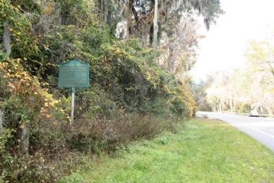
2. William Bartram Scenic Highway Marker, looking north along State Road 13
Also see . . . William Bartram Scenic & Historic Highway. Florida Scenic Highways website entry: (Submitted on September 10, 2023, by Larry Gertner of New York, New York.)
Photographed by Mike Stroud, December 2, 2012
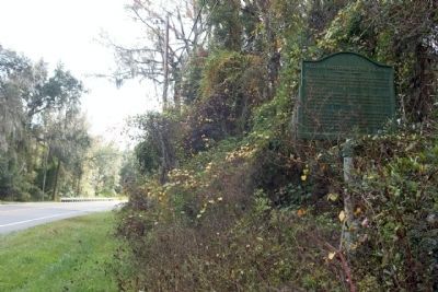
3. William Bartram Scenic Highway Marker looking southward
Credits. This page was last revised on December 2, 2023. It was originally submitted on December 19, 2012, by Mike Stroud of Bluffton, South Carolina. This page has been viewed 2,215 times since then and 46 times this year. Last updated on November 24, 2023, by Carl Gordon Moore Jr. of North East, Maryland. Photos: 1, 2, 3. submitted on December 20, 2012, by Mike Stroud of Bluffton, South Carolina. • Bernard Fisher was the editor who published this page.
