Grant Park in Chicago in Cook County, Illinois — The American Midwest (Great Lakes)
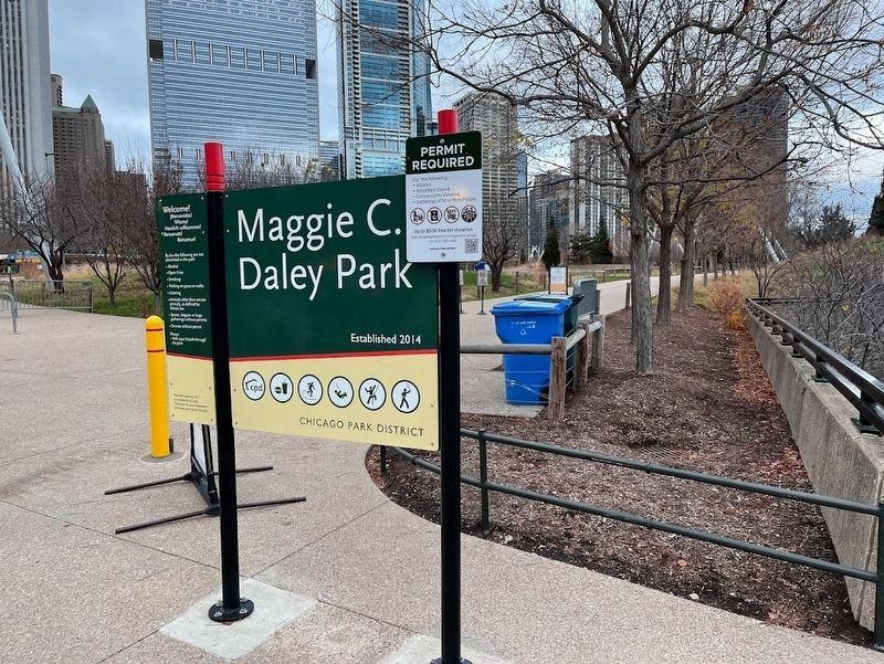
Maggie C. Daley Park
Established 2014
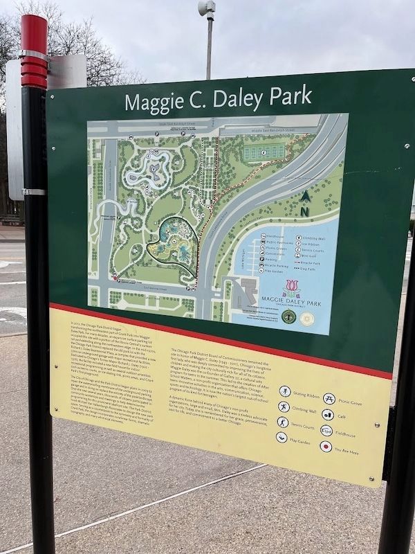
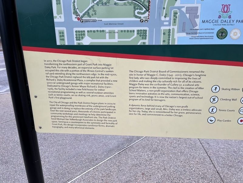
The City of Chicago and the Park District began plans in 2009 to repair the waterproofing membrane of the underground parking garage and in doing so replace the entirety of the park landscape. Over the next several years, thousands of citizens participated in community workshops and meetings to help determine the programming for this prominent lakefront site. The Park District hired Michael Van Valkenburgh Associates to design the new park space. Serving as a counterpoint to the symmetry and formality of Grant Park, the design incorporates curvilinear forms, dramatic topography, and many whimsical elements.
The Chicago Park District Board of Commissioners renamed the site in honor of Maggie C. Daley (1943-2011), Chicago's longtime first lady, who was deeply committed to improving the lives of children and making the city culturally rich for all of its citizens. Maggie Daley was the co-founder of Gallery 37, a cultural arts program for teens in the summer. This led to the creation of After School Matters, a non-profit organization that offers Chicago teens innovative activities in the arts, communication, science, sports and technology. It is now the nation's largest out-of-school program of its kind for teenagers.
A dynamic force behind many of Chicago's non-profit organizations, large and small, Mrs. Daley was a tireless advocate for her city. Today, she is remembered for her grace, perseverance, zest for life, and commitment to a better Chicago.
Erected by Chicago Park District.
Topics. This historical marker is listed in these topic lists: Parks & Recreational Areas • Women. A significant historical year for this entry is 2014.
Location. 41° 52.859′ N, 87° 37.219′ W. Marker is in Chicago, Illinois, in Cook County. It is in Grant Park. Marker is at the intersection of Monroe Street and Columbus Drive, on the right when traveling west on Monroe Street. The park sign is in the southwest corner entrance into Maggie Daley Park. The historical text is on the rear side. Touch for map. Marker is at or near this postal address: 337 East Randolph Street, Chicago IL 60601, United States of America. Touch for directions.
Other nearby markers. At least 8 other markers are within walking distance of this marker. Historic Michigan Boulevard (approx. 0.2 miles away); a different marker also named Historic Michigan Boulevard (approx. 0.2 miles away); The Sisters of Mercy (approx. ¼ mile away); Aaron Montgomery Ward (approx. ¼ mile away); a different marker also named Historic Michigan Boulevard (approx. ¼ mile away); a different marker also named Historic Michigan Boulevard (approx. 0.3 miles away); The Chicago Public Library Cultural Center (approx. 0.3 miles away); Jewelers Row (approx. 0.3 miles away). Touch for a list and map of all markers in Chicago.
More about this marker. The rear of the sign includes a map of Maggie Daley Park.
Regarding Maggie C. Daley Park. The 20-acre Maggie Daley Park, with a playground, miniature golf course, ice skating ribbon, rock-climbing wall, and tennis and pickleball courts, comprises an area in the northeast corner of the 300-acre Grant Park that had, for most of its existence, simply been known as North Grant Park. The park, announced in 2012 and finished in 2014, replaced an earlier plan to place a children's museum on
the site. That controversial plan, which would have gone against 1836 legislation (and affirmed four times since then by the Illinois Supreme Court) that declared the land east of Michigan Avenue to be "forever open, clear and free," was rendered moot when the children's museum decided to stay in its current Navy Pier location.
Also see . . .
1. Maggie Daley Park (official website). (Submitted on November 24, 2023, by Sean Flynn of Oak Park, Illinois.)
2. Maggie Daley Obituary. Maggie Daley, wife of long-time Chicago Mayor Richard M. Daley, died of cancer at age 68 in 2011, not long after her husband left office after 22 years. (Submitted on November 24, 2023, by Sean Flynn of Oak Park, Illinois.)
Photographed By Sean Flynn, March 31, 2016
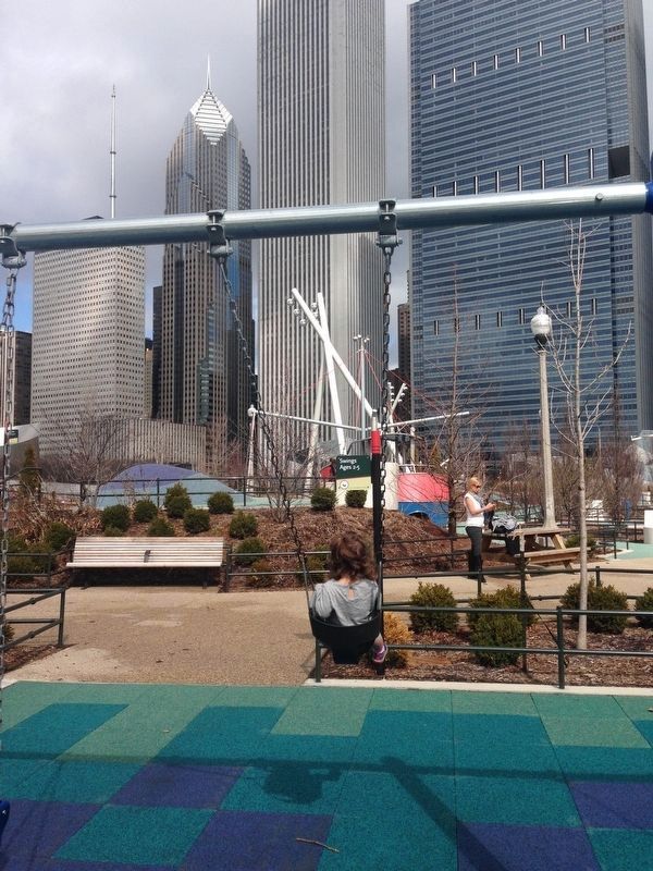
4. Maggie C. Daley Park
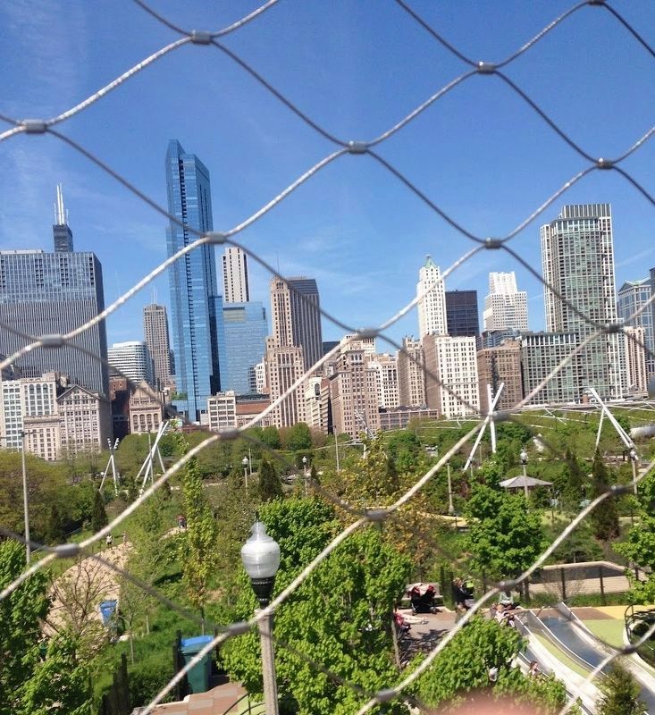
In this 2016 photo, the park is in the foreground with the northern side of the Grant Park skyline in the background. In the background from left to right are the two buildings of Prudential Plaza (originally 1 and 2 Prudential Plaza); Aon Center; and the Blue Cross Blue Shield Tower.
Library of Congress, Geography and Map Division, circa 1898
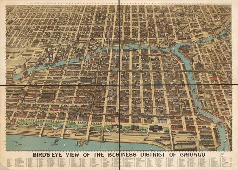
6. Bird's eye view of the business district of Chicago, 1898
This Poole Brothers map shows Chicago's core business district around the turn of the 20th century. The land that today is Maggie Daley Park was still at that point a railyard and the edge of Lake Michigan. On this map it would be in the bottom left corner of the bottom right quadrant.
Credits. This page was last revised on November 27, 2023. It was originally submitted on November 24, 2023, by Sean Flynn of Oak Park, Illinois. This page has been viewed 44 times since then and 17 times this year. Photos: 1, 2, 3, 4, 5. submitted on November 24, 2023, by Sean Flynn of Oak Park, Illinois. 6. submitted on November 25, 2023, by Sean Flynn of Oak Park, Illinois. • Andrew Ruppenstein was the editor who published this page.
