Gilead Township near Mount Gilead in Morrow County, Ohio — The American Midwest (Great Lakes)
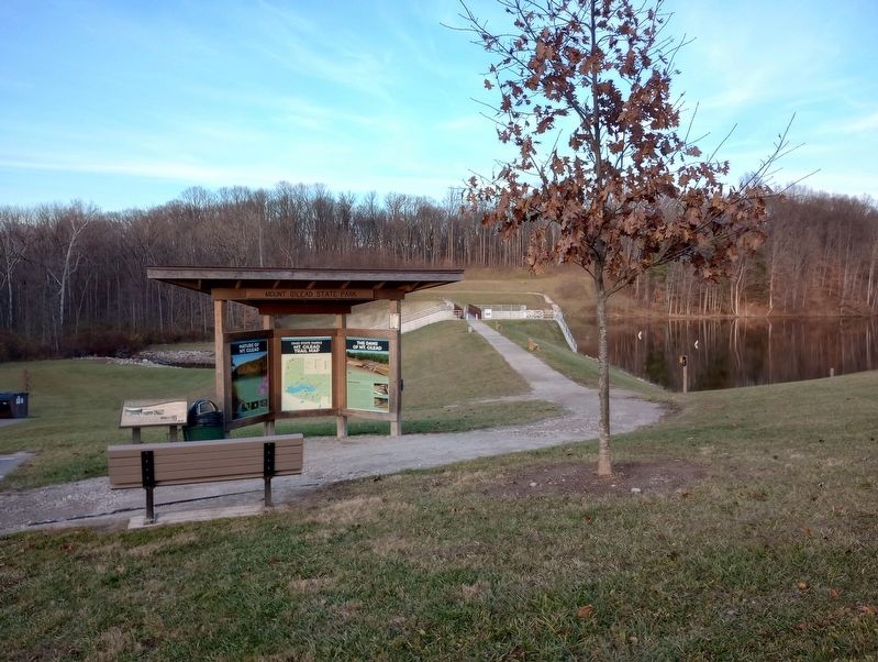
The Dams of Mt. Gilead
Safety
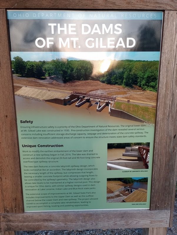
Ensuring infrastructure safety is a priority of the Ohio Department of Natural Resources. The original lower dam at Mt. Gilead Lake was constructed in 1930. Pre-construction investigation of the dam revealed several serious concerns including insufficient storage-discharge capacity, seepage and deterioration of the concrete spillway. The extensive dam renovation addressed areas of concern to ensure the structure meets state dam safety standards.
Unique Construction
Work to modify the earthen embankment of the lower dam and construct a new spillway began in Fall, 2016. The lake was drained to access and demolish the original 20-foot-tall and 90-foot-long concrete overflow-type spillway structure.
The new dam features a concrete labyrinth spillway design, which looks somewhat like an accordion. The labyrinth design incorporates the necessary length of the spillway, but compresses that length, leaving a smaller concrete footprint while allowing outgoing flows to be controlled by the spillway's geometry. The labyrinth design also allows lake levels to be maintained at a higher normal pool. This design is unique for Ohio dams, with similar spillway designs used in dam renovation at Lake Loramie, Indian Lake and Blue Rock state parks.
The extensive scope of improvements at Mt. Gilead State Park also includes improvements to the Upper Dam as well as the outflow channel below the Lower Dam and new spillway. The project allowed ODNR to accomplish a complete lake rehabilitation, leading to improved sport fishing, boating and paddling opportunities.
Erected by Ohio Department of Natural Resorrces.
Topics. This historical marker is listed in these topic lists: Architecture • Parks & Recreational Areas • Waterways & Vessels. A significant historical year for this entry is 1930.
Location. 40° 32.913′ N, 82° 49.102′ W. Marker is near Mount Gilead, Ohio, in Morrow County. It is in Gilead Township. Marker is on East High Street (Ohio Route 95) east of Bank Street, on the left when traveling east. Touch for map. Marker is at or near this postal address: 4101 East High Street, Mount Gilead OH 43338, United States of America. Touch for directions.
Other nearby markers. At least 8 other markers are within walking distance of this marker. Upper and Lower Dams (here, next to this marker); Mount Gilead Veterans Memorial (approx. 0.3 miles away); Morrow County Civil War Memorial (approx. 0.3 miles away); Morrow County Veterans Memorial Plaza (approx. 0.4 miles away); D.A.R. Revolutionary Soldiers Memorial (approx. 0.4 miles away); War Savings Quota (approx. half a mile away); Morrow County War Memorial (approx. half a mile away); Dawn Powell (approx. half a mile away). Touch for a list and map of all markers in Mount Gilead.
Credits. This page was last revised on December 7, 2023. It was originally submitted on November 26, 2023, by Craig Doda of Napoleon, Ohio. This page has been viewed 59 times since then and 22 times this year. Photos: 1, 2, 3, 4. submitted on November 26, 2023, by Craig Doda of Napoleon, Ohio. • Devry Becker Jones was the editor who published this page.


