Jackson in Cape Girardeau County, Missouri — The American Midwest (Upper Plains)
Most...are poor and exceedingly dissipated.
— Trail of Tears National Historic Trail —
Inscription.
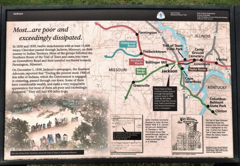
In 1838 and 1839, twelve detachments with at least 11,000 weary Cherokee passed through Jackson, Missouri, on their journey to Indian Territory. Most of the groups followed the Northern Route of the Trail of Tears and came into town on Greensferry Road and then traveled northwest towards Farmington, Missouri.
On December 1, 1838, Jackson's newspaper, the Southern Advocate, reported that “During the present week 1900 of this tribe of Indians, which the Government is engaged in removing, passed through our town. Some of them have considerable wealth, and make a very respectable appearance; but most of them are poor and exceedingly dissipated.” They still had 450 miles to go.
You can retrace their footsteps along the Trail of Tears in southeast Missouri.
Erected by Trail of Tears Association; Procter & Gamble; Cape Girardeau County Historical Society; and National Park Service.
Topics and series. This historical marker is listed in these topic lists: Native Americans • Roads & Vehicles. In addition, it is included in the Trail of Tears series list. A significant historical date for this entry is December 1, 1838.
Location. 37° 22.961′ N, 89° 40.065′ W. Marker is in Jackson, Missouri, in Cape Girardeau County. Marker is at the intersection of West Main Street and South High Street, on the left when traveling east on West Main Street. The marker is located beside the sidewalk on the south side of the Cape Girardeau County Courthouse. Touch for map. Marker is at or near this postal address: 100 Court Street, Jackson MO 63755, United States of America. Touch for directions.
Other nearby markers. At least 8 other markers are within 10 miles of this marker, measured as the crow flies. They Passed This Way (here, next to this marker); Pfc. Richard Wilson (approx. 5.1 miles away); Cape Girardeau Freedom Rock Veterans Memorial (approx. 5.1 miles away); Cape Girardeau (approx. 5.1 miles away); The History of the 140th Infantry Regiment (approx. 5.1 miles away); Bollinger Mill/Burfordville Covered Bridge (approx. 7˝ miles away); George & Fred Naeter (approx. 7.8 miles away); Old Lorimier Cemetery (approx. 9˝ miles away).
Related markers. Click here for a list of markers that are related to this marker.
Additional keywords. Most...are poor and exceedingly dissipated.
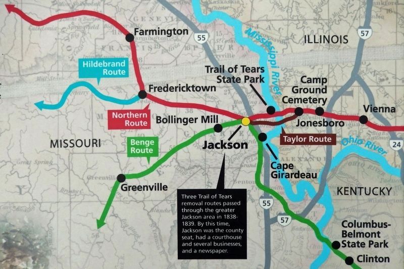
2. Marker detail: Trail of Tears Routes
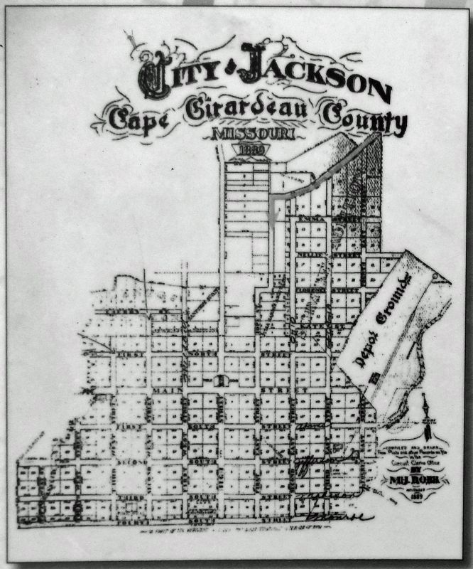
Three Trail of Tears removal routes passed through the greater Jackson area in 1838-1839. By this time, Jackson was the county seat, had a courthouse and several businesses, and a newspaper.
Background map: Samuel Mitchell, Reference & Distance Map Of The United States, 1834; David Rumsey Historical Map Collection.
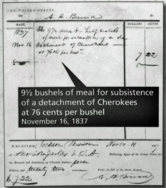
National Archives and Records Administration
3. Marker detail: November 16, 1837 Receipt
9˝ bushels of meal for subsistence of a detachment of Cherokees at 76 cents per bushel November 16, 1837.
Some Cherokee voluntarily removed to Indian Territory before 1838. B. B. Cannon led one such detachment of Cherokee in 1837. This receipt shows they passed through Jackson on November 16, 1837 and made a purchase from A. H. Brevard.
Credits. This page was last revised on November 27, 2023. It was originally submitted on November 26, 2023, by Cosmos Mariner of Cape Canaveral, Florida. This page has been viewed 67 times since then and 24 times this year. Photos: 1, 2, 3, 4, 5. submitted on November 26, 2023, by Cosmos Mariner of Cape Canaveral, Florida.
