Preque Isle Township near Presque Isle in Presque Isle County, Michigan — The American Midwest (Great Lakes)
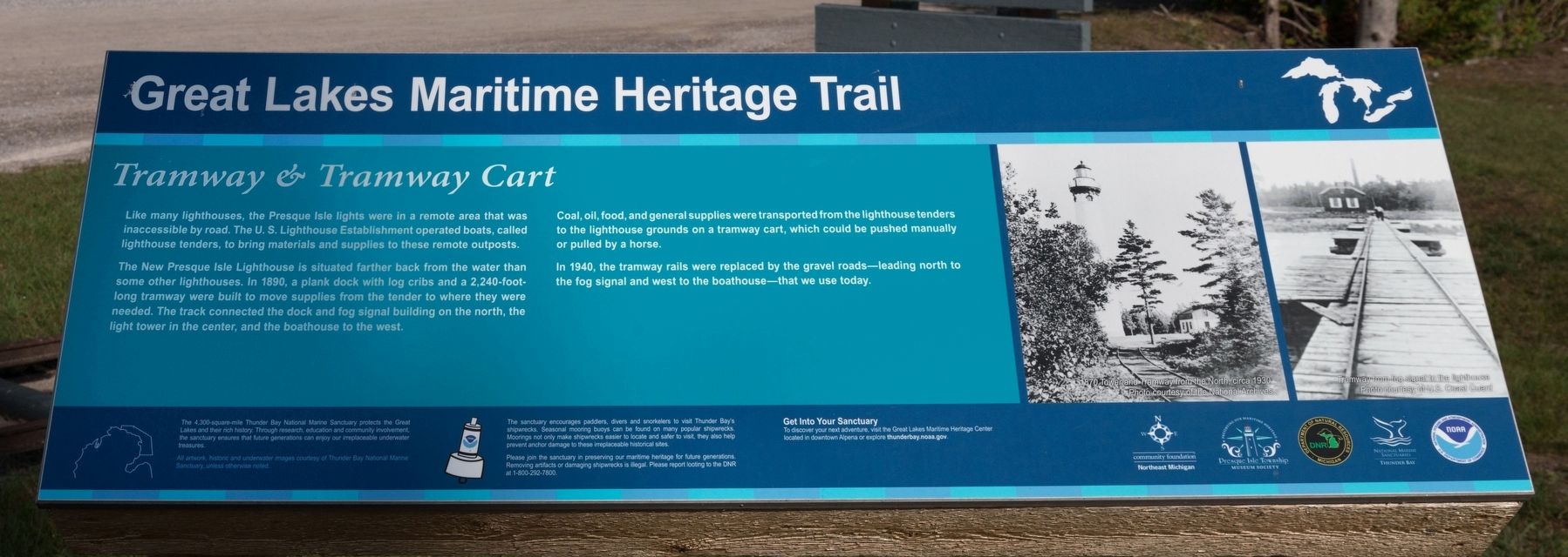
Tramway & Tramway Cart
| — | Great Lakes Maritime Heritage Trail | — |
Photographed by J. J. Prats, September 23, 2023
1. Tramway & Tramway Cart Marker
Like many lighthouses, the Presque Isle lights were in a remote area that was inaccessible by road. The U.S. Lighthouse Establishment operated boats, called lighthouse tenders, to bring materials and supplies to these remote outposts.
The New Presque Isle Lighthouse is situated farther back from the water than some other lighthouses. In 1890, a plank dock with log cribs and a 2.240-foot-long tramway were built to move supplies from the tender to where they were needed. The track connected the dock and fog signal building on the north, the light tower in the center, and the boathouse to the west.
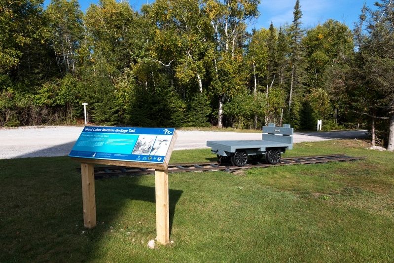
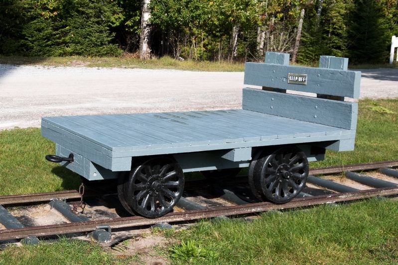
Coal, oil, food and general supplies were transported from the lighthouse tenders to the lighthouse grounds on a tramway cart, which could be pushed manually or pulled by a horse.
In 1940, the tramway rails were replaced by the gravel roads—leading north to the fog signal and west to the boathouse—that we use today.
Erected by Great Lakes Maritime Heritage Trail.
Topics and series. This historical marker is listed in this topic list: Waterways & Vessels. In addition, it is included in the Lighthouses
this page online
Location. 45° 21.398′ N, 83° 29.548′ W. Marker is near Presque Isle, Michigan, in Presque Isle County. It is in Preque Isle Township. It is on the northernmost end of East Grand Lake Road, on the left. Touch for map. Marker is at or near this postal address: 4500 E Grand Lake Rd, Presque Isle MI 49777, United States of America. Touch for directions.

Regionally, this marker is in Northern Michigan Lower Peninsula and in one of the Lake Huron Shore counties. It is also in the American Midwest. Globally, it is in North America, in the Great North Woods, on the Great Lakes, in the Western Hemisphere, in the Western World, and in the Anglosphere. Historically, it finds itself in what was once the Northwest Territory.
Other nearby markers. At least 8 other markers are within one mile of this marker, measured as the crow flies: Sanctuary Sentinels (a few steps from this marker); Lester R. Nichols II (a few steps from this marker); 1905 Keeper’s House (within shouting distance of this marker); Presque Isle Light Station (about 400 feet away, measured in a direct line); Old Presque Isle Lighthouse
Photographed by J. J. Prats, September 23, 2023
2. Tramway Cart and Marker
More about this marker. This interpretive panel is illustrated with two black and white photographs showing the tramway approaching the lighthouse and the tramway on the dock.
Photographed by J. J. Prats, September 23, 2023
3. Presque Isle New Lighthouse Tramway Cart
Credits. This page was last revised on November 28, 2023. It was originally submitted on November 27, 2023, by J. J. Prats of Powell, Ohio. This page has been viewed 157 times since then and 19 times this year. Photos: 1. submitted on November 27, 2023, by J. J. Prats of Powell, Ohio. 2, 3. submitted on November 28, 2023, by J. J. Prats of Powell, Ohio.
