Marshall in Madison County, North Carolina — The American South (South Atlantic)
Buncombe Turnpike
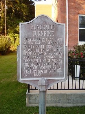
Photographed by Stanley and Terrie Howard, September 27, 2009
1. Buncombe Turnpike Marker
Topics. This historical marker is listed in this topic list: Roads & Vehicles. A significant historical year for this entry is 1827.
Location. 35° 47.853′ N, 82° 41.046′ W. Marker is in Marshall, North Carolina, in Madison County. It is at the intersection of Main Street and Bridge Street on Main Street. Touch for map. Marker is at or near this postal address: 58 Main St, Marshall NC 28753, United States of America. Touch for directions.

Regionally, this marker is in the Mountains. It is also in the American South, specifically in the Upper South, in Appalachia, and specifically in Southern Appalachia. Globally, it is in North America, the Western Hemisphere, the Western World, and the Anglosphere. Historically, it finds itself in what was once the original Cherokee Nation, the territory of the Mississippian Culture, one of the original Thirteen Colonies, one of the Confederate
this page online
Other nearby markers. At least 8 other markers are within 8 miles of this marker, measured as the crow flies: David Vance (here, next to this marker); The Charters of Freedom (here, next to this marker); Colonel Edward F. Rector, USAF (here, next to this marker); Col. Lawrence M. Allen House (within shouting distance of this marker); Marshall (about 300 feet away, measured in a direct line); Marshall High School (approx. 0.2 miles away); Jewell Hill (approx. 4.7 miles away); Wellness Center (approx. 7.7 miles away). Touch for a list and map of all markers in Marshall.
Another marker is no longer nearby. Robert E. Lee (was a few steps from this marker but has been confirmed missing).
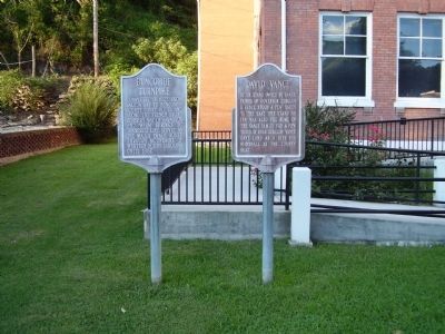
Photographed by Stanley and Terrie Howard, September 27, 2009
2. Buncombe Turnpike Marker
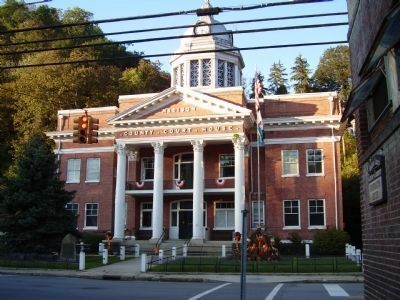
Photographed by Stanley and Terrie Howard, September 27, 2009
3. Madison County Court House
Marker is out of site to the left of the Court House.
Credits. This page was last revised on June 16, 2016. It was originally submitted on October 26, 2009, by Stanley and Terrie Howard of Greer, South Carolina. This page has been viewed 967 times since then and 45 times this year. Photos: 1, 2, 3. submitted on October 26, 2009, by Stanley and Terrie Howard of Greer, South Carolina. • Kevin W. was the editor who published this page.
