Near Grantsville in Garrett County, Maryland — The American Northeast (Mid-Atlantic)
Negro Mountain
The Highest Point on the National Road
— The Road That Built The Nation —
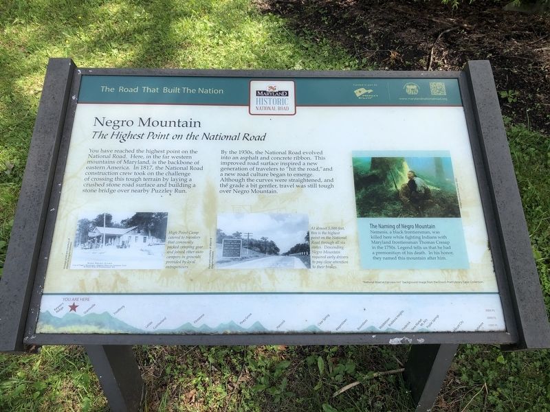
You have reached the highest point on the National Road. Here, in the far western mountains of Maryland is the backbone of eastern America. In 1817, the National Road construction crew took on the challenge of crossing this tough terrain by laying a crushed stone road surface and building a stone bridge over nearby Puzzley Run.
By the 1930s, the National Road evolved into an asphalt and concrete ribbon. This improved road surface inspired a new generation of travelers to “hit the road,” and a new road culture began to emerge. Although the curves were straightened, and the grade a bit gentler, travel was still tough over Negro Mountain.
At almost 3000 feet, this is the highest point on the National Road through all six states. Descending Negro Mountain required early drivers to pay close attention to their brakes.
High Point camp catered to travelers that commonly packed camping gear and joined other auto campers in grounds provided by entrepreneurs.
The Naming of Negro Mountain. Nemesis, a black frontiersman, was killed here while fighting Indians with Maryland frontiersman Thomas Cresap in the 1750s. Legend tells us that he had a premonition of his death. In his honor, they named this mountain after him.
Erected by America's Byways; Maryland National Road Association.
Topics and series. This historical marker is listed in these topic lists: African Americans • Natural Features • Roads & Vehicles. In addition, it is included in the The Historic National Road series list. A significant historical year for this entry is 1817.
Location. 39° 42.374′ N, 79° 12.68′ W. Marker is near Grantsville, Maryland, in Garrett County. Marker is at the intersection of National Pike (Alternate U.S. 40) and Zehner Road, on the left when traveling west on National Pike. Touch for map. Marker is in this post office area: Grantsville MD 21536, United States of America. Touch for directions.
Other nearby markers. At least 8 other markers are within 4 miles of this marker, measured as the crow flies. A different marker also named Negro Mountain (a few steps from this marker); Keyser's Ridge (approx. 2.1 miles away); General Braddock’s 5th Camp (approx. 2.1 miles away); The Fuller-Baker House (approx. 2.2 miles away); The National Road (approx. 3 miles away); Leo J. Beachy (approx. 3 miles away); Casselman Hotel (approx. 3.2 miles away); Traveling the National Road (approx. 3.2 miles away). Touch for a list and map of all markers in Grantsville.
Related marker. Click here for another marker that is related to this marker. This marker has replaced the linked marker.
Credits. This page was last revised on November 28, 2023. It was originally submitted on November 28, 2023, by Devry Becker Jones of Washington, District of Columbia. This page has been viewed 85 times since then and 41 times this year. Photos: 1, 2. submitted on July 19, 2020, by Devry Becker Jones of Washington, District of Columbia.

