Near Fort Towson in Choctaw County, Oklahoma — The American South (West South Central)
Doaksville Cemetery
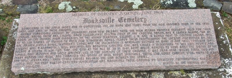
Memory of Dorothy J. Orton, June 1968
Established in the early 1800's, and in continuous use, its name was taken from the now vanished town of the same name, just East of these grounds.
Marble Tombstones, brought by steamboat from New Orleans, show the high regard frontier residents held for their leaders, among these are, Colonel David Folsom, first elected Chief of the Choctaw Nation, and a leader during the removal of the Indians from Mississippi to the Indian Territory, Colonel J.H. Nail is buried next to Colonel Folsom and he to, led parties of Indians to their new territorial homes. Nearby these frontiersmen the laconic inscription on this one marker simply reads, Tryphena's Grave and the inscription is appealing because of what is not said. Tryphena Wall Stewart was a remarkable, well educated, and beautiful Choctaw girl, was called a Missionary to her own people, and became a legend in her own time. She died at the age of 25 in 1849. Britt Willis, reputed to have been the owner of the slaves, Aunt Minerva and Uncle Wallace, lies in the serenity of these grounds. It was near here where these two pioneers hummed the music and composed the words of well known spirituals, "Swing Low, Sweet Chariot," "Steal Away to Jesus" and "Roll, Jordan, Roll." Many other graves pre-date the War Between the States. Since 1962, the Fort Towson Cemetery Association has maintained these grounds by voluntary contributions and fundraising projects. Donated by Don Robinson and Family.
Erected 1968 by Fort Towson Cemetery Association.
Topics. This historical marker is listed in these topic lists: Arts, Letters, Music • Cemeteries & Burial Sites • Native Americans • Settlements & Settlers.
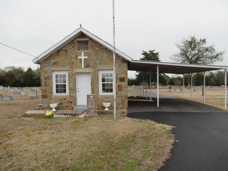
Location. 34° 1.977′ N, 95° 16.414′ W. Marker is near Fort Towson, Oklahoma, in Choctaw County. Marker is on Red Road, one mile north of U.S. 70, on the right when traveling north. The marker is located in the Fort Towson Cemetery. Touch for map. Marker is in this post office area: Fort Towson OK 74735, United States of America. Touch for directions.
Other nearby markers. At least 8 other markers are within walking distance of this marker. Dedicated To Veterans Who Served (here, next to this marker); Roads and Rivers (about 500 feet away, measured in a direct line); ...A Small But Pleasant Looking Village (about 600 feet away); The End of Doaksville (about 700 feet away); The Treaty of Doaksville, 1837 (about 800 feet away); Archaeology at Doaksville (approx. 0.2 miles away); Old Doaksville Cemetery (approx. 0.2 miles away); Doaksville History Trail (approx. 0.2 miles away). Touch for a list and map of all markers in Fort Towson.
Credits. This page was last revised on November 30, 2023. It was originally submitted on November 30, 2023, by Jason Armstrong of Talihina, Oklahoma. This page has been viewed 85 times since then and 52 times this year. Photos: 1, 2. submitted on November 30, 2023, by Jason Armstrong of Talihina, Oklahoma. • J. Makali Bruton was the editor who published this page.

