Milford Township in Pike County, Pennsylvania — The American Northeast (Mid-Atlantic)
Milford
East Stroudsburg 33
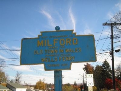
Photographed by Bill Coughlin, October 25, 2009
1. Milford Marker
Topics and series. This historical marker is listed in these topic lists: Colonial Era • Settlements & Settlers. In addition, it is included in the Pennsylvania Keystone Markers series list. A significant historical year for this entry is 1767.
Location. 41° 19.629′ N, 74° 48.639′ W. Marker is near Milford, Pennsylvania, in Pike County. It is in Milford Township. It is at the intersection of Grand Army of the Republic Hwy and Old Owego Tpk, on the right when traveling east on Grand Army of the Republic Hwy. Touch for map. Marker is at or near this postal address: 613 W Harford St, Milford PA 18337, United States of America. Touch for directions.

Regionally, this marker is in Pennsylvania’s Pocono Mountains. It is also in the American Northeast, in the Mid-Atlantic, in Appalachia, and specifically in Northern Appalachia. Globally, it is in North America, the Western Hemisphere, the Western World, and the Anglosphere. Historically, it finds itself in what was once the Haudenosaunee (Iroquois) Confederacy and also one of the original
this page online
Other nearby markers. At least 8 other markers are within walking distance of this marker: Gifford Pinchot (approx. 0.2 miles away); The Jervis Gordon Grist Mill (approx. ¼ mile away); 100 Mill Street (approx. 0.3 miles away); Milford School (approx. 0.4 miles away); Milford High School (approx. 0.4 miles away); 117 West Hartford Street (approx. 0.4 miles away); The Bait Box (approx. 0.4 miles away); Domestic Dwelling (approx. 0.4 miles away). Touch for a list and map of all markers in Milford.
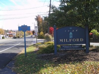
Photographed by Bill Coughlin, October 25, 2009
2. Milford Marker
Credits. This page was last revised on August 27, 2023. It was originally submitted on October 27, 2009, by Bill Coughlin of Woodland Park, New Jersey. This page has been viewed 1,022 times since then and 22 times this year. Photos: 1, 2. submitted on October 27, 2009, by Bill Coughlin of Woodland Park, New Jersey.
