
Leesylvania in Prince William County, Virginia — The American South (Mid-Atlantic)
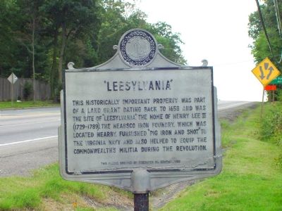
“Leesylvania”
Photographed by J. J. Prats, September 24, 2006
1. “Leesylvania” Marker
Marker has not been repainted in some time.
This historically important property was part of a land grant dating back to 1658 and was the site of “Leesylvania,” the home of Henry Lee II (1729–1789). The Neabsco Iron Foundry, which was located nearby, furnished “pig iron and shot” to the Virginia Navy and also helped to equip the Commonwealth’s militia during the Revolution.
Erected 1958 by The Tidewater Oil Company.
Topics. This historical marker is listed in these topic lists: Colonial Era • Settlements & Settlers • War, US Revolutionary. A significant historical year for this entry is 1658.
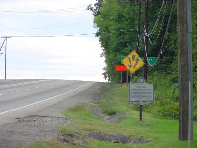
Location. Marker is missing. It was located near 38° 36.385′ N, 77° 17.556′ W. Marker was in Leesylvania, Virginia, in Prince William County. It was on Cardinal Drive (U.S. 1) south of Neabsco Road and Cardinal Drive, on the right when traveling south. Touch for map. Marker was at or near this postal address: 15950 Cardinal Dr, Woodbridge VA 22191, United States of America. Touch for directions.

Regionally, this marker was in the Washington Metropolitan Area, in Northern Virginia, and in the Piedmont. It was also in the American South, specifically in the
this page online
Other nearby markers. At least 8 other markers are within walking distance of this location: Neabsco Iron Works (approx. 0.2 miles away); Neabsco Ironworks & Mills (approx. 0.7 miles away); Julie J. Metz Amphitheater (approx. 0.8 miles away); a different marker also named Leesylvania (approx. 0.8 miles away); Confederate Winter Camps (approx. 0.8 miles away); War in the Chesapeake (approx. 0.8 miles away); Like to Eat? (approx. 0.8 miles away); Passing Blackburn House (approx. 0.9 miles away). Touch for a list and map of all markers in Leesylvania.
Another marker is no longer nearby. Events Along Neabsco Creek (was approx. 0.3 miles away but has been confirmed missing).
Regarding “Leesylvania”. The mansion burned in the late 1700s. Leesylvania State Park,
Photographed by J. J. Prats, September 24, 2006
2. “Leesylvania” Marker
Also see . . .
1. Leesylvania (plantation). Wikipedia entry (Submitted on April 21, 2024, by Larry Gertner of New York, New York.)
2. Leesylvania State Park. Virginia Department of Conservation and Recreation website entry (Submitted on April 21, 2024, by Larry Gertner of New York, New York.)
Credits. This page was last revised on April 21, 2024. It was originally submitted on December 19, 2006, by J. J. Prats of Powell, Ohio. This page has been viewed 1,923 times since then and 25 times this year. Last updated on December 4, 2023, by N. Jozsa of Woodbridge, Virginia. Photos: 1, 2. submitted on December 19, 2006, by J. J. Prats of Powell, Ohio. • Bernard Fisher was the editor who published this page.
