
Leesylvania in Prince William County, Virginia — The American South (Mid-Atlantic)
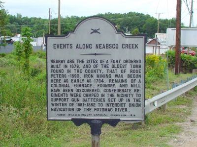
Events Along Neabsco Creek
Photographed by J. J. Prats, September 24, 2006
1. Events Along Neabsco Creek Marker
Erected 1976 by the Prince William County Historical Commission. (Marker Number 7.)
Topics and series. This historical marker is listed in these topic lists: Forts and Castles • Industry & Commerce • Settlements & Settlers • War, US Civil. In addition, it is included in the Virginia, Prince William County Historical Commission series list. A significant historical year for this entry is 1679.
Location. Marker is missing. It was located near 38° 36.637′ N, 77° 17.438′ W. Marker was in Leesylvania, Virginia, in Prince William County. It was on Jefferson Davis Highway (U.S. 1) north of Neabsco Road, on the right when traveling south. It is just south of the Neabsco Creek bridge. Touch for map. Marker was in this
this page online

Regionally, this marker was in the Washington Metropolitan Area, in Northern Virginia, and in the Piedmont. It was also in the American South, specifically in the Upper South, and in the Mid-Atlantic. Globally, it was in the North Atlantic Region, North America, the Western Hemisphere, the Western World, and the Anglosphere. Historically, it found itself in what was once the territory of the Mississippian Culture, one of the original Thirteen Colonies, one of the Confederate States of America, and the Antebellum South.
Other nearby markers. At least 8 other markers are within walking distance of this location: Neabsco Iron Works (about 700 feet away, measured in a direct line); Passing Blackburn House (approx. 0.6 miles away); Like to Eat? (approx. 0.6 miles away); Native Americans from Eastern Prince William County (approx. 0.6 miles away); The King's Highway (approx. 0.7 miles away); Neabsco Ironworks & Mills (approx. 0.7 miles away); Collo. Richard Blackburn (approx. 0.7 miles away); Stones, but No Bones (approx. 0.7 miles away).
Photographed by J. J. Prats, September 24, 2006
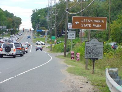
2. Events Along Neabsco Creek Marker
Traffic light in the distance is at Neabsco Road (left turn) and Cardinal Drive (right turn).
Another marker is no longer nearby. “Leesylvania” (was approx. 0.3 miles away but has been confirmed missing).
Also see . . . Featherstone National Wildlife Refuge. U.S. Fish & Wildlife Service website entry:
This refuge, located at the confluence of Neabsco Creek and the Potomac River, is closed to the public. (Submitted on December 18, 2006.)
Photographed by J. J. Prats, September 24, 2006
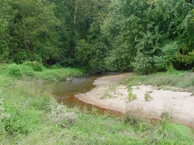
3. Neabsco Creek
This is the view west from the bridge. A few hundred feet to the east this small creek opens up into a wide cove on the Potomac River, most of which is the Featherstone National Wildlife Refuge.

Via Unknown, unknown
4. Site and remains of Tayloe's Iron Works.
Tayloe’s Iron Works were along Neabsco Creek, the “furnace, foundry and mill” mentioned here on the marker. Somewhere nearby, there’s a marker for the Neabsco Iron Works.
Credits. This page was last revised on December 7, 2023. It was originally submitted on December 18, 2006, by J. J. Prats of Powell, Ohio. This page has been viewed 2,970 times since then and 60 times this year. Last updated on December 6, 2023, by N. Jozsa of Woodbridge, Virginia. Photos: 1, 2, 3. submitted on December 18, 2006, by J. J. Prats of Powell, Ohio. 4. submitted on August 23, 2023, by Larry Gertner of New York, New York. • Bernard Fisher was the editor who published this page.
