Schodack in Rensselaer County, New York — The American Northeast (Mid-Atlantic)
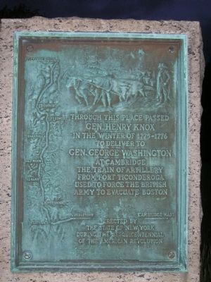
Gen. Henry Knox Trail
Photographed by Howard C. Ohlhous, May 15, 2008
1. Gen. Henry Knox Trail Marker NY-25 Schodack, NY
The Henry Knox Cannon Trail follows the route that Gen. Henry Knox used to transport 59 cannons from Fort Ticonderoga and Crown Point, New York to Cambridge, Massachusetts in the winter of 1775-1776.
Gen. Henry Knox
In the Winter of 1775 - 1776
To Deliver To
Gen. George Washington
At Cambridge
The Train of Artillery
From Fort Ticonderoga
Used to Force the British
Army to Evacuate Boston
Erected by
The State of New York
During the Sesquicentennial
of the American Revolution
Erected 1926 by State of New York. (Marker Number NY-25.)
Topics and series. This historical marker is listed in these topic lists: Roads & Vehicles • War, US Revolutionary. In addition, it is included in the Former U.S. Presidents: #01 George Washington, and the General Henry Knox Trail series lists. A significant historical year for this entry is 1775.
Location. 42° 33.924′ N, 73° 40.999′ W. Marker is in Schodack, New York, in Rensselaer County. It is at the intersection of Columbia Turnpike (U.S. 20) and North Old Post Road, on the right when traveling south on Columbia Turnpike. It is on the grounds of the Schodack Town Hall. Touch for map. Marker is at or near this postal address: 265 Schuurman Road, Castleton on Hudson NY 12033, United States of America. Touch for directions.

Regionally, this
this page online
Other nearby markers. At least 8 other markers are within 5 miles of this marker, measured as the crow flies: A different marker also named Gen. Henry Knox Trail (approx. 1.8 miles away); Citizen Genet (approx. 1.8 miles away); Van Wie Point (approx. 3.8 miles away); Van Wie’s Dock (approx. 3.8 miles away); Henry Hudson Park at Cedar Hill (approx. 4.1 miles away); Bethlehem's Historic Waterfront (approx. 4.2 miles away); Edmonia Lewis (approx. 4.3 miles away); Empire State Trail (approx. 4.3 miles away).
More about this marker. This marker was moved in 2025 from its original location at approx. 42° 32.882′ N, 73° 40.263′ W, the junction of New York State Route 9 and U.S. 20. It was in a small triangular green on the east side of Route 9 at the intersection
Photographed by Howard C. Ohlhous, May 15, 2009
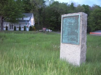
2. Gen. Henry Knox Trail Marker at its original location
It was in the small triangular green at the junction of Routes 20 and 9. The marker was mounted so that it faced the traffic on NY Route 9. US Route 20 is in the background.
The marker consists of a bronze plaque mounted on a large stone base. The plaque is attributed to sculptor Henry James Albright, 1887-1951.
A bas-relief plaque on a stone marker commemorates General Henry Knox's delivery of artillery from Fort Ticonderoga to General George Washington at Cambridge, Massachusetts in the winter of 1775-1776. The image on the relief plaque depicts a young male figure driving a team of oxen. A uniformed male, probably General Knox, stands to the far right. The left side of the plaque contains a map that traces Knox's route from Fort Ticonderoga to Cambridge, also naming Ft George, Ft Edward, Saratoga, Halfmoon, Albany, Kinderhook, Claverach, and Noblestown.
Regarding Gen. Henry Knox Trail. The Henry Knox Cannon Trail denotes the path followed by Colonel Knox and his men from December 1775 to January 1776 to transport 59 captured weapon pieces from Fort Ticonderoga and Crown Point on Lake Champlain, New York to General George Washington at Dorchester Heights overlooking Boston, Massachusetts.
This pivotal event of the American Revolution resulted in the evacuation

Photographed by Howard C. Ohlhous, May 15, 2008
3. Marker at its original location
Its original location was within the Town of Schodack. In this photo Rte 20 is in the foreground. The automobile is on Rte 9 which veers south in the background.
The Advisory Board on Battlefields and Historic Sites recommended that the state of New York purchase 30 granite markers in identical pattern, each with a bronze tablet featuring a map of the trail, an image in relief of cannon being dragged by ox sled through the snow, and the words:
"Through this place passed General Henry Knox in the winter of 1775 - 1776 to deliver to General George Washington at Cambridge the Train of Artillery from Fort Ticonderoga used to force the British army to evacuate Boston. Erected by the State of New York 1927."
In all, 30 of the bronze plaques are in New York State and 26 in Massachusetts. They represent the 56-day journey of American troops from Fort Ticonderoga to Boston.
The monuments were erected beginning in 1926, during the commemoration of the 150-year anniversary of the American Revolution, and completed in 1927. The trail is one of the earliest heritage paths created in the United States.
According to the Hudson River Valley Institute website, General Washington believed he could dislodge the British from the city, and dispatched Henry Knox, a 25-year-old
Photographed by Howard C. Ohlhous, May 15, 2008
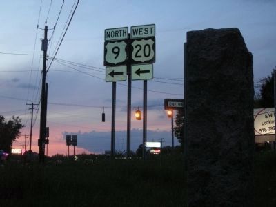
4. Sunset photo at the marker's original location
The marker stone is on the right, located at the junction of Routes 9 & 20. It has since been moved to the Town Hall grounds.
Henry Knox arrived at Fort Ticonderoga on the evening of December 5, 1775 accompanied by his 19-year-old brother William and a servant, Miller. Early the next day, assisted by the garrison of Fort Ticonderoga, he began to move the guns, including 43 heavy brass and iron cannons, 6 coehorns, 8 mortars and 2 howitzers.
In the second week of March, 1776, four months before the Declaration of Independence was signed, General Washington was ready to bombard the British in Boston from Dorchester Heights, using the array of heavy guns General Knox had laboriously dragged from Lake Champlain.
Lord William Howe recognized that only the evacuation of his army could save it, and on March 18 the victorious American army marched into the deserted city.
Related markers. Click here for a list of markers that are related to this marker. These markers follow the route used by Knox to transfer cannons
Photographed by Bill Coughlin, July 11, 2008
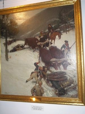
5. The Noble Train of Artillery
This Tom Lovell painting of General Knox and his soldiers transporting the cannons is on display at Fort Ticonderoga.
Also see . . . "Major General Henry Knox" biography from The American Revolution Homepage website. (Submitted on October 28, 2009, by Howard C. Ohlhous of Duanesburg, New York.)
Additional commentary.
1. This Marker has been moved!
Marker NY-25 was moved in 2025 from its location at the junction of Routes 20 and 9 to the site of the Schodack Town Hall at 265 Schuurman Road in Schodack.
The Schodack Town Hall is located at 265 Schuurman Road, Castleton-on-Hudson, NY. It sits just off the US Route 9 and 20 corridor, at the corner of Schuurman Road, and is situated directly across from the busy commercial plaza area with retail stores and the general Route 9 diner corridor.
The municipal building houses multiple town government services, including the Town Supervisor, Town Clerk, Building Department, and the Town Justice Court. A local historical group requested that the town relocate the marker because it was hard to find at the former location. The new location is also thought to be near where the train passed by, near where the town hall happened to be at the time.
During
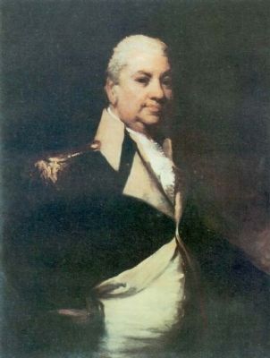
Photographed by U.S. Army Center Of Military History
6. Gen. Henry Knox
Born in Boston, July 25, 1750, and died Oct. 25, 1806
— Submitted June 2, 2026, by Lea Bishop of Hopewell Junction, New York.
Additional keywords. George Washington, Ft George, Ft Edward, Saratoga, Halfmoon, Albany, Kinderhook, Claverach, Noblestown, Cambridge, Heritage Trail, Canon Trail, oxen
Credits. This page was last revised on June 21, 2026. It was originally submitted on October 28, 2009, by Howard C. Ohlhous of Duanesburg, New York. This page has been viewed 2,475 times since then and 84 times this year. Photos: 1, 2, 3, 4. submitted on October 28, 2009, by Howard C. Ohlhous of Duanesburg, New York. 5. submitted on July 24, 2009, by Bill Coughlin of Woodland Park, New Jersey. 6. submitted on October 28, 2009, by Howard C. Ohlhous of Duanesburg, New York. • Kevin W. was the editor who published this page.
Editor’s want-list for this marker. Photos of the marker showing it and its environment in its new location at town hall • Also the exact map coordinates of its new location • Can you help?
