Mankato in Blue Earth County, Minnesota — The American Midwest (Upper Plains)
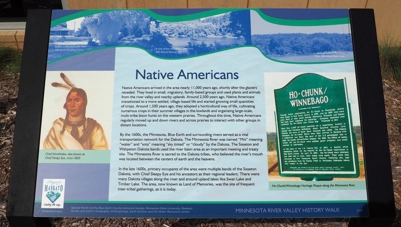
Native Americans
— Minnesota River Valley History Walk —
Native Americans arrived in the area nearly 11,000 years ago, shortly after the glaciers receded. They lived in small, migratory, family-based groups and used plants and animals from the river valley and nearby uplands. Around 2,500 years ago, Native Americans transitioned to a more settled, village-based life and started growing small quantities of crops. Around 1,500 years ago, they adopted a horticultural way of life, cultivating numerous crops in their summer villages in the lowlands and organizing large-scale multi-tribe bison hunts on the western prairies. Throughout this time, Native Americans regularly moved up and down rives and across prairies to interact with other groups in distant locations.
By the 1600s, the Minnesota, Blue Earth and surrounding rivers served as a vital transportation network for the Dakota. The Minnesota River was named "Mni" meaning "water" and "sota" meaning "sky tinted" or "cloudy" by the Dakota. The Sisseton and Wahpeton Dakota bands used the river basin area as an important meeting and treaty site. The Minnesota River is sacred to the Dakota tribes, who believed the river's mouth was located between the centers of earth and the heavens.
In the late 1600s, primary occupants of the area were multiple bands of the Sisseton Dakota, with Chief Sleepy Eye and his ancestors as their regional leaders. There were many Dakota villages along the river and around upland lakes like Swan Lake and Timber Lake. The area, now known as Land of Memories, was the site of frequent inter-tribal gatherings, as it is today.
Buffalo in Reconciliation Park, 100 North Riverfront Drive.
A view of the river from Sibley Park, 900 Mound Avenue.
View of Land of Memories Park, 300 Amos Owen Lane.
Chief Ishtakhaba, also known as Chief Sleepy Eye, circa 1850.
Ho-Chunk/Winnebago Heritage Plaque along the Minnesota River.
Special thanks to the Blue Earth County Historical Society, Minnesota State University, Mankato faculty and staff in Geography, Anthropology, Earth Science and the Water Resources Center.
Erected 2019 by City of Mankato.
Topics. This historical marker is listed in these topic lists: Native Americans • Waterways & Vessels.
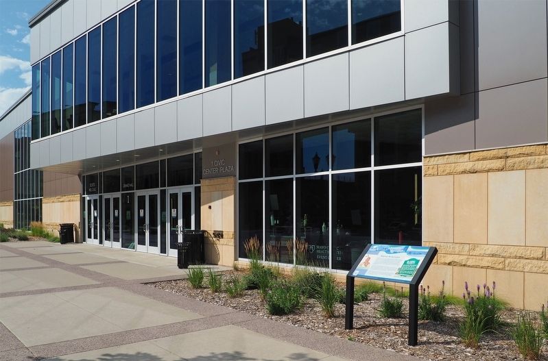
Location. 44° 9.912′ N, 94° 0.203′ W. Marker is in Mankato, Minnesota, in Blue Earth County. Marker is at the intersection of Civic Center Plaza (Hickory Street) and S. 2nd Street, on the right when traveling west on Civic Center Plaza (Hickory Street). The marker is outside Door 1 of the Mankato Civic Center. Touch for map
. Marker is at or near this postal address: 1 Civic Center Plaza, Mankato MN 56001, United States of America. Touch for directions.
Other nearby markers. At least 8 other markers are within walking distance of this marker. Early European Explorers (within shouting distance of this marker); Early Settlers (within shouting distance of this marker); Navigating the River (within shouting distance of this marker); Sinclair Lewis House (about 600 feet away, measured in a direct line); Korean War (approx. 0.2 miles away); Dakota (Sioux) Memorial – 1862 (approx. 0.2 miles away); Minnesota River Steamboating (approx. 0.2 miles away); The Lorin & Lulu Cray Home (approx. ¼ mile away). Touch for a list and map of all markers in Mankato.
Related marker. Click here for another marker that is related to this marker. The nearby Ho-Chunk/Winnebago marker depicted on this marker
Credits. This page was last revised on December 18, 2023. It was originally submitted on December 10, 2023, by McGhiever of Minneapolis, Minnesota. This page has been viewed 59 times since then and 30 times this year. Photos: 1, 2. submitted on December 10, 2023, by McGhiever of Minneapolis, Minnesota. • J. Makali Bruton was the editor who published this page.

