Fort Snelling in Hennepin County, Minnesota — The American Midwest (Upper Plains)
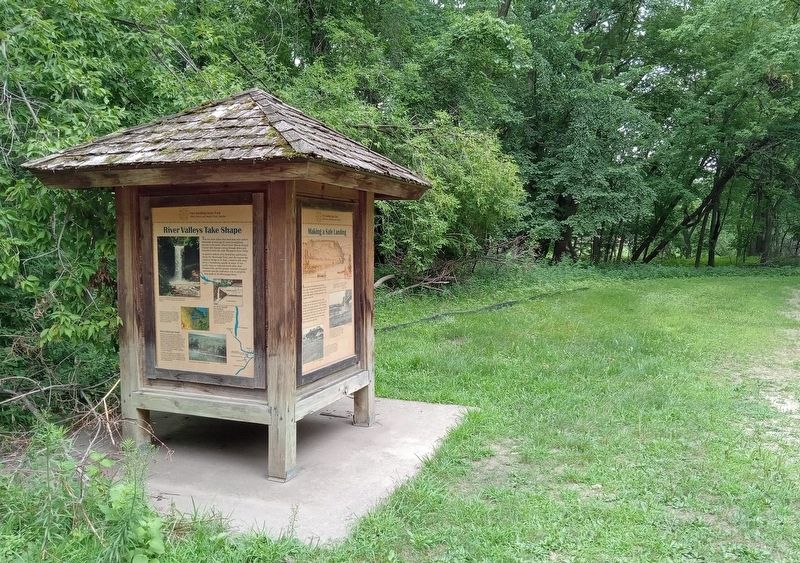
River Valleys Take Shape / A Strategic Advantage / Making a Safe Landing
Fort Snelling State Park
— Where Rivers and People Come Together —
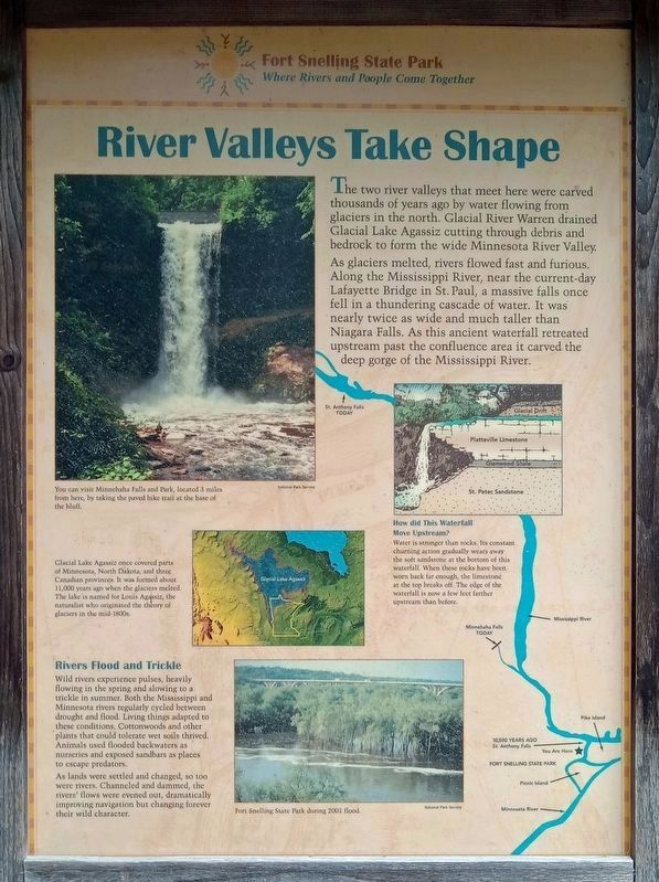
The two river valleys that meet here were carved thousands of years ago by water flowing from glaciers in the north. Glacial River Warren drained Glacial Lake Agassiz cutting through debris and bedrock to form the wide Minnesota River Valley.
As glaciers melted, rivers flowed fast and furious. Along the Mississippi River, near the current-day Lafayette Bridge in St. Paul, a massive falls once fell in a thundering cascade of water. It was nearly twice as wide and much taller than Niagara Falls. As this ancient waterfall retreated upstream past the confluence area it carved the deep gorge of the Mississippi River.
You can visit Minnehaha Falls and Park, located 3 miles from here, by taking the paved bike trail at the base of the bluff.
How did This Waterfall Move Upstream?
Water is stronger than rocks. Its constant churning action gradually wears away the soft sandstone at the bottom of this waterfall. When these rocks have been worn back far enough, the limestone at the top breaks off. The edge of the waterfall is now a few feet farther upstream than before.
Rivers Flood and Trickle
Wild rivers experience pulses, heavily flowing in the spring and slowing to a trickle in summer. Both the Mississippi and Minnesota rivers regularly cycled between drought and flood. Living things adapted to these conditions. Cottonwoods and other plants that could tolerate wet soils thrived. Animals used flooded backwaters as nurseries and exposed sandbars as places to escape predators.
As lands were settled and changed, so too were rivers. Channeled and dammed, the rivers' flows were evened out, dramatically improving navigation but changing forever their wild character.
Fort Snelling State Park during 2001 flood.
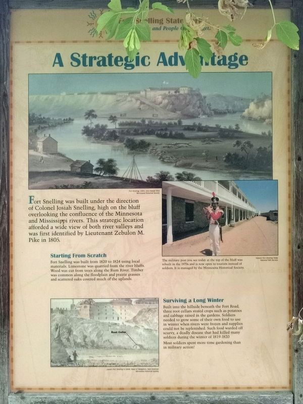
Fort Snelling, 1844, John Casper Wild
Fort Snelling was built under the direction of Colonel Josiah Snelling, high on the bluff overlooking the confluence of the Minnesota and Mississippi rivers. This strategic location afforded a wide view of both river valleys and was first identified by Lieutenant Zebulon M. Pike in 1805.
Starting From Scratch
Fort Snelling was built form 1820 to 1824 using local materials. Limestone was quarried from the river bluffs. Wood was cut from trees along the Rum River. Timber was common along the floodplain and prairie grasses and scattered oaks covered much of the uplands.
Historic Fort Snelling Today
The military post you see today at the top of the bluff was rebuilt in the 1970s and is now open to tourists instead of soldiers. It is managed by the Minnesota Historical Society.
Surviving a Long Winter
Built into the hillside beneath the Fort Road, three root cellars stored crops such as potatoes and cabbage raised in the gardens. Soldiers needed to grow some of their own food to use in winter when rivers were frozen and supplies could not be replenished. Such food warded off scurvy, a deadly disease that had killed many soldiers during the winter of 1819-1820.
Most soldiers spent more time gardening than in military action!
(detail) Fort Snelling in 1848, Head of Navigation, Seth Eastman
Fort Snelling in 1848, Head of Navigation, Seth Eastman
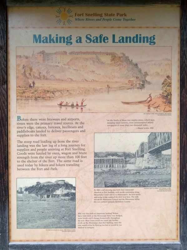
Before there were freeways and airports, rivers were the primary travel routes. At the river's edge, canoes, bateaux, keelboats and paddleboats landed to deliver passengers and supplies to the fort.
The steep road leading up from the river landing was the last leg of a long journey for supplies and people arriving at Fort Snelling. Goods were hauled by oxen, wagon and brute strength from the river up more than 100 feet to the shelter of the Fort. The same road is used today by bikers and hikers traveling between the Fort and Park.
"on the banks of these two mighty rivers, which here, mingling their currents, form uninterrupted inland navigation of more than two thousand miles...—Henry Lewis, 1858
In 1865 a rail crossing was built that connected Mendota to Fort Snelling, with tracks continuing along Minnehaha Creek and on to Minneapolis. An iron trestle and swing bridge spanned the river near here. The rails served the Minnesota Central and the Minnesota Valley, the two earliest railroads in Dakota County.
Milwaukee Short Line Bridge at Fort Snelling, ca. 1880, Benjamin Franklin Upton
Why was this such an important landing? Before dams were built or the Mississippi River was dredged, water levels could change dramatically throughout the year. Most boats could not travel any further north on the Mississippi than Fort Snelling, since the river would either be flowing too fast or would be too shallow to navigate.
Fort Snelling during the dry season, 1862, William H. Jacoby
Explore Your Mississippi
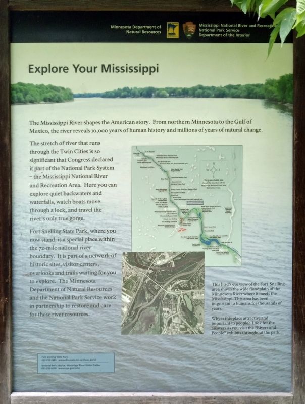
The Mississippi River shapes the American story. From northern Minnesota to the Gulf of Mexico, the river reveals 10,000 years of human history and millions of years of natural change.
The stretch of river that runs through the Twin Cities is so significant that Congress declared it part of the National Park System – the Mississippi National River and Recreation Area. Here you can explore quiet backwaters and waterfalls, watch boats move through a lock, and travel the river's only true gorge.
Fort Snelling State Park, where you now stand, is a special place within the 72-mile national river boundary. It is part of a network of historic sites, visitor centers, overlooks and trails waiting for you to explore. The Minnesota Department of Natural Resources and the National Park Service work in partnership to restore and care for these river resources.
This bird's eye view of the Fort Snelling area shows the wide floodplain of the Minnesota River where it meets the Mississippi. This area has been important to humans for thousands of years.
Why is this place attractive and important to people? Look for the answers as you visit the "Rivers and People" exhibits throughout the park.
Erected by Minnesota Department of Natural Resources, National Park Service.
Topics. This historical marker is listed in these topic lists: Environment • Forts and Castles • Railroads & Streetcars • Waterways & Vessels.
Location. 44° 53.505′ N, 93° 10.752′ W. Marker is in Fort Snelling, Minnesota, in Hennepin County. Marker can be reached from the Minnehaha Trail north of Snelling Lake Road, on the right when traveling north. The marker is in Fort Snelling State Park (vehicle permit required), on a kiosk opposite the foot of the path leading up to the fort. Touch for map. Marker is in this post office area: Minneapolis MN 55417, United States of America. Touch for directions.
Other nearby markers. At least 8 other markers are within walking distance of this marker. Land Between Two Rivers (about 600 feet away, measured in a direct line); Three Sisters Garden (about 800 feet away); Wokiksuye K'a Woyuonihan (about 800 feet away); St. Peters Agency (approx. 0.2 miles away); Welcome to Fort Snelling State Park / A Moving Obstacle (approx. 0.2 miles away); Executions at Fort Snelling (approx. 0.2 miles away); Imprisonment of Dakota Families (approx. 0.2 miles away); US–Dakota War of 1862 (approx. 0.2 miles away). Touch for a list and map of all markers in Fort Snelling.
Credits. This page was last revised on December 18, 2023. It was originally submitted on December 10, 2023, by McGhiever of Minneapolis, Minnesota. This page has been viewed 64 times since then and 21 times this year. Photos: 1, 2, 3, 4, 5. submitted on December 10, 2023, by McGhiever of Minneapolis, Minnesota. • J. Makali Bruton was the editor who published this page.
