Elliott State Forest near Allegany in Coos County, Oregon — The American West (Northwest)
Jerry Phillips Reserve
Elliott State Forest
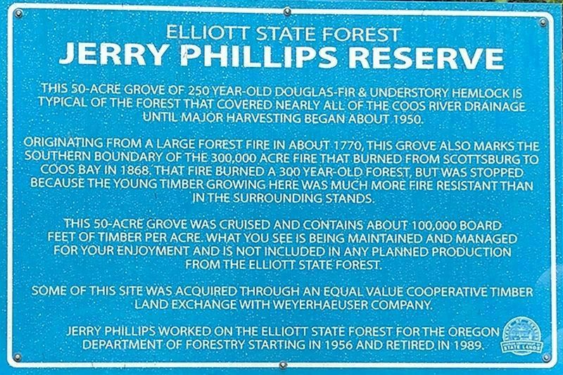
Inscription.
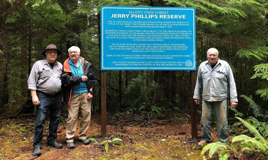
This 50-acre grove of 250 year-old Douglas-fir & understory hemlock is typical of the forest that covered nearly all of the Coos River drainage until major harvesting began about 1950.
Originating from a large forest fire in about 1770, this grove also marks the southern boundary of the 300,000 acre fire that burned from Scottsburg to Coos Bay in 1868. That fire burned a 300 year-old forest, but was stopped because the younger timber growing here was much more fire resistant than in the surrounding stands.
This 50-acre grove was cruised and contains about 100,000 board feet of timber per acre. What you see is being maintained and managed for your enjoyment and is not included in any planned production from the Elliott State Forest.
Some of this site was acquired through an equal value cooperative timber land exchange with Weyerhaeuser Company. Jerry Phillips worked on the Elliott State Forest for the Oregon Department of Forestry starting in 1956 and retired in 1989.
Erected 2019 by Oregon Department of State Lands.
Topics. This historical marker is listed in these topic lists: Education • Environment • Horticulture & Forestry • Parks & Recreational Areas. A significant historical date for this entry is October 12, 1962.
Location. 43° 27.761′ N, 124° 0.52′ W. Marker is near Allegany, Oregon, in Coos County. It is in Elliott State Forest. Marker can be reached from Elk Ridge (1000) Road. The Jerry Phillips Reserve marker can be reached by turning east from Elk Ridge Road between Eleven Ridge and Big Saddle, and then turning north along an old logging road to a former Weyerhaeuser landing, built to salvage windfall following the 1962 Columbus Day Storm. Touch for map. Marker is in this post office area: Allegany OR 97407, United States of America. Touch for directions.
Other nearby markers. At least 8 other markers are within 13 miles of this marker, measured as the crow flies. Lynching in America / Lynching in Coos County (approx. 11.9 miles away); In Memory of Curtis Sause (1913-2001) (approx. 12 miles away); 340 Year Old Tree (approx. 12 miles away); Bay View Brewery / Guildesheim's 2nd Hand Hide & Junk Store (approx. 12 miles away); Tug Power (approx. 12.1 miles away); Tugboat Ancestors (approx. 12.1 miles away); What is a Tugboat? (approx. 12.1 miles away); Shipping (approx. 12.1 miles away).
Also see . . .
1. Elliott State Forest History. This marker is at the Elliott State Forest. Jerry Phillips wrote the history of the Elliott through 1995 and David Gould’s great grandparents first settled the future State Forest as ranchers, trappers, and hunters in the early 1880s, and his grandfather, Clarence,

Photographed By Sam Schwarz, December 15, 2019
2. Elliott State Forest Jerry Phillips Reserve Marker
Bob Zybach, Jerry Phillips, and David Gould visiting new Jerry Phillips Reserve Sign for the first time after its placement in 2019. This was one of Jerry's very last visits to his beloved Elliott State Forest, which had been his second home for more than 65 years. Jerry story is told in the article at the second link in the Also See section below.
2. “God, Family, and The Elliott:” Jerry Phillips. 2022 article by Bob Zybach in the Oregon Fish & Wildlife Journal. Article begins on the third page of this reprint. Excerpt:
The following year, 1944, Jerry was given the task of manning the Chetco Peak Lookout Tower, located in today’s Kalmiopsis Wilderness and then only accessible by a 17-mile pack trail. Because it was still wartime, he was also trained to identify the silhouettes of Japanese warplanes and to keep a constant vigil for them, as well as for forest fires.(Submitted on December 6, 2023.)
Additional commentary.
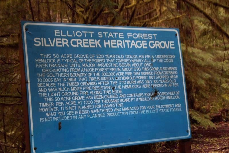
1. Transcription of the old sign shown in photograph No. 3
This 50 acre grove of 220 year old Douglas fir & understory hemlock is typical of the forest that covered nearly all of the Coos River drainage until major harvesting began about 1950.
Originating from a huge forest fire in about 1770, this grove also marks the southern boundry of the 300,000 acre fire that burned from Scottsburg to Coos Bay in 1868.

Photographed By Anne Farrell-Matthews, April 17, 2018
3. Old Elliott State Forest Jerry Phillips Reserve Marker
This is the original name and sign on the Jerry Phillips Reserve. It had been in place for nearly 40 years with only a few bullet holes indicating any vandalism, but was stolen in 2019 shortly before the reserve was renamed.
This 50 acre grove has been cruised and contains 100,000 board feet of timber per acre. At $200 per thousand board ft. it would be worth $1 million. However it is not planned for harvesting.
What you see is being maintained and managed for your enjoyment and is not included in any planned production from the Elliott State Forest.
— Submitted December 5, 2023, by Bob Zybach of Creswell, Oregon.
Additional keywords. Old-Growth, Reserve, Oregon, Common School Fund

Photographed By Bob Zybach, July 8, 2017
4. Elliott State Forest Jerry Phillips Reserve Marker
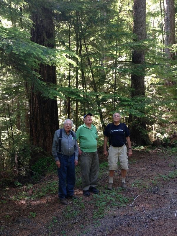
Original meeting of Wayne Giesy, Jerry Phillips, David Gould, and Bob Zybach at future Jerry Phillips Reserve during tour of Elliott State Forest and discussion of strategic approach regarding its future. During this trip, David told the story that the location had been jokingly referred to as "Jerry Phillips Private Reserve" after a popular beer commercial at that time ("Henry Weinhard's Private Reserve") because of Jerry's leading role in acquiring the property for the Elliott and putting it off-limits to harvesting. Following this information, and with the help of a couple of local elected representatives, the Oregon legislature officially renamed the site as "Jerry Phillips Reserve" in 2019.
Credits. This page was last revised on January 8, 2024. It was originally submitted on December 1, 2023, by Bob Zybach of Creswell, Oregon. This page has been viewed 175 times since then and 82 times this year. Last updated on December 11, 2023, by Bob Zybach of Creswell, Oregon. Photos: 1. submitted on December 1, 2023, by Bob Zybach of Creswell, Oregon. 2, 3, 4. submitted on December 2, 2023, by Bob Zybach of Creswell, Oregon. • J. Makali Bruton was the editor who published this page.
