Near Fort Towson in Choctaw County, Oklahoma — The American South (West South Central)
Roads and Rivers
19th-Century Transportation and Doaksville
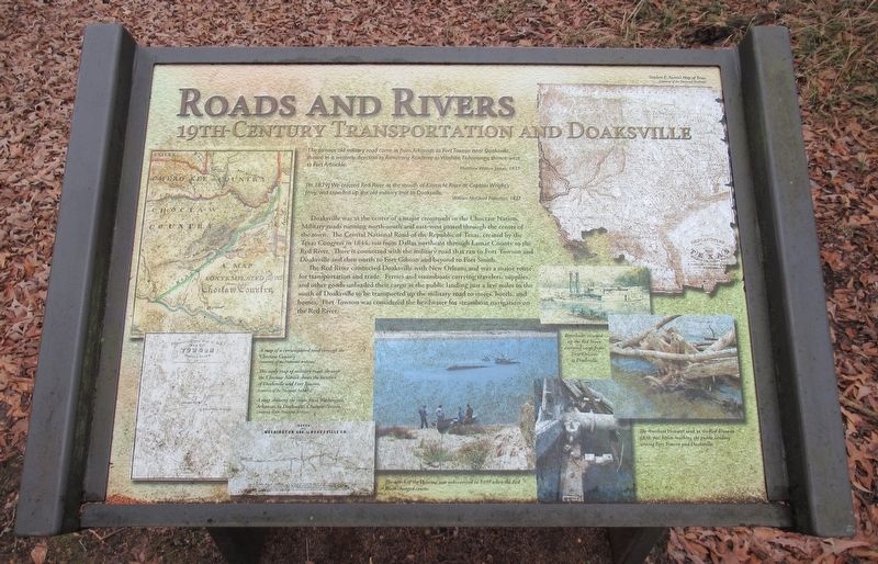
"The famous old military road came in from Arkansas to Fort Towson near Doaksville, thence in a westerly direction to Armstrong Academy to Washita, Tishomingo, thence west to Fort Arbuckle." Matthew Walton James, 1937
[In 1879] "We crossed Red River at the mouth of Kiamichi River at Captain Wright's ferry and travelled up the old military trail to Doaksville." William McClead Patterson, 1937
Doaksville was at the center of a major crossroads in the Choctaw Nation. Military roads running north-south and east-west passed through the center of the town. The Central national Road of the Republic of Texas, created by the Texas Congress in 1844, ran from Dallas northeast through Lamar County to the Red River. There it connected with the military road that ran to Fort Towson and Doaksville and then north to Fort Gibson and beyond to Fort Smith.
The Red River connected Doaksville with New Orleans and was a major route for transportation and trade. Ferries and steamboats carrying travelers, supplies, and other goods unloaded their cargo at the public landing just a few miles to the south of Doaksville to be transported up the military road to stores, hotels, and homes. Fort Towson was considered the headwater for steamboat navigation on the Red River.
[Captions:]
A map of a contemplated road through the Choctaw Country (courtesy of the National Archives)
This early map of military roads through the Choctaw Nation shows the location of Doaksville and Fort Towson. (courtesy of the National Archives)
A map showing the route from Washington, Arkansas, to Doaksville, Choctaw Nation (courtesy of the National Archives)
Riverboats steamed up the Red River carrying cargo from New Orleans to Doaksville.
The Riverboat Heroine sank in the Red River in 1838, just before reaching the public landing serving Fort Towson and Doaksville.
The wreck of the Heroine was rediscovered in 1999 when the Red River changed course.
Erected by Oklahoma Historical Society.
Topics. This historical marker is listed in these topic lists: Native Americans • Roads & Vehicles • Settlements & Settlers. A significant historical year for this entry is 1937.
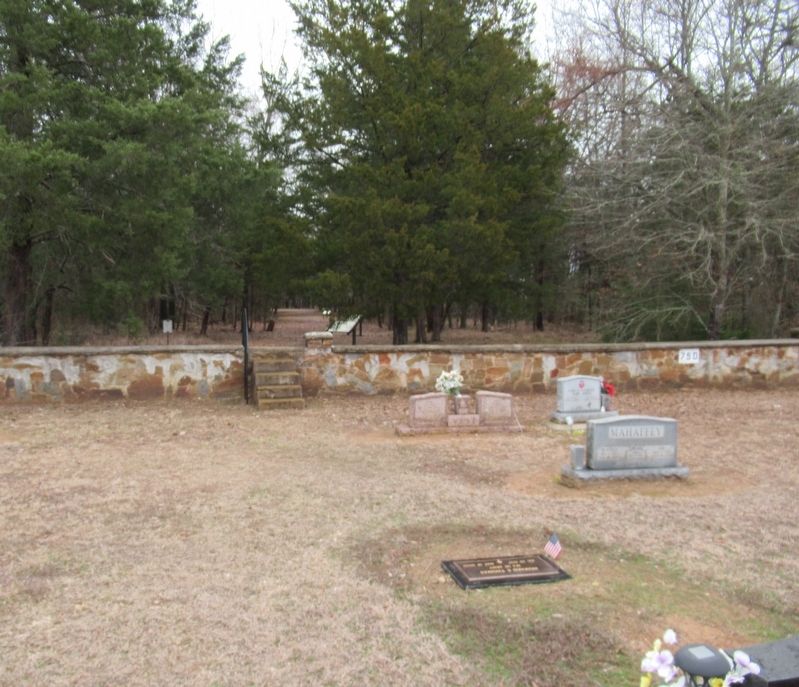
Location. 34° 2.051′ N, 95° 16.351′ W. Marker is near Fort Towson, Oklahoma, in Choctaw County. Marker can be reached from Red Road, 0.8 miles north of Wilson Street, on the right when traveling north. The marker stands on the inside of the Fort Towson Cemetery on the back wall is a set of stairs that leads into the Old Doaksville Townsite History Trail. The marker
is located along the trail. Touch for map. Marker is in this post office area: Fort Towson OK 74735, United States of America. Touch for directions.
Other nearby markers. At least 8 other markers are within walking distance of this marker. ...A Small But Pleasant Looking Village (here, next to this marker); The End of Doaksville (within shouting distance of this marker); The Treaty of Doaksville, 1837 (about 300 feet away, measured in a direct line); Archaeology at Doaksville (about 400 feet away); Old Doaksville Cemetery (about 400 feet away); Doaksville Cemetery (about 500 feet away); Dedicated To Veterans Who Served (about 600 feet away); The Old Stone Jail (about 600 feet away). Touch for a list and map of all markers in Fort Towson.
Credits. This page was last revised on December 23, 2023. It was originally submitted on December 14, 2023, by Jason Armstrong of Talihina, Oklahoma. This page has been viewed 56 times since then and 21 times this year. Photos: 1, 2. submitted on December 14, 2023, by Jason Armstrong of Talihina, Oklahoma. • Devry Becker Jones was the editor who published this page.

