Cridersville in Auglaize County, Ohio — The American Midwest (Great Lakes)
The Shawnee In Western Ohio
Photographed by Craig Doda, December 2, 2023
1. The Shawnee In Western Ohio Marker
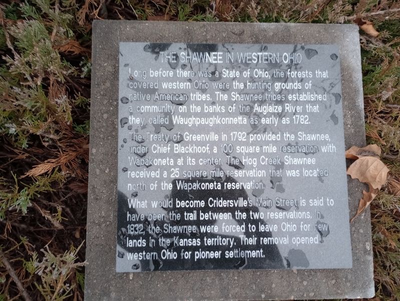
Long before there was a State of Ohio, the forests that covered western Ohio were the hunting grounds of native American tribes. The Shawnee tribes established a community on the banks of the Auglaize River that they called Waughpaughkonnetta as early as 1782.
The Treaty of Greenville in 1792 provided the Shawnee, under Chief Blackhoof, a 100 square mile reservation with Wapakoneta at its center. The Hog Creek Shawnee received a 25 square mile reservation that was located north of the Wapakoneta reservation.
What would become Cridersville's Main Street is said to have been the trail between the two reservations. In 1832, the Shawnee were forced to leave Ohio for new lands in the Kansas territory. Their removal opened western Ohio for pioneer settlement.
Topics. This historical marker is listed in these topic lists: Government & Politics • Indigenous Peoples and Communities • Settlements & Settlers. A significant historical year for this entry is 1782.
Location. 40° 39.244′ N, 84° 8.348′ W. Marker is in Cridersville, Ohio, in Auglaize County. It is on East Main Street east of South Water Street, on the right
this page online

Regionally, this marker is in the Till Plains. It is also in the American Midwest and in the Corn Belt. Globally, it is in North America, the Western Hemisphere, the Western World, and the Anglosphere. Historically, it finds itself in what was once the Haudenosaunee (Iroquois) Confederacy, the territory of the Mississippian Culture, and the Northwest Territory.
Other nearby markers. At least 8 other markers are within walking distance of this marker: Founding The Town (here, next to this marker); Cridersville Goes To War (here, next to this marker); Investing In Education (here, next to this marker); Cridersville Rams (a few steps from this marker); The Place For Basketball & More (a few steps from this marker); Oil Boom Years (a few steps from this marker); Fredrick Delong (a few steps from this marker); Cridersville High School Veterans Memorial (within shouting distance of this marker). Touch for a list and map of all markers in Cridersville.
Photographed by Craig Doda, December 2, 2023
2. The Shawnee In Western Ohio Marker
Credits. This page was last revised on December 23, 2023. It was originally submitted on December 14, 2023, by Craig Doda of Napoleon, Ohio. This page has been viewed 972 times since then and 97 times this year. Photos: 1, 2. submitted on December 14, 2023, by Craig Doda of Napoleon, Ohio. • Devry Becker Jones was the editor who published this page.
