Mille Lacs Kathio State Park near Onamia in Mille Lacs County, Minnesota — The American Midwest (Upper Plains)
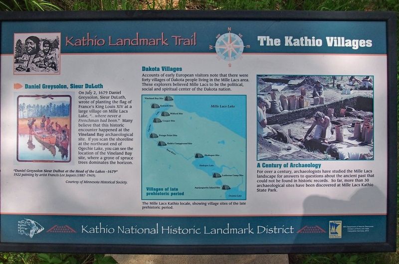
The Kathio Villages
Kathio Landmark Trail
— Kathio National Historic Landmark District —
Daniel Greysolon, Sieur DuLuth
On July 2, 1679 Daniel Greysolon, Sieur DuLuth, wrote of planting the flag of France's King Louis XIV at a large village on Mille Lacs Lake, "...where never a Frenchman had been." Many believe that this historic encounter happened at the Vineland Bay archaeological site. If you scan the shoreline at the northeast end of Ogechie Lake, you can see the location of the Vineland Bay site, where a grove of spruce trees dominates the horizon.
"Daniel Greysolon Sieur Dulhut at the Head of the Lakes 1679"
1922 painting by artist Francis Lee Jaques (1887-1969).
Dakota Villages
Accounts of early European visitors note that there were forty villages of Dakota people living in the Mille Lacs area. These explorers believed Mille Lacs to be the political, social and spiritual center of the Dakota nation.
The Mille Lacs Kathio locale, showing village sites of the late prehistoric period.
A Century of Archaeology
For over a century, archaeologists have studied the Mille Lacs landscape for answers to questions about the ancient past that could not be found in historic records. So far, more than 30 archaeological sites have been discovered at Mille Lacs Kathio State Park.
Erected 2013 by Minnesota Department of Natural Resources.
Topics. This historical marker is listed in these topic lists: Anthropology & Archaeology • Exploration • Native Americans. A significant historical date for this entry is July 2, 1679.
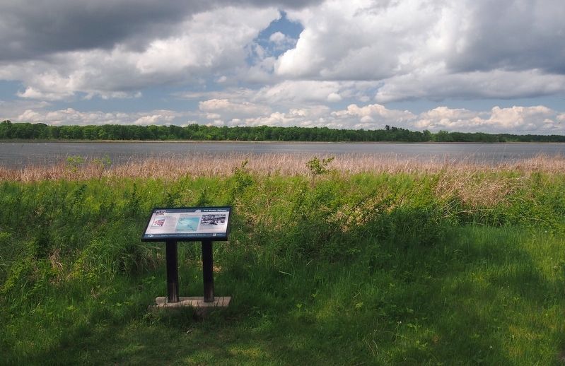
Location. 46° 9.014′ N, 93° 46.106′ W. Marker is near Onamia, Minnesota, in Mille Lacs County. It is in Mille Lacs Kathio State Park. Marker can be reached from the road to Ogechie Campground north of Kathio State Park Road. The marker is on the Kathio Landmark Trail. Touch for map. Marker is in this post office area: Onamia MN 56359, United States of America. Touch for directions.
Other nearby markers. At least 8 other markers are within 11 miles of this marker, measured as the crow flies. The Wilford Site (within shouting distance of this marker); Izatys (approx. one mile away); Harry & Jeannette Ayer House (approx. 1.9 miles away); Tourist Cottage (approx. 1.9 miles away); Mille Lacs Indian Boat Works (approx. 1.9 miles away); Explore Minnesota's Pinelands at Mille Lacs Kathio State Park (approx. 2.3 miles away); Lake Mille Lacs Walleye (approx. 10.3 miles away); William A. Tauer (approx. 10.3 miles away). Touch for a list and map of all markers in Onamia.
Credits. This page was last revised on December 18, 2023. It was originally submitted on December 15, 2023, by McGhiever of Minneapolis, Minnesota. This page has been viewed 49 times since then and 15 times this year. Photos: 1, 2. submitted on December 15, 2023, by McGhiever of Minneapolis, Minnesota. • J. Makali Bruton was the editor who published this page.

