Manassas, Virginia — The American South (Mid-Atlantic)
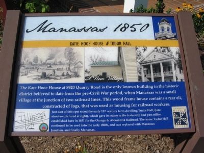
Manassas 1850
Katie Hooe House & Tudor Hall
— A New Village —
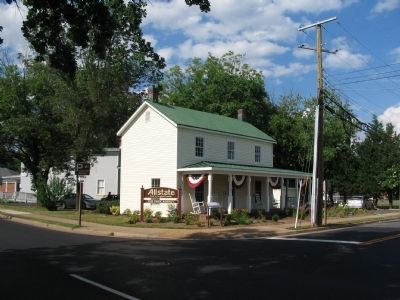
Just east of this spot stood the early 19th century farm dwelling Tudor Hall, (later structure pictured at right), which gave its name to the train stop and post office established here in 1851 for the Orange & Alexandria Railroad. The name Tudor Hall continued to be used into the early 1860s, and was replaced with Manassas Junction and finally Manassas.
Erected 2009.
Topics. This historical marker is listed in these topic lists: Notable Buildings • Railroads & Streetcars.
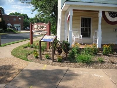
Location. 38° 45.148′ N, 77° 28.103′ W. Marker is in Manassas, Virginia. Marker is at the intersection of Quarry Road and Zebedee Street, on the left when traveling east on Quarry Road. Touch for map. Marker is at or near this postal address: 8920 Quarry Road, Manassas VA 20110, United States of America. Touch for directions.
Other nearby markers. At least 8 other markers are within walking distance of this marker. Katie Hooe House (here, next to this marker); Steam Locomotive Tire Fire Alarm – 1909 (within shouting distance of this marker); Manassas 1862 (about 600 feet away, measured in a direct line); Wartime Manassas (about 700 feet away); Harry J. Parrish (about 800 feet away); a different marker also named Steam Locomotive Tire Fire Alarm – 1909 (approx. 0.2 miles away); The Right to Vote (approx. 0.2 miles away); Manassas Presbyterian Church (approx. 0.2 miles away). Touch for a list and map of all markers in Manassas.
Also see . . .
1. National Register of Historic Places Nomination. (PDF) Covers the Old Town Manassas District. The Hooe house is discussed on page 45. (Submitted on October 29, 2009, by Craig Swain of Leesburg, Virginia.)
2. Katie Hooe House. Older marker that stood at this location. (Submitted on October 29, 2009, by Craig Swain of Leesburg, Virginia.)
Credits. This page was last revised on June 16, 2016. It was originally submitted on October 29, 2009, by Craig Swain of Leesburg, Virginia. This page has been viewed 1,310 times since then and 30 times this year. Photos: 1, 2, 3. submitted on October 29, 2009, by Craig Swain of Leesburg, Virginia.


