Gambles Hill in Richmond, Virginia — The American South (Mid-Atlantic)
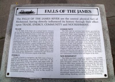
Falls of the James
Trade
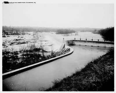
As the Falls of the James are a natural barrier between the sea and the interior, the area immediately surrounding the Falls has for centuries been a center for trade. Before European settlement, the Powhatan and Monacan Indians exploited the lands around the Falls as a trading center for the entire region. With the arrival of Europeans, trade between the settlers and Indians flourished and the warehousing and export of tobacco grew in importance. Later, Richmond became a major transportation hub as a result of the construction of the James River and Kanawha Canal, built to by-pass the Falls. Transportation, hydro-power and nearby coal deposits made Richmond a center for the manufacture and trade of flour, wheat, tobacco and iron. Even today, Richmond’s commercial and financial core overlooks the whitewater rapids of the Falls.
Energy
Though a barrier to navigation, the Falls were a boon to industry. Richmonders harnessed the water flow of the Falls to drive flour mills, iron plants, and paper mills, all major components of the city’s manufacturing growth. Later, hydro power from the Falls was utilized to generate electricity which fed the industrial and residential needs of the community. This included the powering of Richmond’s trolley system, the first in the world to successfully operate by electricity.
Community
The Falls and its environs have always provided the most basic physical requirements for settlement and community: food, water, energy, and transport. With the growth of trade and industry along the Falls, Richmond became a more culturally diverse community as immigrants from all parts of Europe followed English settlers to the region. African-American slaves provided much of the labor and many of the skills and crafts essential to the early growth of Richmond, and upon achieving their freedom, became a major factor in the culture and growth of the city. Richmond’s selection as Virginia’s capital and later as capital of the Confederacy can be traced to the city’s growth along the river. While the livelihood of Richmond depends less today on the James, our community’s mutual bond still begins at the Falls.
Nourishment
The Falls provided a wealth of vegetation, fish, wildlife and fresh water to nourish both Native Americans and early European settlers. By the early 1800’s, hydro power from the Falls drove pumps which provided the City with its first municipal drinking water system. Today, the Falls of the James continue to provide
Richmonders with spiritual nourishment, whether through contemplation of the natural beauty of the Falls or through the unique recreational opportunities available along the James: white water rafting, kayaking, canoeing, fishing and swimming.
Topics. This historical marker is listed in these topic lists: Industry & Commerce • Natural Resources • Settlements & Settlers • Waterways & Vessels.
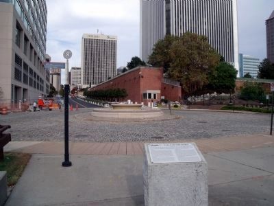
Location. 37° 32.106′ N, 77° 26.53′ W. Marker is in Richmond, Virginia. It is in Gambles Hill. Marker is at the intersection of Tredegar Street and South 7th Street, on the right when traveling east on Tredegar Street. This marker is on the Richmond Riverfront Canal Walk. Touch for map. Marker is in this post office area: Richmond VA 23219, United States of America. Touch for directions.
Other nearby markers. At least 8 other markers are within walking distance of this marker. Canal Walk / Historic Canals (a few steps from this marker); R&P Railroad Piers (about 300 feet away, measured in a direct line); Confederate Laboratory (about 300 feet away); Confederate Ordnance Lab Explosion (about 400 feet away); Brown’s Island (about 400 feet away); Tredegar Iron Works (about 400 feet away); John Jasper (about 500 feet away); Albemarle Paper (about 500 feet away). Touch for a list and map of all markers in Richmond.
Also see . . .
1. Richmond’s Historic Canal Walk
. Venture Richmond (Submitted on October 29, 2009.)
2. James River and Kanawha Canal Historic District. National Register of Historic Places (Submitted on October 29, 2009.)
Credits. This page was last revised on February 1, 2023. It was originally submitted on October 29, 2009, by Bernard Fisher of Richmond, Virginia. This page has been viewed 1,594 times since then and 121 times this year. Photos: 1, 2. submitted on October 29, 2009, by Bernard Fisher of Richmond, Virginia. 3. submitted on November 2, 2009, by Bernard Fisher of Richmond, Virginia.


