Waverly in Bremer County, Iowa — The American Midwest (Upper Plains)
Waverly Cedar River Dam
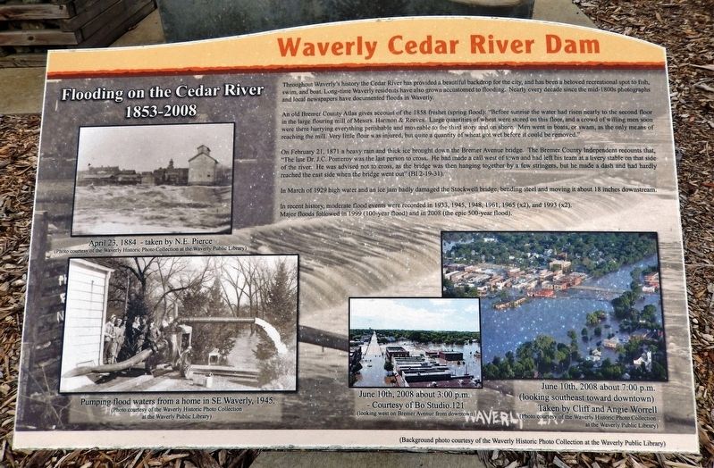
Flooding on the Cedar River, 1853-2008
Throughout Waverly's history the Cedar River has provided a beautiful backdrop for the city, and has been a beloved recreational spot to fish, swim and boat. Long-time Waverly residents have also grown accustomed to flooding. Nearly every decade since the mid-1800s photographs and local newspapers have documented floods in Waverly.
An old Bremer County Atlas gives account of the 1858 freshet (spring flood): "Before sunrise the water had risen nearly to the second floor in the large flouring mill of Messrs. Harmon & Reeves. Large quantities of wheat were stored on this floor, and a crowd of willing men soon were there hurrying everything perishable and moveable to the third story and on shore. Men went in boats, or swam, as the only means of reaching the mill. Very little flour was injured, but quite a quantity of wheat got wet before it could be removed."
On February 21, 1871 a heavy rain and thick ice brought down the Bremer Avenue bridge. The Bremer County Independent recounts that, “The late Dr. J.C. Pomeroy was the last person to cross. He had made a call west of town and had left his team at a livery stable on that side of the river. He was advised not to cross, as the bridge was then hanging together by a few stringers, but he made a dash and had hardly reached the east side when the bridge went out” (BI 2-19-31).
In March of 1929 high water and an ice jam badly damaged the Stockwell bridge, bending steel and moving it about 18 inches downstream.
In recent history, moderate flood events were recorded in 1933, 1945, 1948, 1961, 1965 (x2), and 1993 (x2). Major floods followed in 1999 (100-year flood) and in 2008 (the epic 500-year flood).
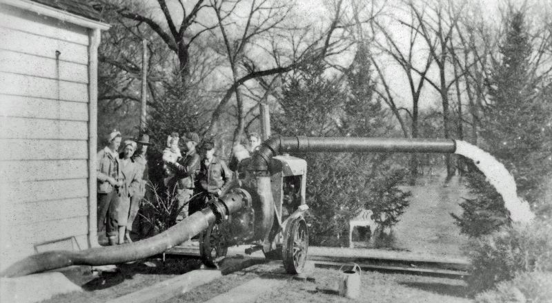
[photo captions]
• April 23, 1884 — taken by N.E. Pierce(Background photo courtesy of the Waverly Historic Photo Collection at the Waverly Public Library.)
• June 10th, 2008 about 3:00 p.m. (looking west on Bremer Avenue from downtown)
• June 10th, 2008 about 7:00 p.m. (looking southeast toward downtown)
Topics. This historical marker is listed in these topic lists: Disasters • Industry & Commerce • Parks & Recreational Areas • Waterways & Vessels. A significant historical date for this entry is June 10, 2008.
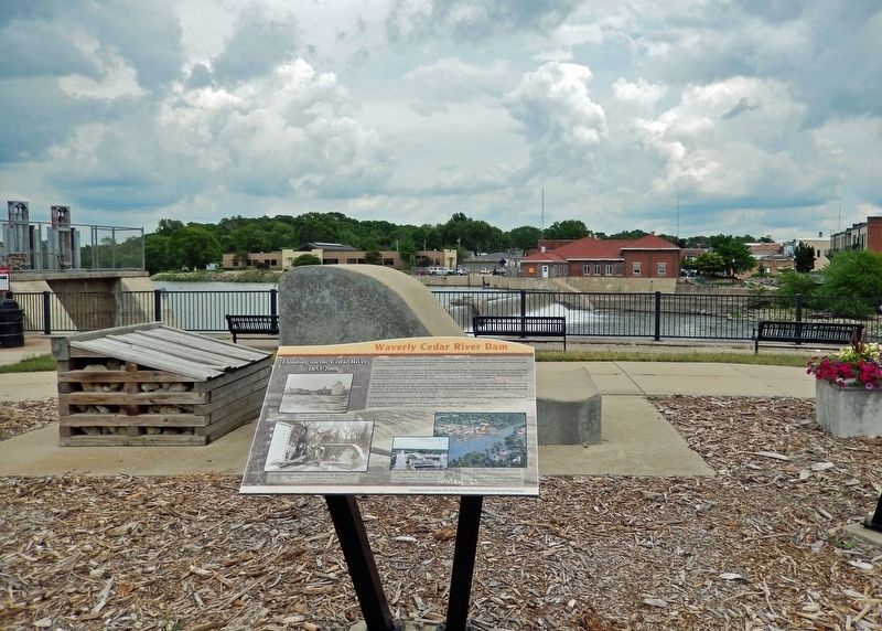
Location. 42° 43.579′ N, 92° 28.297′ W. Marker is in Waverly, Iowa, in Bremer County. Marker is on 1st Street Northwest just north of East Bremer Avenue (State Route 3), on the right when traveling north. The marker is located along the walkway in Kohlmann Park, overlooking the Cedar River Dam. Touch for map. Marker is at or near this postal address: 212 1st Street Northwest, Waverly IA 50677, United States of America. Touch for directions.
Other nearby markers. At least 8 other markers are within walking distance of this marker. A different marker also named Waverly Cedar River Dam (here,
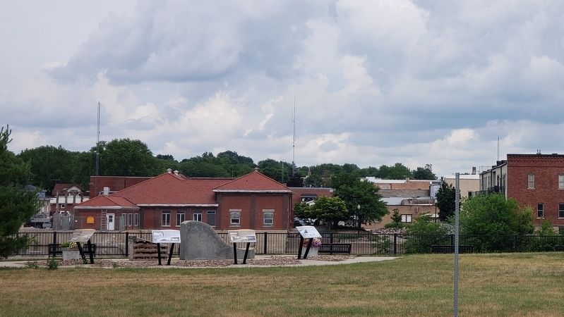
next to this marker); a different marker also named Waverly Cedar River Dam (here, next to this marker); a different marker also named Waverly Cedar River Dam (here, next to this marker); The Bremer Avenue Bridge over the Cedar River (within shouting distance of this marker); Rock Island Depot (about 300 feet away, measured in a direct line); Bremer County World War Memorial (approx. 0.3 miles away); Replica of the Statue of Liberty (approx. 0.3 miles away); Bremer County Korean & Vietnam War Memorial (approx. 0.3 miles away). Touch for a list and map of all markers in Waverly.
Related markers. Click here for a list of markers that are related to this marker. Waverly Cedar River Dam
Also see . . .
1. Historic Dam, Historic Flood. Excerpt:
Waverly flooded 10 times since 1915. In 1965 and 1993, it flooded twice both years. The dam that founded the town and proven so useful over the years was also contributing to a great deal of damage. Then along came 2008’s record-setting crest, bringing damage Waverly had never before seen. According to a FEMA report, “The Cedar River flows through the main commercial and residential district of the City of Waverly, so when the river reached 19.3 feet — 8 feet above flood stage — the city’s core felt the impact. Damages in the June 2008 flood included an estimated 700 homes or about 15 percent of the housing stock, 100 businesses, and three of the eight schools in the Waverly-Shell Rock school system.”(Submitted on December 25, 2023, by Cosmos Mariner of Cape Canaveral, Florida.)
2. Iowa flood of 2008: Waverly (Wikipedia). Excerpt:
Waverly was caught somewhat unprepared for the river's height, causing officials to scramble; the river crested locally at 19.33 feet on June 10. More than 2500 people were evacuated. Much of the town was inundated with many homes and businesses experiencing flood damage. In the flood's aftermath 151 homes were reported to be flood-impacted, with 69 of the properties eventually being bought out by the city. Since the floods of 2008, Waverly has been made an official forecast point to better help with predicting river crest levels and impact information – information that was not available during the floods of 2008.(Submitted on December 25, 2023, by Cosmos Mariner of Cape Canaveral, Florida.)
Credits. This page was last revised on December 25, 2023. It was originally submitted on December 24, 2023, by Cosmos Mariner of Cape Canaveral, Florida. This page has been viewed 53 times since then and 16 times this year. Photos: 1, 2, 3, 4. submitted on December 25, 2023, by Cosmos Mariner of Cape Canaveral, Florida.


