Waverly in Bremer County, Iowa — The American Midwest (Upper Plains)
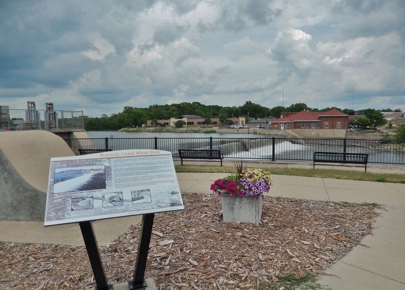
Waverly Cedar River Dam
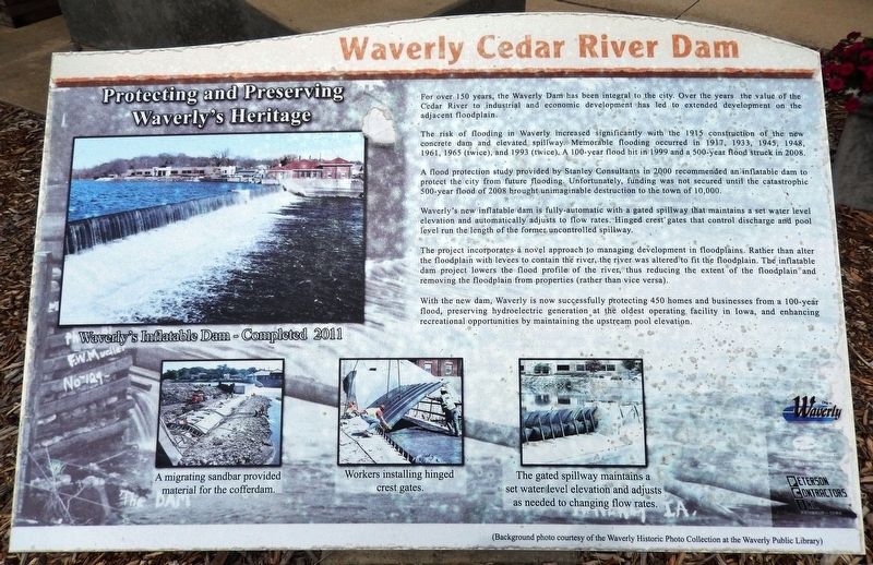
Protecting and Preserving Waverly's Heritage
For over 150 years, the Waverly Dam has been integral to the city. Over the years the value of the Cedar River to industrial and economic development has led to extended development on the adjacent floodplain.
The risk of flooding in Waverly increased significantly with the 1915 construction of the new concrete dam and elevated spillway. Memorable flooding occurred in 1917, 1933, 1945, 1948, 1961, 1965 (twice), and 1993 (twice). A 100-year flood hit in 1999 and a 500-year flood struck in 2008.
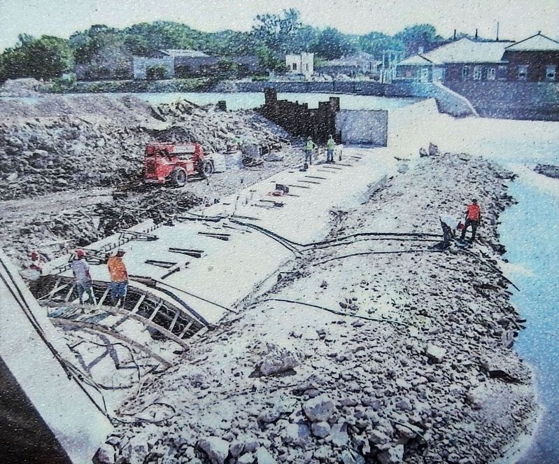
A flood protection study provided by Stanley Consultants in 2000 recommended an inflatable dam to protect the city from future flooding. Unfortunately, funding was not secured until the catastrophic 500-year flood of 2008 brought unimaginable destruction to the town of 10,000.
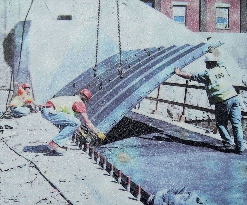
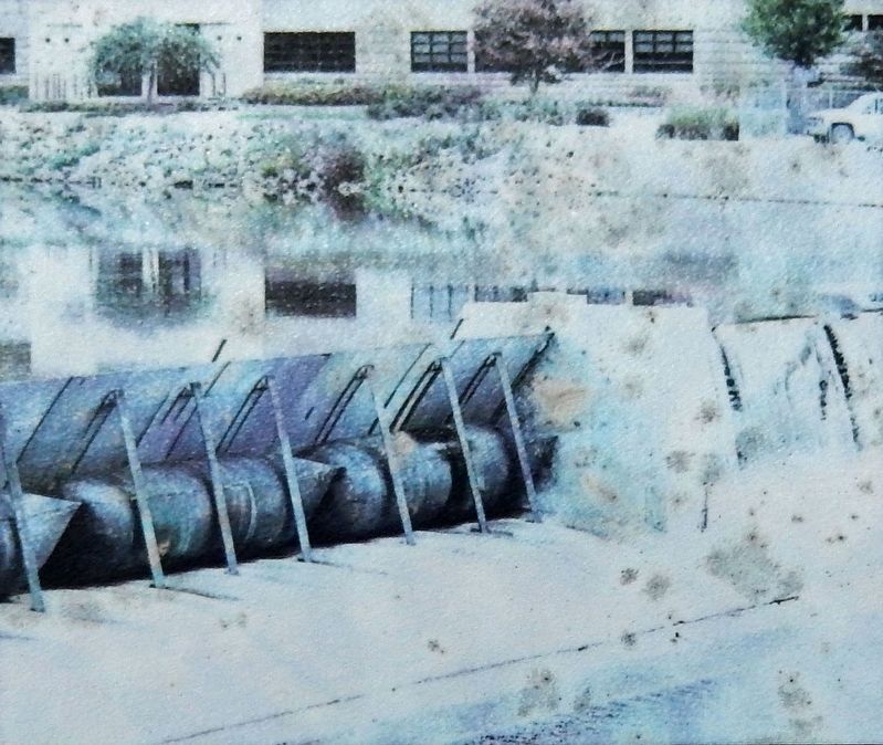
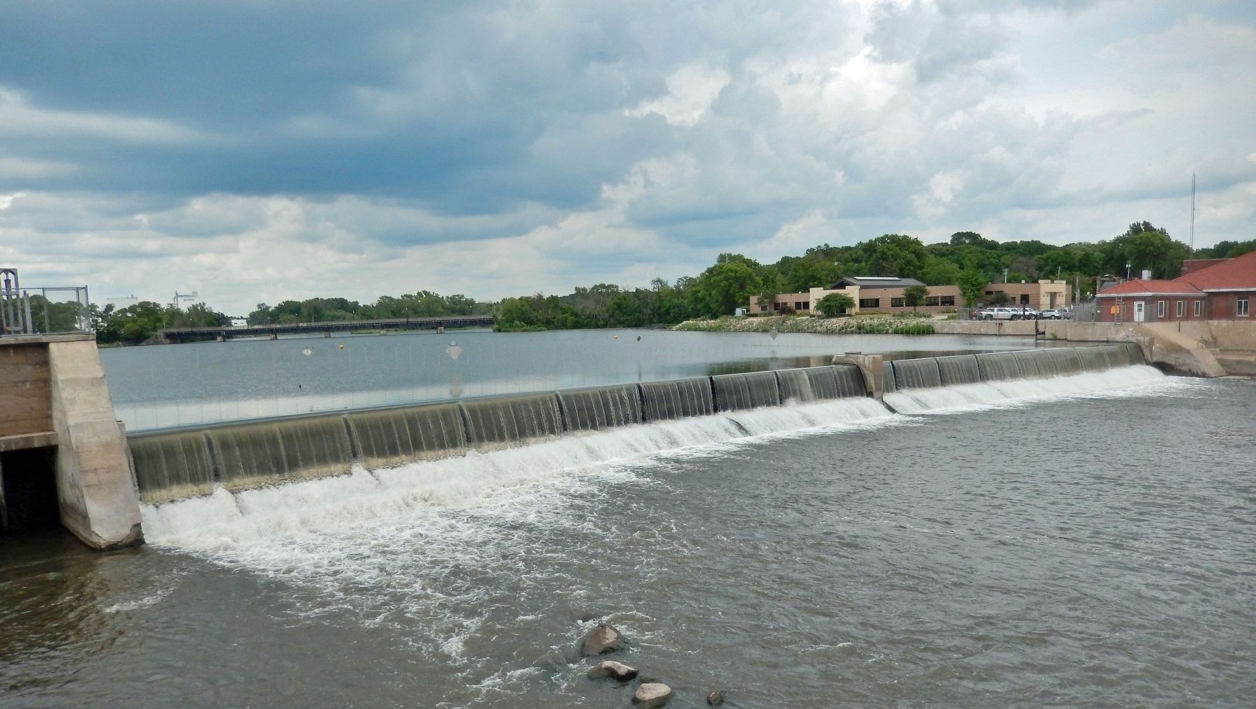
Waverly's new inflatable dam is fully-automatic with a gated spillway that maintains a set water level elevation and automatically adjusts to flow rates. Hinged crest gates that control discharge and pool level run the length of the former uncontrolled spillway.
The project incorporates a novel approach to managing development in floodplains. Rather than alter the floodplain with levees to contain the river, the river was altered to fit the floodplain. The inflatable dam project lowers the flood profile of the river, thus reducing the extent of the floodplain and removing the floodplain from properties (rather than vice versa).
With the new dam, Waverly is now successfully protecting 450 homes and businesses from a 100-year flood, preserving hydroelectric generation at the oldest operating facility in Iowa, and enhancing recreational opportunities by maintaining the upstream pool elevation.
(Background photo courtesy of the Waverly Historic Photo Collection at the Waverly Public Library.)
Topics. This historical marker is listed in these topic lists: Disasters • Industry & Commerce • Parks & Recreational Areas • Waterways & Vessels. A significant historical year for this entry is 2011.
Location. 42° 43.578′ N, 92° 28.296′ W. Marker is in Waverly, Iowa, in Bremer County. Marker is on 1st Street Northwest just north of East Bremer Avenue (State Route 3), on the right when traveling north. The marker is located along the walkway in Kohlmann Park, overlooking the Cedar River Dam. Touch for map. Marker is at or near this postal address: 212 1st Street Northwest, Waverly IA 50677, United States of America. Touch for directions.
Other nearby markers. At least 8 other markers are within walking distance of this marker. A different marker also named Waverly Cedar River Dam (here, next to this marker); a different marker also named Waverly Cedar River Dam (here, next to this marker); a different marker also named Waverly Cedar River Dam (a few steps from this marker); The Bremer Avenue Bridge over the Cedar River (within shouting distance of this marker); Rock Island Depot (within shouting distance of this marker); Bremer County World War Memorial (approx. 0.3 miles away); Replica of the Statue of Liberty (approx. 0.3 miles away); Bremer County Korean & Vietnam War Memorial (approx. 0.3 miles away). Touch for a list and map of all markers in Waverly.
Related markers. Click here for a list of markers that are related to this marker. Waverly Cedar River Dam
Also see . . . Inflatable Dam. Excerpt:
Inflatable dams are a relatively new flood mitigation tool. The top of the dam is formed by a series of large metal plates with a hinge at their upstream ends. There is a series of heavy-duty, inflatable rubber bladders, one under each plate. When the bladders are inflated, the plates swing upward, holding back water. When deflated, the plates, called “crest gates,” lower, allowing water to flow over the gates. The advantage to such a dam is that, because water can flow over the entire top of the dam, it’s less likely to be blocked by debris or ice. Unlike conventional dams, there is no operator’s bridge or top-mounted hoist system — expensive, unattractive elements that can also trap ice and debris and block river flow.(Submitted on December 25, 2023, by Cosmos Mariner of Cape Canaveral, Florida.)
Credits. This page was last revised on December 25, 2023. It was originally submitted on December 24, 2023, by Cosmos Mariner of Cape Canaveral, Florida. This page has been viewed 56 times since then and 19 times this year. Photos: 1, 2, 3, 4, 5, 6, 7. submitted on December 25, 2023, by Cosmos Mariner of Cape Canaveral, Florida.
