The Palisades in Northwest Washington in Washington, District of Columbia — The American Northeast (Mid-Atlantic)
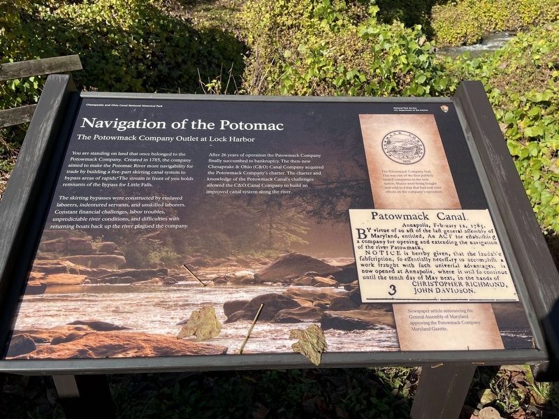
Navigation of the Potomac
Chesapeake and Ohio Canal National Historical Park
| — | National Park Service, U.S. Department of the Interior | — |
Photographed by Catherine N Ball, November 22, 2023
1. Navigation of the Potomac Marker
The Potowmack Company Outlet at Lock Harbor
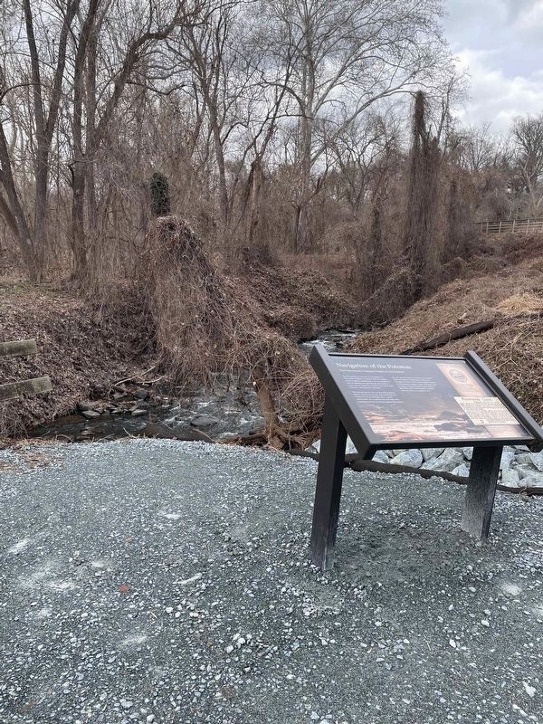
You are standing on land that once belonged to the Potowmack Company. Created in 1785, the company aimed to make the Potomac River more navigability for trade by building a five-part skirting canal system to bypass areas of rapids. The stream in front of you holds the remnants of the bypass for Little Falls.
The skirting bypasses were constructed by enslaved laborers, indentured servants, and unskilled laborers. Constant financial challenges, labor troubles, unpredictable river conditions, and difficulties with returning boats back up the river plagued the company.
After 26 years of operation the Patowmack Company finally succumbed to bankruptcy. The then-new Chesapeake & Ohio (C&O) Canal Company acquired the Potowmack Company's charter. The charter and knowledge of the Potowmack Canal's challenges allowed the C&O Canal Company to build an improved canal system along the river.
[Captions:]
The Potowmack Company Seal. This was one of the first publicly traded companies in the new nation. Shares were being bought and sold in a way that had real-time effects on the company's operation.
Newspaper article announcing the General Assembly of Maryland approving the Potowmack Company.
Maryland Gazette.
Erected by National
this page online
Topics and series. This historical marker is listed in these topic lists: Industry & Commerce • Waterways & Vessels. In addition, it is included in the Chesapeake and Ohio (C&O) Canal series list. A significant historical year for this entry is 1785.
Location. 38° 55.17′ N, 77° 6.153′ W. Marker is in Northwest Washington in Washington, District of Columbia. It is in The Palisades. It can be reached from Canal Road Northwest north of Reservoir Road Northwest, on the right when traveling south. Touch for map. Marker is at or near this postal address: 4940 Canal Road Northwest, Washington DC 20016, United States of America. Touch for directions.

Regionally, this marker is in the Washington Metropolitan Area. It is also in the American Northeast, in the Upper South, in the Mid-Atlantic, in the Tidewater, and in the Chesapeake Bay Region. Globally, it is in North America, the Western Hemisphere, the Western World, and the Anglosphere.
Other nearby markers. At least 8 other markers are within walking distance of this marker: A different marker also named Abner Cloud House (about
Photographed by Catherine N Ball, January 7, 2024
2. Navigation of the Potomac Marker
Other markers no longer nearby. Abner Cloud Mill (was within shouting distance of this marker but has been replaced with another marker now near it); Abner Cloud House (was about 400 feet away, measured in a direct line but has been replaced with another marker now near it).
Related marker. Click here for another marker that is related to this marker. This marker has replaced the linked marker.
Credits. This page was last revised on January 8, 2024. It was originally submitted on December 25, 2023, by Catherine N Ball of Washington, District of Columbia. This page has been viewed 300 times since then and 21 times this year. Photos: 1. submitted on December 25, 2023, by Catherine N Ball of Washington, District of Columbia. 2. submitted on January 8, 2024, by Catherine N Ball of Washington, District of Columbia. • Devry Becker Jones was the editor who published this page.
