Near Point Marion in Fayette County, Pennsylvania — The American Northeast (Mid-Atlantic)
New Hope for Polluted Streams
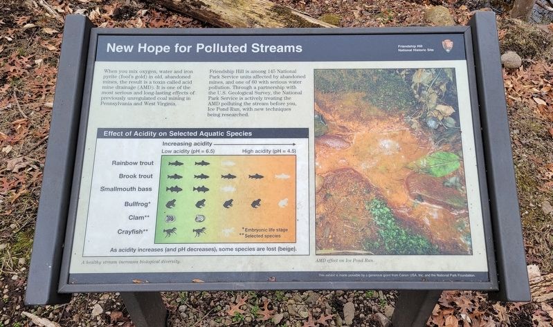
When you mix oxygen, water and iron pyrite (fool's gold) in old, abandoned mines, the result is a toxin called acid mine drainage (AMD). It is one of the most serious and long-lasting effects of previously unregulated coal mining in Pennsylvania and West Virginia.
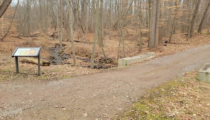
Friendship Hill is among 145 National Park Service units affected by abandoned mines, and one of 60 with serious water pollution. Through a partnership with the U.S. Geological Survey, the National Park Service is actively treating the AMD polluting the stream before you, Ice Pond Run, with new techniques being researched.
(Captions):
A healthy stream increases biological diversity.
AMD effect on Ice Pond Run.
This exhibit is made possible by a generous grant from Canon USA, Inc. and the National Park Foundation.
Erected by Friendship Hill National Historic Site.
Topics. This historical marker is listed in these topic lists: Environment • Industry & Commerce • Waterways & Vessels.
Location. 39° 46.561′ N, 79° 55.538′ W. Marker is near Point Marion, Pennsylvania, in Fayette County. Marker can be reached from New Geneva Road (Pennsylvania Route 166 ) south of Pekar Road, on the left when traveling north. This marker is located at the Friendship Hill National Historic Site. The grounds are open from sunrise to sunset and there is no entrance fee. From the park entrance on New Geneva Rd, continue along the street to the first pulloff on the right hand side. There is a parking area there. The marker is northeast of this location on the Main Loop Trail. Touch for map. Marker is at or near this postal address: 223 New Geneva Road, Point Marion PA 15474, United States of America. Touch for directions.
Other nearby markers. At least 8 other markers are within walking distance of this marker. Friendship Hill Trail System (about 600 feet away, measured in a direct line); Friendship Hill (approx. 0.3 miles away); Albert Gallatin (approx. 0.3 miles away); Stone Cistern (approx. 0.3 miles away); Sophia Allegre Gallatin (approx. 0.3 miles away); Preserving the 1910 Landscape (approx. 0.3 miles away); a different marker also named Friendship Hill Trail System (approx. 0.3 miles away); Monongahela River (approx. 0.3 miles away). Touch for a list and map of all markers in Point Marion.
More about this marker. Marker includes a chart showing the Effect of Acidity on Selected Aquatic Species: rainbow trout, brook trout, smallmouth bass, bullfrog, clam, and crayfish.
Credits. This page was last revised on January 1, 2024. It was originally submitted on December 25, 2023, by Bradley Owen of Morgantown, West Virginia. This page has been viewed 46 times since then and 45 times this year. Photos: 1, 2. submitted on January 1, 2024, by Bradley Owen of Morgantown, West Virginia.

