Bottineau in Minneapolis in Hennepin County, Minnesota — The American Midwest (Upper Plains)
Ecology
Environmental Change
— Edgewater Park —
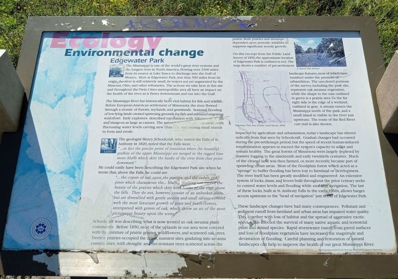
The Mississippi is one of the world's great river systems and the longest river in North America, flowing over 2300 miles from its source at Lake Itasca to discharge into the Gulf of Mexico. Here at Edgewater Park, less than 500 miles from its origin, the river is still relatively small, its waters not yet augmented by the Missouri, Ohio, and other tributaries. The actions we take here at this site and throughout the Twin Cities metropolitan area all have an impact on the health of the river as it flows downstream and out into the Gulf.
The Mississippi River has historically been a vital habitat for fish and wildlife. before European-American settlement of Minnesota, the river flowed through a mosaic of forests, wetlands, and grasslands. Seasonal flooding and low-lying lands created spawning grounds for fish and nurtured migrating waterfowl. Early explorers described encounters with 100-pound catfish and sturgeon as large as canoes. The natural river was very dynamic, with fluctuating water levels carving new channels and causing small islands to form and erode.
The geologist Henry Schoolcraft, who visited the Falls of St. Anthony in 1820, noted that the Falls were
"...in fact the precise point of transition where the beautiful prairies of the upper Mississippi are merged in the rugged lime stone bluffs which skirt the banks of the river from that point downward."He could easily have been describing the Edgewater Park site when he wrote that, above the Falls, he could see
"... the copses of oak upon the prairies, and the cedars and pines which characterize the... bluffs. Nothing can exceed the beauty of the prairies which skirt both banks of the river above the falls. They do not, however, consist of an unbroken plain, but are diversified with gentle ascents and small ravines covered with the most luxuriant growth of grass and heath-flowers, interspersed with groves of oak, which throw and air of the most picturesque beauty upon the scene."
Schoolcraft was describing what is now termed an oak savanna plant community. Before 1850, most of the uplands in our area were covered with this mixture of prairie grasses, wildflowers, and scattered oak trees. Treeless prairies occupied the driest, sunniest sites, gradating into savanna communities, with drought- and fire-resistant trees scattered across the prairie. Both prairies and savannas depended upon periodic wildfires to suppress significant woody growth.
A Typical Oak Savanna
On this excerpt from the Public Land Survey of 1856, the approximate location of Edgewater Park is outlined in red. The map shows a number of pre-settlement landscape features, most of which have vanished under the pressure of urbanization. The uncolored portions of the survey, including the park site, represent oak savanna vegetation, while the shape to the east outlined in green is a prairie area. To the far right side is the edge of a wetland, outlined in gray. A stream enters the Mississippi north of the park, and a small island is visible in the river just upstream. The route of the Red River cart trail is also shown.
Edgewater Park Area (Public Land Survey, 1856)
Impacted by agriculture and urbanization, today's landscape has altered radically from that seen by Schoolcraft. Gradual changes had occurred during the pre-settlement period, but the speed of recent human-induced transformation appears to exceed the system's capacity to adapt and remain healthy. The great forests of Minnesota were largely depleted by massive logging in the nineteenth and early twentieth centuries. Much of the cleared land was then farmed, or, more recently, became part of sprawling urban areas. Most of the floodplain forest which acted as a "sponge" to buffer flooding has been lost to farmland or development. The river itself has been greatly modified and engineered. An extensive system of locks, dams, and levees built throughout the prior century seeks to control water levels and flooding while enabling navigation. The last of these locks, built at St. Anthony Falls in the early 1960s, allows barges access upstream to the "head of navigation" just north of Edgewater Park.
These landscape changes have had many consequences. Pollutant and sediment runoff from farmland and urban areas has impaired water quality. This, together with loss of habitat and the spread of aggressive exotic species, has affected the survival of many native aquatic and terrestrial plant and animal species. Rapid stormwater runoff from paved surfaces and loss of floodplain vegetation have increased the magnitude and devastation of flooding. Careful planning and restoration of natural landscapes can help to improve the health of our Great Mississippi River.
Project funding provided by the Mississippi Watershed Management Organization
Oak savanna photo courtesy of Jim G. Hagstrom
Erected by the Minneapolis Park and Recreation Board.
Topics. This historical marker is listed in these topic lists: Environment • Waterways & Vessels.
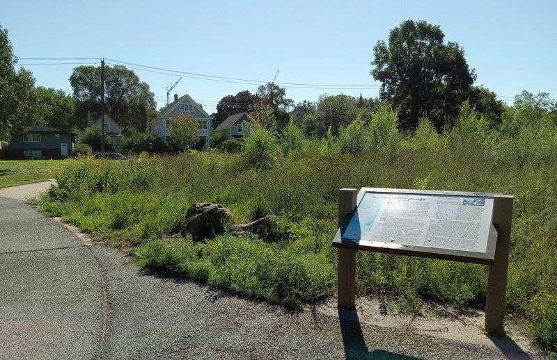
Location. 45° 0.732′ N, 93° 16.349′ W. Marker is in Minneapolis, Minnesota, in Hennepin County. It is in Bottineau. Marker is on Marshall Street NE south of Lowry Avenue North, on the right when traveling south. The marker is in Edgewater Park, on a paved path leading to a riverside plaza. Touch for map. Marker is at or near this postal address: 2420 Marshall Street NE, Minneapolis MN 55418, United States of America. Touch for directions.
Other nearby markers. At least 8 other markers are within one mile of this marker, measured as the crow flies. Land Use (about 300 feet away, measured in a direct line); Marshall Terrace (approx. 0.8 miles away); Orth Brewery Plaza (approx. 0.9 miles away); Sheridan Veterans Memorial (approx. 0.9 miles away); MLB ★ Minnesota Twins Rod Carew All★Star Field (approx. one mile away); Carl Ripken, Sr. (approx. one mile away); Park Planning and the Grand Rounds (approx. 1.1 miles away); Columbia Park and Golf Course (approx. 1.1 miles away). Touch for a list and map of all markers in Minneapolis.
Credits. This page was last revised on December 28, 2023. It was originally submitted on December 27, 2023, by McGhiever of Minneapolis, Minnesota. This page has been viewed 49 times since then and 10 times this year. Photos: 1, 2. submitted on December 27, 2023, by McGhiever of Minneapolis, Minnesota. • J. Makali Bruton was the editor who published this page.

