Panora in Guthrie County, Iowa — The American Midwest (Upper Plains)
Western Skies Scenic Byway
Background
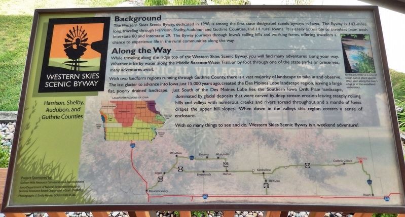
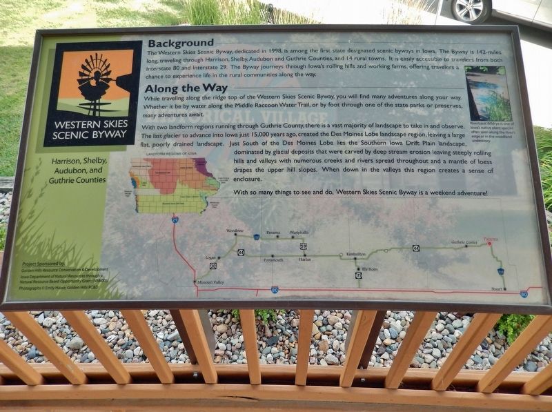
The Western Skies Scenic Byway, dedicated in 1998, is among the first state designated scenic byways in Iowa. The Byway is 142-miles long, traveling through Harrison, Shelby, Audubon and Guthrie Counties, and 14 rural towns. It is easily accessible to travelers from both Interstate 80 and Interstate 29. The Byway journeys through Iowa's rolling hills and working farms, offering travelers a chance to experience life in the rural communities along the way.
Along the Way
While traveling along the ridge top of the Western Skies Scenic Byway, you will find many adventures along your way. Whether it be by water along the Middle Raccoon Water Trail, or by foot through one of the state parks or preserves, many adventures await.
With two landform regions running through Guthrie County, there is a vast majority of landscape to take in and observe. The last glacier to advance into Iowa just 15,000 years ago, created the Des Moines Lobe landscape region, leaving a large flat, poorly drained landscape. Just South of the Des Moines Lobe lies the Southern Iowa Drift Plain landscape, dominated by glacial deposits that were carved by deep stream erosion leaving steeply rolling hills and valleys with numerous creeks and rivers spread throughout and a mantle of loess drapes the upper hill slopes. When down in the valleys this region creates a sense of enclosure.
With so many things to see and do, Western Skies Scenic Byway is a weekend adventure!
[inset image captions]
• Riverbank Wildrye is one of Iowa's native plant species often seen along the river's edge or in the woodland understory.
• Landform Regions of Iowa
Project Sponsored by:
Golden Hills Resource Conservation & Development
Iowa Department of Natural Resources through a Natural Resource Based Opportunity Grant (NRBOG).
Photographs © Emily Haase; Golden Hills RC&D
Topics. This historical marker is listed in these topic lists: Parks & Recreational Areas • Roads & Vehicles. A significant historical year for this entry is 1998.
Location. 41° 41.51′ N, 94° 21.908′ W. Marker is in Panora, Iowa, in Guthrie County. Marker is on West Main Street (State Highway 44) just west of North 1st Street, on the right when traveling west. The marker is mounted on the south railing of the gazebo in the Panora community park, overlooking West Main Street. Touch for map. Marker is at or near this postal address: 115 West Main Street, Panora IA 50216, United States of America. Touch for directions.
Other nearby markers. At least 6 other markers are within 14 miles of this marker, measured as the crow flies. Welcome to Panora (approx. 0.4 miles away); Prominent Pioneers Memorial (approx.
7.1 miles away); Women Pioneers Memorial (approx. 7.1 miles away); Co. H. 39th Iowa Volunteer Infantry (approx. 11.1 miles away); Fighting Slavery - Aiding Runaways (approx. 11.3 miles away); First National Bank (approx. 13.2 miles away).
Also see . . . Western Skies Scenic Byway. Excerpt:
You might have noticed the signs along Hwy 44 and P28 in Guthrie County that designate the Western Skies Scenic Byway and are intended to help tourists experience Iowa's natural beauty, history, and culture. Panora, Guthrie County's first incorporated town in 1851, is home to the Guthrie County Historical Village & Museum, the Raccoon River Valley Trail, and Lenon Mill Park, another popular place for camping and fishing along the Middle Raccoon River. The byway turns at the 4-way stop and heads west on Highway 44 traveling along the Main Street lined with historical buildings, the town's square, and the old Hotel Panora.(Submitted on December 27, 2023, by Cosmos Mariner of Cape Canaveral, Florida.)
Credits. This page was last revised on December 27, 2023. It was originally submitted on December 27, 2023, by Cosmos Mariner of Cape Canaveral, Florida. This page has been viewed 48 times since then and 10 times this year. Photos: 1, 2. submitted on December 27, 2023, by Cosmos Mariner of Cape Canaveral, Florida.

