Hyattsville in Prince George's County, Maryland — The American Northeast (Mid-Atlantic)
Rhode Island Ave Trolley Trail

Photographed By Devry Becker Jones (CC0), December 29, 2023
1. Rhode Island Ave Trolley Trail Marker
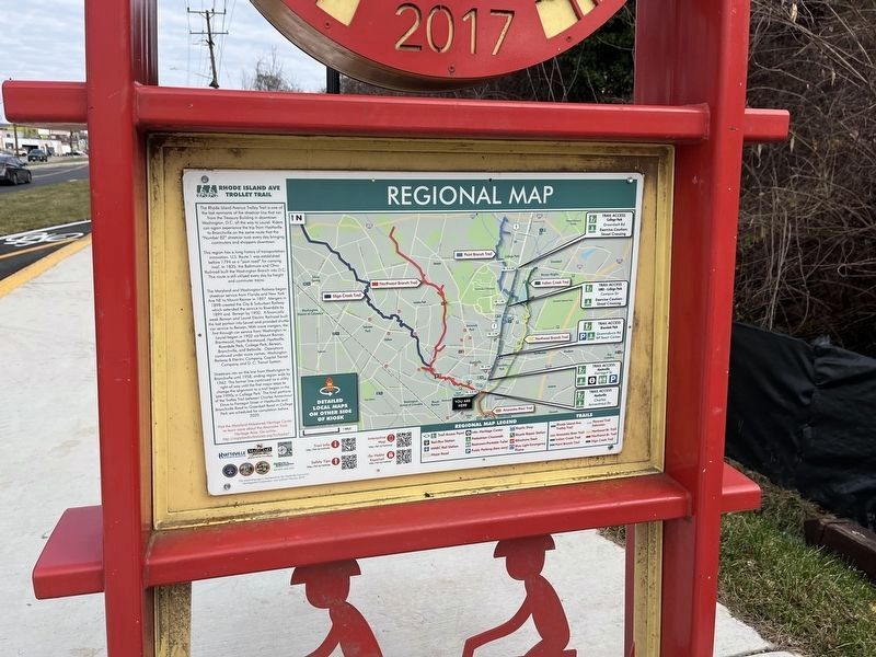
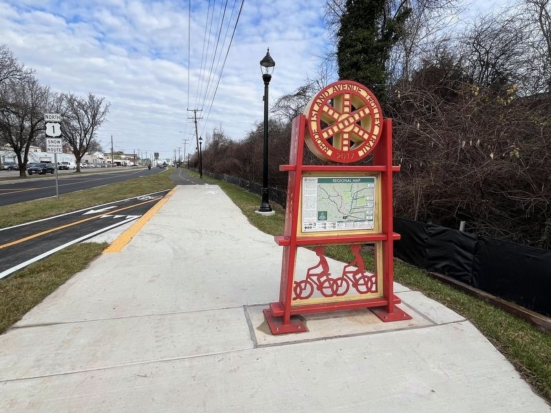
the Rhode Island Avenue Trolley Trail is one of the last remnants of the streetcar line that ran from the Treasury Building in downtown Washington, D.C. all the way to Laurel. Riders can again experience the trip from Hyattsville to Branchville on the same route that the "Number 82" streetcar took every day bringing commuters and shoppers downtown.
This region has a long history of transportation innovation. U.S. Route 1 was established before 1794 as a "post road" for carrying mail. In 1835, the Baltimore and Ohio Railroad built the Washington Branch into D.C. This route is still utilized every day by freight and commuter trains.
The Maryland and Washington Railway began streetcar service from Florida and New York Ave NE to Mount Ranier in 1897. Mergers in 1898 created the City & Suburban Railway which extended the service to Riverdale by 1899 and Berwyn by 1900. A financially weak Berwyn and Laurel Electric Railroad built the last portion into Laurel and provided shuttle car service to Berwyn. With more mergers, the first through car service from Washington to Laurel began in 1902 via Mount Ranier, Brentwood, North Brentwood, Hyattsville, Riverdale Park, College Park, Berwyn, Branchville, and Beltsville. Operations continued under more names: Washington Railway & Electric Company, Capital Transit Company, and D.C. Transit System.
Streetcars ran on the line from Washington to Branchville until 1958, ending region wide by 1962. The former line continued as a utility right-of-way until the first major steps to change the alignment to a trail began in the late 1990s in College Park. The final portions of the Trolley Trail between Charles Armentrout Drive to Farragut Street in Hyattsville and Branchville Road to Greenbelt Road in College Park are scheduled for completion before 2020.
Visit the Maryland Milestones Heritage Center to learn more about the Anacostia Trails Heritage Area. Go online: http://marylandmilestones.org/trolleytrail
Erected 2018 by Hyattsville Community Development Corp.; Maryland Heritage Areas Authority; Maryland Milestones; Town of Riverdale Park; City of Hyattsville; City of College Park; M-NCPPC Parks & Recreation.
Topics and series. This historical marker is listed in these topic lists: Parks & Recreational Areas • Railroads & Streetcars • Roads & Vehicles. In addition, it is included in the Baltimore and Ohio Railroad (B&O) series list. A significant historical year for this entry is 1794.
Location. 38° 56.782′ N, 76° 56.72′ W. Marker is in Hyattsville, Maryland, in Prince George's County. Marker is at the intersection of
![Rhode Island Ave Trolley Trail Marker [Reverse]. Click for full size. Rhode Island Ave Trolley Trail Marker [Reverse] image. Click for full size.](Photos7/766/Photo766636.jpg?1229202314700PM)
Photographed By Devry Becker Jones (CC0), December 29, 2023
2. Rhode Island Ave Trolley Trail Marker [Reverse]
Other nearby markers. At least 8 other markers are within walking distance of this marker. Suffrage Motorcade (about 300 feet away, measured in a direct line); Black Entertainment in North Brentwood (approx. 0.3 miles away); North Brentwood Memorial Garden (approx. 0.3 miles away); Gwendolyn Britt Senior Activity Center (approx. 0.4 miles away); Squire W. Garland (approx. 0.4 miles away); Indian Queen Tavern (approx. 0.4 miles away); George Washington House (approx. 0.4 miles away); British Advance (approx. 0.4 miles away).

Photographed By Devry Becker Jones (CC0), December 29, 2023
3. Rhode Island Ave Trolley Trail Marker
![Rhode Island Ave Trolley Trail Marker [Reverse]. Click for full size. Rhode Island Ave Trolley Trail Marker [Reverse] image. Click for full size.](Photos7/766/Photo766637.jpg?1229202314800PM)
Photographed By Devry Becker Jones (CC0), December 29, 2023
4. Rhode Island Ave Trolley Trail Marker [Reverse]
Credits. This page was last revised on December 29, 2023. It was originally submitted on December 29, 2023, by Devry Becker Jones of Washington, District of Columbia. This page has been viewed 290 times since then and 259 times this year. Photos: 1, 2, 3, 4. submitted on December 29, 2023, by Devry Becker Jones of Washington, District of Columbia.