Iron Hill Park near Newark in New Castle County, Delaware — The American Northeast (Mid-Atlantic)
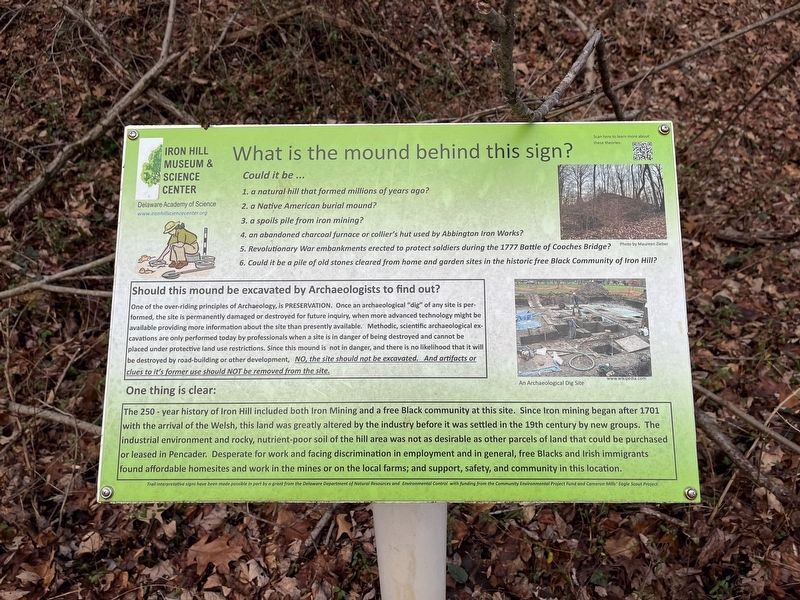
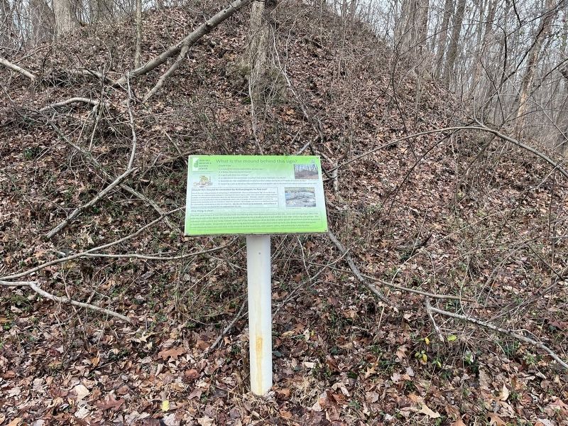
What is the mound behind this sign?
Iron Hill Museum & Science Center
— Delaware Academy of Science —

Photographed By Devry Becker Jones (CC0), December 30, 2023
1. What is the mound behind this sign? Marker
Could it be …
1. a natural hill that formed millions of years ago?
2. a Native American burial mound?
3. a spoils pile from iron mining?
4. an abandoned charcoal furnace or collier's hut used by Abbington Iron Works?
5. Revolutionary War embankments erected to protect soldiers during the 1777 Battle of Cooches Bridge??
6. Could it be a pile of old stones cleared from home and garden sites in the historic free Black Community of Iron Hill?
Should this mound be excavated by Archaeologists to find out?
One of the over-riding principles of Archaeology, is preservation. Once an archaeological "dig" of any site is performed, the site is permanently damaged or destroyed for future inquiry, when more advanced technology might be available providing more information about the site than presently available. Methodic, scientific archaeological excavations are only performed today by professionals when a site is in danger of being destroyed and cannot be placed under protective land use restrictions. Since this mound is not in danger, and there is no likelihood that it will be destroyed by road-building or other development, No, the site should not be excavated. And artifacts or clues to it's former use should not be removed from the site.
One thing is clear:
The 250 - year history of Iron Hill included both from Iron Mining and a free Black community at this site. Since Iron mining began after 1701 with the arrival of the Welsh, this land was greatly altered by the industry before it was settled in the 19th century by new groups. The industrial environment and rocky, nutrient-poor soil of the hill area was not as desirable as other parcels of land that could be purchased or leased in Pendcander. Desperate for work and facing discrimination in employment and in general, free Blacks and Irish immigrants found affordable homesites and work in the mines or on the local farms; and support, safety, and community in this location.
Erected by Delaware Academy of Science.
Topics. This historical marker is listed in these topic lists: African Americans • Anthropology & Archaeology • Immigration • Settlements & Settlers. A significant historical year for this entry is 1777.
Location. 39° 37.888′ N, 75° 45.536′ W. Marker is near Newark, Delaware, in New Castle County. It is in Iron Hill Park. Marker can be reached from South Old Baltimore Pike east of Whittaker Road, on the right when traveling west. Touch for map. Marker is at or near this postal address: 1355 S Old Baltimore Pike, Newark DE 19702, United States of America. Touch for directions.
Other nearby markers. At least 8 other markers

Photographed By Devry Becker Jones (CC0), December 30, 2023
2. What is the mound behind this sign? Marker
Credits. This page was last revised on December 31, 2023. It was originally submitted on December 30, 2023, by Devry Becker Jones of Washington, District of Columbia. This page has been viewed 70 times since then and 32 times this year. Photos: 1, 2. submitted on December 30, 2023, by Devry Becker Jones of Washington, District of Columbia.