Near Spotsylvania Courthouse in Spotsylvania County, Virginia — The American South (Mid-Atlantic)
A Mass Capture
Battle of Spotsylvania Court House
— Fredericksburg and Spotsylvania National Military Park —
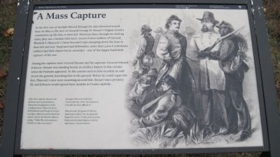
As the first rays of daylight filtered through the rain-drenched woods here on May 12, the men of General George H. Steuart’s brigade heard a commotion up the line, to their left. Moments later, through the shifting mists, they saw a human tidal wave: 20,000 Union soldiers of General Winfield S. Hancock’s Union Second Corps sweeping down the lines to their left and rear. Surprised and defenseless, more than 3,000 Confederate soldiers had little choice but to surrender – one of the largest battlefield captures of the war.
Among the captives were General Steuart and his superior, General Edward Johnson. Steuart was standing beside an artillery battery in this vicinity when the Federals appeared. As the cannon next to him recoiled, its trail struck the general, knocking him to the ground. Before he could regain his feet, Hancock’s men were swarming around him. Steuart was a prisoner. He and Johnson would spend three months in Union captivity.
After their capture, Steuart and Johnson were hustled back to Hancock’s headquarters at the Landram house. Hancock knew both Johnson and Stuart from pre-war days. Johnson readily shook his captor’s hand, but Steuart refused, saying, “Under the circumstances, I decline to take your hand.”
An angry Hancock shot back: “And under any other circumstances I should not have offered it.”
Placed under the guard of African-American soldiers, the two generals began the trek to Union prison camps. Hancock provided Johnson with an ambulance. Steuart walked.
Erected by National Park Service, U.S. Department of the Interior.
Topics. This historical marker is listed in this topic list: War, US Civil. A significant day of the year for for this entry is May 12.
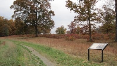
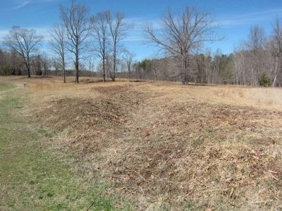
Location. 38° 13.289′ N, 77° 35.651′ W. Marker is near Spotsylvania Courthouse, Virginia, in Spotsylvania County. Marker can be reached from Gordon Drive, on the left when traveling north. Located on the East Face of the Salient trail at tour stop six (East Face) on the driving tour of Spotsylvania Battlefield unit of the Fredericksburg and Spotsylvania National Military Park. Touch for map. Marker is in this post office area: Spotsylvania VA 22553, United States of America. Touch for directions.
Other nearby markers. At least 8 other markers are within walking distance of this marker. Fighting for Time (about 300 feet away, measured in a direct line); The Confederate Line (about 600 feet away); Spotsylvania Campaign (approx. 0.2 miles away); a different marker also named Spotsylvania Campaign (approx. 0.2 miles away); Dawn Assault (approx. ¼ mile away); a different marker also named Spotsylvania Campaign (approx. ¼ mile away); Fatal Mistake at the East Angle (approx. ¼ mile away); Containing the Enemy, Reclaiming the Works (approx. ¼ mile away). Touch for a list and map of all markers in Spotsylvania Courthouse.
Credits. This page was last revised on April 21, 2020. It was originally submitted on October 30, 2009, by Kevin W. of Stafford, Virginia. This page has been viewed 1,221 times since then and 17 times this year. Photos: 1, 2. submitted on October 30, 2009, by Kevin W. of Stafford, Virginia. 3. submitted on April 7, 2014, by Craig Swain of Leesburg, Virginia. • Craig Swain was the editor who published this page.


