
Jerusalem Township near Bono in Lucas County, Ohio — The American Midwest (Great Lakes)
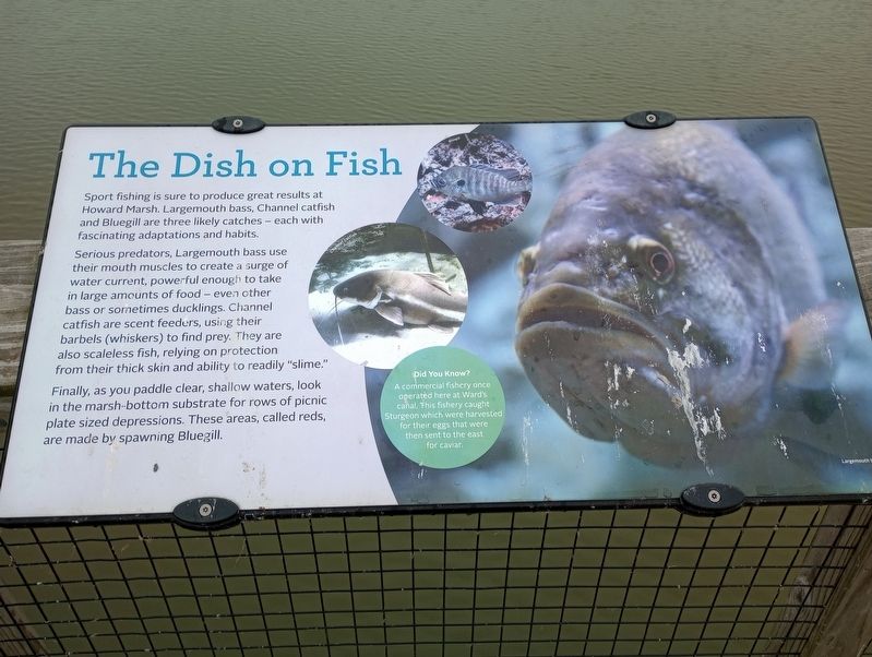
The Dish on Fish
Photographed by Craig Doda, December 22, 2023
1. The Dish on Fish Marker
Sport fishing is sure to produce great results at Howard Marsh. Largemouth bass, Channel catfish and Bluegill are three likely catches - each with fascinating adaptations and habits.
Serious predators, Largemouth bass use their mouth muscles to create a surge of water current, powerful enough to take in large amounts of food - even other bass or sornetimes ducklings. Channel catfish are scent feeders, using their barbels (whiskers) to find prey. They are also scaleless fish, relying on protection from their thick skin and ability to readily "slime."
Finally, as you paddle clear, shallow waters, look in the marsh-bottom substrate for rows of picnic plate sized depressions. These areas, called reds, are made by spawning Bluegill.
Did You Know?
A commercial fishery once operated here at Ward's canal, This fishery caught Sturgeon which were harvested for their eggs that were then sent to the east for caviar.
Topics. This historical marker is listed in these topic lists: Animals • Industry & Commerce • Waterways & Vessels.
Location. 41° 38.683′ N, 83° 15.944′ W.
this page online

Regionally, this marker is on the Lake Erie Shore and in the Toledo Metropolitan Area. It is also in the American Midwest, on the Great Lakes, and in the Corn Belt. Globally, it is in North America, the Western Hemisphere, the Western World, and the Anglosphere. Historically, it finds itself in what was once the Viceroyalty of New France, the Haudenosaunee (Iroquois) Confederacy, the territory of the Mississippian Culture, and the Northwest Territory.
Other nearby markers. At least 8 other markers are within 5 miles of this marker, measured as the crow flies: The Changing Faces of Howard Marsh (about 500 feet away, measured in a direct line); Howard Marsh (about 800 feet away); Ward's Canal (approx. 0.6 miles away); Call to Duty Salute (approx. 4½ miles away); Purple Martins (approx. 4.6
Photographed by Craig Doda, December 22, 2023
2. The Dish on Fish Marker
Credits. This page was last revised on January 3, 2024. It was originally submitted on January 1, 2024, by Craig Doda of Napoleon, Ohio. This page has been viewed 203 times since then and 16 times this year. Photos: 1, 2. submitted on January 1, 2024, by Craig Doda of Napoleon, Ohio. • Devry Becker Jones was the editor who published this page.
