Oakville in Halton Region, Ontario — Central Canada (North America)
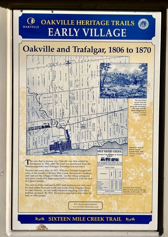
Oakville and Trafalgar, 1806-1870
— Sixteen Mile Creek Trail —
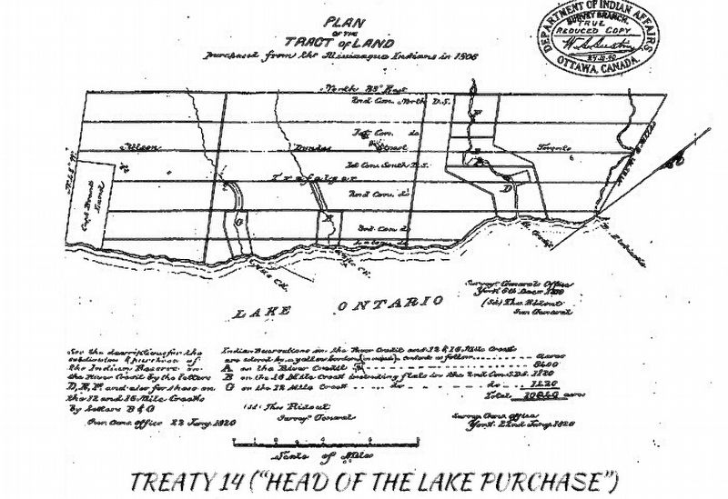
The area that is present day Oakville was first settled by Europeans in 1806, after the land was purchased from the Mississauga tribe and Trafalgar Township was surveyed.
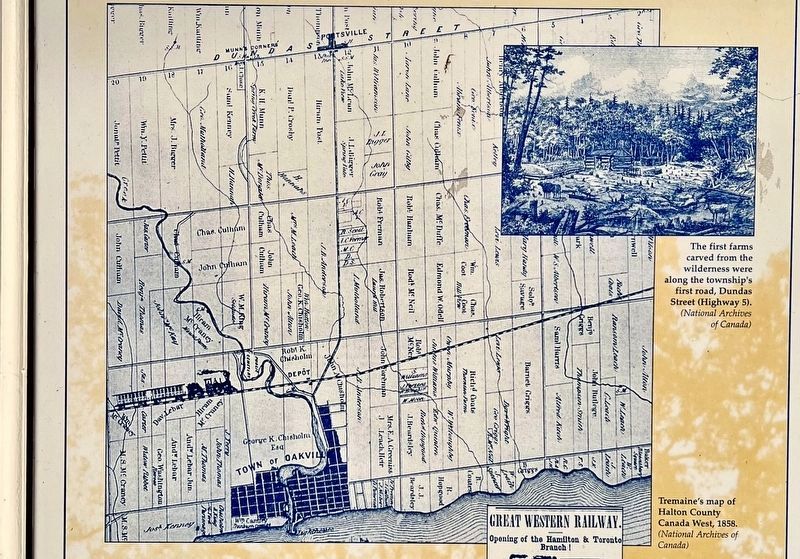
Twenty-one years later, in 1827, William Chisholm bought 960 acres at the mouth of Sixteen Mile Creek, developed a harbour, and laid out the village of Oakville. As the village prospered and grew, roads and ships were built to connect it with the rest of Upper Canada.
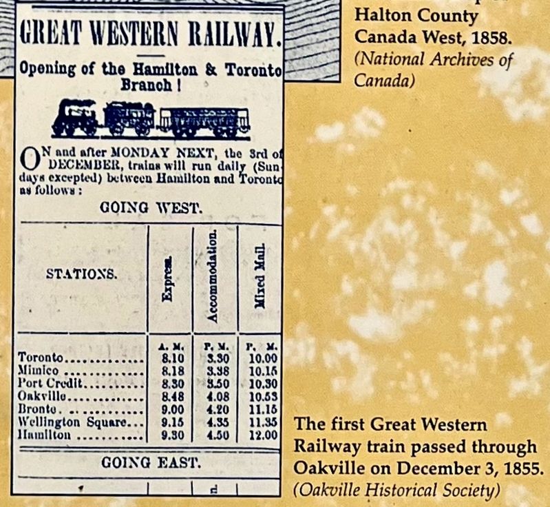
The arrival of the railroad in 1855 took business east and west by land rather than just north and south along Trafalgar Road to Lake Ontario. As rail traffic replaced shipping, Oakville's harbour declined. By 1871, the town's population had fallen by half, to 1000 people.
Erected by Town of Oakville.
Topics. This historical marker is listed in these topic lists: Colonial Era • Native Americans • Railroads & Streetcars • Settlements & Settlers. A significant historical year for this entry is 1806.
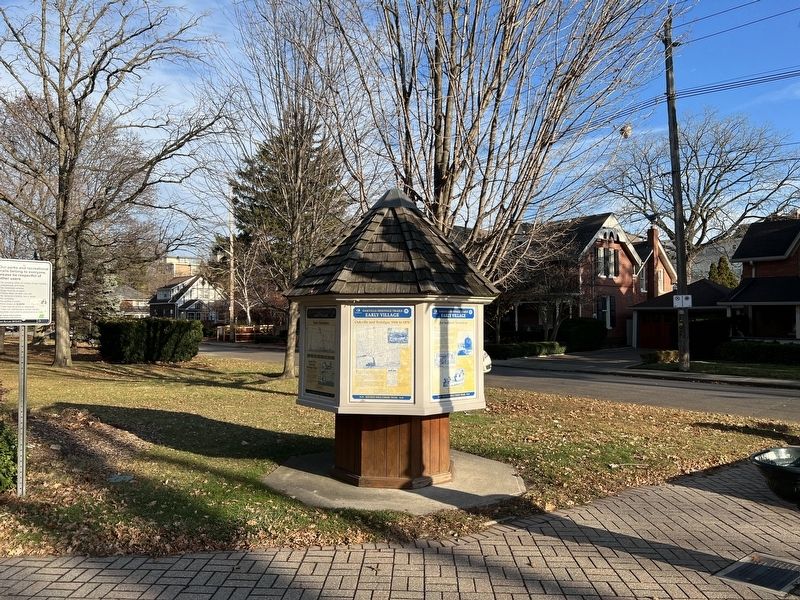
Location. 43° 26.952′ N, 79° 40.155′ W. Marker is in Oakville, Ontario, in Halton Region. Marker is at the intersection of Trafalgar Road and Sumner Avenue, on the right when traveling north on Trafalgar Road. The marker is at the south-west corner of George’s Square. Touch for map . Marker is at or near this postal address: 179 Trafalgar Road, Oakville ON L6J L6J, Canada. Touch for directions.
Other nearby markers. At least 8 other markers are within walking distance of this marker. An Isolated Township (here, next to this marker); The Prosperous Years (here, next to this marker); Churches Schools and Taverns (here, next to this marker); Heritage Homes of Trafalgar Road and George's Square (here, next to this marker); The Underground Railroad (here, next to this marker); The Lorne Scots (about 90 meters away, measured in a direct line); Hunter-Gatherer and Fisher People (9,000 BC to AD 500) (approx. 0.4 kilometers away); The First Horticultural People (AD 500 to 1610) (approx. 0.4 kilometers away). Touch for a list and map of all markers in Oakville.
Also see . . . Anishinaabek News - Head of the Lake Purchase (1806).
By 1805, the Crown had acquired almost all of the north shore of Lake Ontario around to Niagara, with the exception of a block of around 35 miles frontage at the head of the Lake, between York and Niagara. In 1797, an approach was made by the Administrator, Peter Russell, the interim head of the administration after Lt. Governor Simcoe’s departure, to the Mississaugas. At the time, Joseph Brant had been named as the land agent for the Mississaugas, following his successful leasing and sale of some of the Grand River lands of the Six Nations, and he was seeking what the Crown considered to be too high a price for the lands. The Crown decided at that time not to pursue the Mississauga Tract, as it was known.(Submitted on January 2, 2024, by Tim Boyd of Hamilton, Ontario.)
Credits. This page was last revised on January 6, 2024. It was originally submitted on January 2, 2024, by Tim Boyd of Hamilton, Ontario. This page has been viewed 43 times since then. Photos: 1, 2, 3, 4, 5, 6. submitted on January 2, 2024, by Tim Boyd of Hamilton, Ontario. • Andrew Ruppenstein was the editor who published this page.
