Lyndon in Whiteside County, Illinois — The American Midwest (Great Lakes)
Lyndon Bridge

Photographed by Sean Flynn, January 7, 2024
1. Lyndon Bridge Marker
and the
National Park Service
United States Department of the Interior
Announce the listing of
Lyndon Bridge
in the
National Register of Historic Places
Erected 2003.
Topics and series. This historical marker is listed in these topic lists: Bridges & Viaducts • Waterways & Vessels. In addition, it is included in the National Register of Historic Places (NRHP) series list. A significant historical year for this entry is 1894.
Location. 41° 42.717′ N, 89° 55.53′ W. Marker is in Lyndon, Illinois, in Whiteside County. It is at the intersection of 6th Avenue West and 1st Street West, on the right when traveling west on 6th Avenue West. The marker is near the northern end of the Lyndon Bridge, which crosses the Rock River on the southern end of the village of Lyndon. Touch for map. Marker is in this post office area: Lyndon IL 61261, United States of America. Touch for directions.

Regionally, this marker is in Northern Illinois. It is also in the American Midwest, in the Corn Belt, and in the Great River Road Region. Globally, it is in North America, the Western Hemisphere, the Western
this page online
Other nearby markers. At least 8 other markers are within 10 miles of this marker, measured as the crow flies: Wabokieshiek, White Cloud The Prophet (approx. 2.7 miles away); Prophetstown State Park (approx. 2.7 miles away); Prophetstown (approx. 2.8 miles away); 106 Main Street (approx. 9.1 miles away); 110 Main Street (approx. 9.1 miles away); 107 Main Street (approx. 9.1 miles away); 109 Main Street (approx. 9.1 miles away); 111 Main Street (approx. 9.1 miles away).
Regarding Lyndon Bridge. Lyndon Bridge, a Parker Pratt truss bridge over the Rock River in Whiteside County, Illinois, crosses the river at the village of Lyndon's 6th Avenue on the north bank towards a corn field on the south bank.
The bridge was constructed by Lyndon in 1894 as a wagon crossing, and was updated in 1906 to support automobile and tractor traffic. It remained in active use until 1980, when the county declared it unsafe and barred all car and pedestrian traffic. After 15 years of disuse, the

Photographed by Sean Flynn, January 7, 2024
2. Lyndon Bridge
The marker is on the stone in the foreground behind the Rock River Trail sign, with the bridge itself (covered in snow) in the rear.
Also see . . .
1. NHRP Registration Form for Lyndon Bridge.
The bridge was added to the National Register of Historic Places in 2003. This form was prepared in 2003 by Fred D. Steele, President of the Lyndon Economic Advisory Panel. A statement of the bridge's historical significance can be found on page 6:
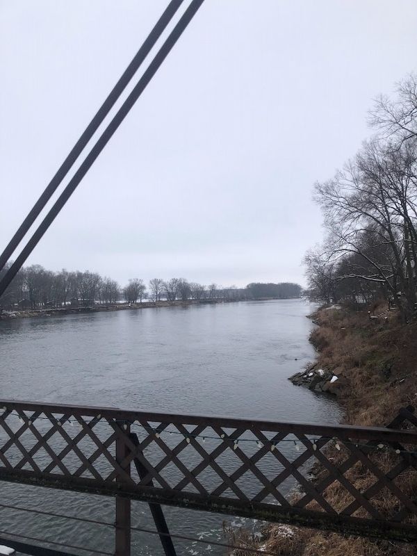
The Lyndon Bridge is eligible for listing in the National Register of Historic Places under Criterion C, for engineering as a good local example of the Parker Pratt through truss bridge type with the addition of one approach span. The bridge is the only metal through truss bridge remaining in Whiteside County. The period of significance is from 1894 when the bridge was built to 1912 when the Pratt through(Submitted on January 8, 2024, by Sean P. Flynn of Oak Park, Illinois.)truss span was added to the south end.Photographed by Sean Flynn, January 7, 20243. Rock RiverA view of the Rock River from the bridge, facing in a southwesterly direction.
2. Lyndon Bridge Timeline. From the Village of Lyndon (Submitted on January 8, 2024, by Sean P. Flynn of Oak Park, Illinois.)
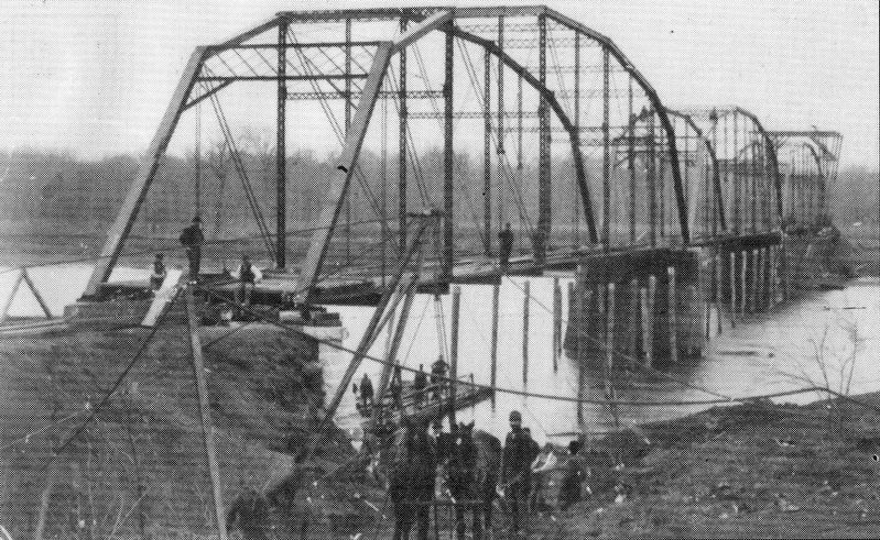
Courtesy of Village of Lyndon, circa 1894
4. Lyndon Bridge (1894)
An 1894 view of the bridge under construction
Credits. This page was last revised on April 14, 2024. It was originally submitted on January 8, 2024, by Sean P. Flynn of Oak Park, Illinois. This page has been viewed 361 times since then and 38 times this year. Photos: 1, 2, 3, 4. submitted on January 8, 2024, by Sean P. Flynn of Oak Park, Illinois. • Devry Becker Jones was the editor who published this page.
