
Wellesley Lower Falls in Norfolk County, Massachusetts — The American Northeast (New England)
Near This Spot

Photographed by Donald Cooke, January 9, 2024
1. Near This Spot Marker
President Washington
entered this town
November 6, 1789
erected by
Wellesley Historical Society
1932
Erected 1932 by Wellesley Historical Society.
Topics. This historical marker is listed in this topic list: Notable Events. A significant historical date for this entry is November 6, 1789.
Location. 42° 19.501′ N, 71° 15.527′ W. Marker is in Wellesley, Massachusetts, in Norfolk County. It is in Wellesley Lower Falls. It is at the intersection of River Street and Washington Street (Massachusetts Route 16), on the right when traveling north on River Street. Touch for map. Marker is in this post office area: Wellesley Hills MA 02481, United States of America. Touch for directions.

Regionally, this marker is in Greater Boston. It is also in the American Northeast, in New England, and on the Eastern Seaboard. Globally, it is in the North Atlantic Region, North America, the Western Hemisphere, the Western World, and the Anglosphere. Historically, it finds itself in what was once one of the original Thirteen Colonies.
Other nearby markers. At least 8 other markers are within 3 miles of this marker, measured
this page online
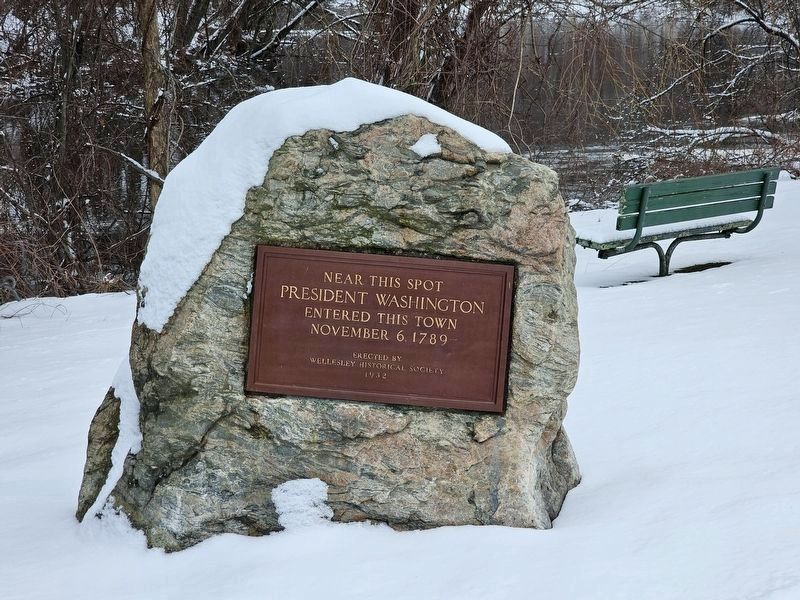
Photographed by Donald Cooke, January 9, 2024
2. Near This Spot Marker
The Charles River is behind the marker.
Credits. This page was last revised on January 15, 2024. It was originally submitted on January 9, 2024, by Donald Cooke of Aguanga, California. This page has been viewed 201 times since then and 39 times this year. Photos: 1, 2. submitted on January 9, 2024, by Donald Cooke of Aguanga, California. • Michael Herrick was the editor who published this page.
