Near Fort Towson in Choctaw County, Oklahoma — The American South (West South Central)
Why The Mound?
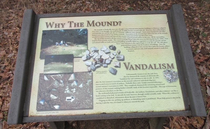
The mounds at Doaksville were once thought to have formed when masonry buildings or chimneys collapsed. Over time, it was thought the resulting pile of rubble became covered with soil. However, when archaeologists excavated this site and the jail, also on a mound, a different story emerged. Intact stone foundations and other features were discovered on top of these mounds. Excavation on the mound slopes and at the base of the mounds revealed no intact remains and showed that erosion had removed the topsoil in these areas.
The top of this mound is all that remains of the original ground surface in this area. All the surrounding land has been severely eroded. This erosion probably began when the town was thriving during the 1800s. Foot and animal traffic on roads and around buildings probably killed any vegetation covering the ground, and the heavy rains common to this region began to erode the soil. The only places protected from erosion were the locations of buildings. Once the buildings collapsed or were moved, these spots also became subject to erosion, and now only small mounds remain to mark their location.
Unfortunately, erosion is not the only force that has destroyed the remains of old Doaksville. Vandalism has and continues to take it toll. In 1995, Vandalism has and continues to take its toll. in 1995, after the first summer's excavation on this mound, unknown individuals dug into unexcavated areas in search of artifacts. Probably these same vandals returned following a second summer's excavation in 1996. They completely destroyed the remaining unexcavated portions of this mound, making further scientific study of this location impossible. This type of destruction was also seen elsewhere on the site.
The undisturbed physical remains of Doaksville- the artifacts, foundations, and other evidence-are like a book waiting to be read. It can only be read, however, through careful scientific study. When this evidence is vandalized or disturbed, information about the past is forever lost.
Digging on this site, picking up artifacts, or disturbing ruins is prohibited. Please help preserve this site by leaving it just the way you found it when you entered the park.
Erected by Oklahoma Historical Society.
Topics. This historical marker is listed in these topic lists: Anthropology & Archaeology • Native Americans • Settlements & Settlers.
Location. 34° 2.083′ N, 95° 16.231′ W. Marker is near Fort Towson, Oklahoma, in Choctaw County. Marker can be reached from Red Road, 0.8 miles north of Tram Road, on the right when traveling north. The marker is located along the Old Doaksville Townsite History Trail at the back of the Fort Towson Cemetery. Stairs on the back wall of the cemetery leads to the trail. Touch for map. Marker is in this post office area: Fort Towson OK 74735, United States of America. Touch for directions.
Other nearby markers. At least 8 other markers are within walking distance of this marker. A Store on Commercial Row (within shouting distance of this marker); The Preservation of Doaksville (within shouting distance of this marker); The Doaksville Hotel (within shouting distance of this marker); The Old Stone Jail (within shouting distance of this marker); A Community Well (within shouting distance of this marker); Doaksville (within shouting distance of this marker); Stand Watie’s Surrender (within shouting distance of this marker); Evidence For A Tavern… (within shouting distance of this marker). Touch for a list and map of all markers in Fort Towson.
Credits. This page was last revised on January 10, 2024. It was originally submitted on January 9, 2024, by Jason Armstrong of Talihina, Oklahoma. This page has been viewed 47 times since then. Photos: 1, 2. submitted on January 9, 2024, by Jason Armstrong of Talihina, Oklahoma. • J. Makali Bruton was the editor who published this page.

