Near Fort Towson in Choctaw County, Oklahoma — The American South (West South Central)
Old Doaksville Cemetery
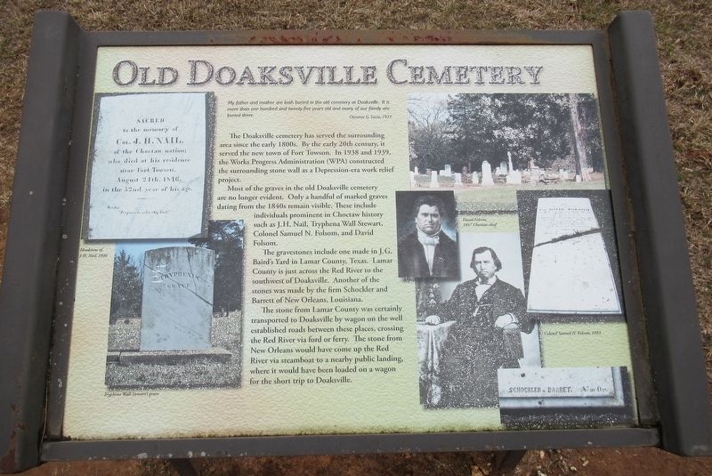
My father and mother are both buried in the old cemetery at Doaksville. It is more than one hundred and twenty-five years old and many of our family are buried there.
Clemmie G. Sacra, 1937
The Doaksville cemetery has served the surrounding area since the early 1800s. By the early 20th century, it served the new town of Fort Towson. In 1938 and 1939, the Works Progress Administration (WPA) constructed the surrounding stone wall as a Depression-era work relief project.
Most of the graves in the old Doaksville cemetery are no longer evident. Only a handful of marked graves dating from the 1840s remain visible. These include individuals prominent in Choctaw history such as J.H. Nail, Tryphena Wall Stewart, Colonel Samuel N. Folsom, and David Folsom.
The gravestones include one made in J.G. Baird's Yard in Lamar County, Texas. Lamar County is just across the Red River to the southwest of Doaksville. Another of the stones was made by the firm Schockler and Barrett of New Orleans, Louisiana.
The sone from Lamar County was certainly transported to Doaksville by wagon on the well established roads between these places, crossing the Red River via ford or ferry. The stone from New Orleans would have come up the Red River via steamboat to a nearby public landing, where it would have been loaded on a wagon for the short trip to Doaksville.
Erected by Oklahoma Historical Society.
Topics. This historical marker is listed in these topic lists: Cemeteries & Burial Sites • Native Americans.
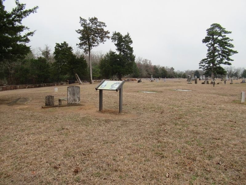
Location. 34° 2.117′ N, 95° 16.388′ W. Marker is near Fort Towson, Oklahoma, in Choctaw County. Marker is on Red Road, 0.1 miles north of Tram Road, on the right when traveling north. The marker is located in the North end of the Fort Towson Cemetery. Touch for map. Marker is in this post office area: Fort Towson OK 74735, United States of America. Touch for directions.
Other nearby markers. At least 8 other markers are within walking distance of this marker. Doaksville History Trail (within shouting distance of this marker); Roads and Rivers (about 400 feet away, measured in a direct line); ...A Small But Pleasant Looking Village (about 500 feet away); The End of Doaksville (about 600 feet away); The Treaty of Doaksville, 1837 (about 600 feet away); Archaeology at Doaksville (about 700 feet away); Why The Mound? (approx. 0.2 miles away); A Store on Commercial Row (approx. 0.2 miles away). Touch for a list and map of all markers in Fort Towson.
Credits. This page was last revised on January 15, 2024. It was originally submitted on January 13, 2024, by Jason Armstrong of Talihina, Oklahoma. This page has been viewed 51 times since then. Photos: 1, 2. submitted on January 13, 2024, by Jason Armstrong of Talihina, Oklahoma. • J. Makali Bruton was the editor who published this page.

