Winslow in Navajo County, Arizona — The American Mountains (Southwest)
Winslow Today: Downtown Renaissance and Tourism
Journeys to Winslow
Inscription.
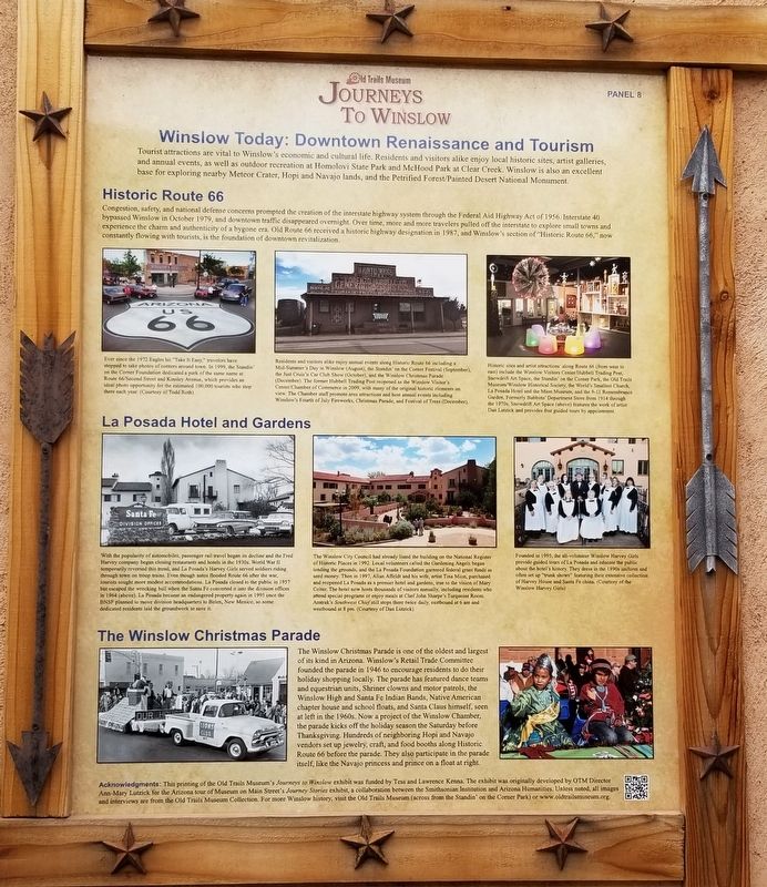
Tourist attractions are vital to Winslow's economic and cultural life. Residents and visitors alike enjoy local historic sites, artist galleries, and annual events, as well as outdoor recreation at Homolovi State Park and McHood Park at Clear Creek. Winslow is also an excellent base for exploring nearby Meteor Crater, Hopi and Navajo lands, and the Petrified Forest/Painted Desert National Monument.
Historic Route 66
Congestion, safety, and national defense concerns prompted the creation of the interstate highway system through the Federal Aid Highway Act of 1956. Interstate 40 bypassed Winslow in October 1979, and downtown traffic disappeared overnight. Over time, more and more travelers pulled off the interstate to explore small towns and experience the charm and authenticity of a bygone era. Old Route 66 received a historic highway designation in 1987, and Winslow's section of "Historic Route 66," now constantly flowing with tourists, is the foundation of downtown revitalization.
La Posada Hotel and Gardens
The Winslow Christmas Parade
The Winslow Christmas Parade is one of the oldest and largest of its kind in Arizona. Winslow's Retail Trade Committee founded the parade in 1946 to encourage residents to do their holiday shopping locally. The parade has featured dance teams and equestrian units, Shriner clowns and motor patrols, the Winslow High and Santa Fe Indian Bands, Native American chapter house and school floats, and Santa Claus himself, seen at left in the 1960s. Now a project of the Winslow Chamber, the parade kicks off the holiday season the Saturday before Thanksgiving. Hundreds of neighboring Hopi and Navajo vendors set up jewelry, craft, and food booths along Historic Route 66 before the parade. They also participate in the parade itself, like the Navajo princess and prince on a float at right.
Captions
Ever since the 1972 Eagles hit "Take It Easy," travelers have stopped to take photos of corners around town. In 1999, the Standin on the Corner Foundation dedicated a park of the same name at Route 66/Second Street and Kinsley Avenue, which provides an ideal photo opportunity for the estimated 100,000 tourists who stop there each year. (Courtesy of Todd Roth)
Residents and visitors alike enjoy annual events along Historic Route 66 including a Mid-Summer's Day in Winslow (August), the Standin' on the Corner Festival (September), the Just Cruis'n Car Club Show (October), and the Winslow Christmas Parade (December). The former Hubbell Trading Post reopened as the Winslow Visitor's Center/Chamber of Commerce in 2009, with many of the original historic elements on view. The Chamber staff promote
area attractions and host annual events including Winslow's Fourth of July Fireworks, Christmas Parade, and Festival of Trees (December).
Historic sites and artist attractions along Route 66 (from west to east) include the Winslow Visitors Center/Hubbell Trading Post, Snowdrift Art Space, the Standin' on the Corner Park, the Old Trails Museum/Winslow Historical Society, the World's Smallest Church, La Posada Hotel and the Mion Museum, and the 9-11 Remembrance Garden. Formerly Babbitts' Department Store from 1914 through the 1970s, Snowdrift Art Space (above) features the work of artist Dan Lutzick and provides free guided tours by appointment.
With the popularity of automobiles, passenger rail travel began its decline and the Fred Harvey company began closing restaurants and hotels in the 1930s. World War II temporarily reversed this trend, and La Posada's Harvey Girls served soldiers riding through town on troop trains. Even though autos flooded Route 66 after the war, tourists sought more modest accommodations. La Posada closed to the public in 1957 but escaped the wrecking ball when the Santa Fe converted it into the division offices in 1964 (above). La Posada became an endangered property again in 1995 once the BNSF planned to move division headquarters to Belen, New Mexico, so some dedicated residents laid the groundwork to save it.
The Winslow City Council had already listed the building on the National Register of Historic Places in 1992. Local volunteers called the Gardening Angels began tending the grounds, and the La Posada Foundation garnered federal grant funds as seed money. Then in 1997, Allan Affeldt and his wife, artist Tina Mion, purchased and reopened La Posada as a premier hotel and gardens, true to the vision of Mary Colter. The hotel now hosts thousands of visitors annually, including residents who attend special programs or enjoy meals at Chef John Sharpe's Turquoise Room. Amtrak's Southwest Chief still stops there twice daily, eastbound at 6 am and westbound at 8 pm. (Courtesy of Dan Lutzick)
Founded in 1995, the all-volunteer Winslow Harvey Girls provide guided tours of La Posada and educate the public about the hotel's history. They dress in the 1890s uniform and often set up "trunk shows" featuring their extensive collection of Harvey House and Santa Fe china. (Courtesy of the Winslow Harvey Girls)
Acknowledgments: This printing of the Old Trails Museum's Journeys to Winslow exhibit was funded by Tess and Lawrence Kenna. The exhibit was originally developed by OTM Director Ann-Mary Lutzick for the Arizona tour of Museum on Main Street's Journey Stories exhibit, a collaboration between the Smithsonian Institution and Arizona Humanities. Unless noted, all images and interviews are from the Old Trails Museum Collection. For more Winslow history, visit the Old Trails Museum (across from the Standin' on the Corner Park) or www.oldtrailsmuseum.org.
Erected 2017 by Old Trails Museum - Winslow Historical Society. (Marker Number 8.)
Topics. This historical marker is listed in these topic lists: Industry & Commerce • Native Americans • Roads & Vehicles. A significant historical month for this entry is October 1979.
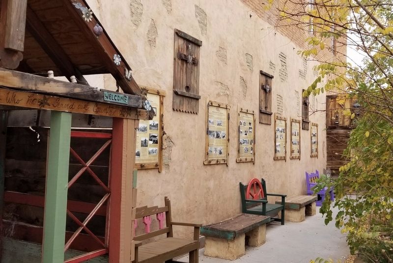
Location. 35° 1.398′ N, 110° 41.84′ W. Marker is in Winslow, Arizona, in Navajo County. Marker is on East 2nd Street, 0.1 miles east of North Kinsley Ave. The marker is located in an alley way between two buildings next to the Worlds Smallest Church. Touch for map. Marker is at or near this postal address: 116 E 2nd St, Winslow AZ 86047, United States of America. Touch for directions.
Other nearby markers. At least 8 other markers are within walking distance of this marker. Winslow Today: Commerce and Employment (here, next to this marker); A City in Motion: Modern Modes (here, next to this marker); A City in Motion: The Heyday of the Santa Fe Railway (here, next to this marker); The Railroads Build a Town: Early Industry (a few steps from this marker); The Railroads Build a Town: Early Days (a few steps from this marker); The First Peoples of the Southwestern Colorado Plateau (a few steps from this marker); Early Trails Across the Little Colorado River Valley (a few steps from this marker); Standin’ on the Corner Park, Winslow, Arizona (within shouting distance of this marker). Touch for a list and map of all markers in Winslow.
Also see . . . Journeys to Winslow. Old Trails Museum - Winslow Historical Society
The Old Trails Museum debuted the Journeys to Winslow exhibit in October 2017 in the Skylark Courtyard, which is a stop along the Journey Through Winslow Pathway. Developed by Tess and Lawrence Kenna, the Pathway is a trail for residents and visitors to explore Winslow’s history and current downtown revitalization, and its other stops include the World’s Smallest Church on Route 66 and historic facades and murals throughout the downtown historic district. The Kennas funded the reprinting of Journeys to Winslow, which was originally developed by the Old Trails Museum for the Winslow stop on the Arizona tour of the Smithsonian’s Journey Stories exhibition (above at the Grand Opening at La Posada Hotel in June 2013).(Submitted on January 15, 2024, by James Hulse of Medina, Texas.)
Credits. This page was last revised on February 4, 2024. It was originally submitted on January 14, 2024, by James Hulse of Medina, Texas. This page has been viewed 63 times since then. Photos: 1, 2. submitted on January 15, 2024, by James Hulse of Medina, Texas.

