Colgate Center in Jersey City in Hudson County, New Jersey — The American Northeast (Mid-Atlantic)
What Is This Small Body of Water?
Historic Walk
— Exchange Place Alliance —

Photographed By Devry Becker Jones (CC0), January 14, 2024
1. What Is This Small Body of Water? Marker
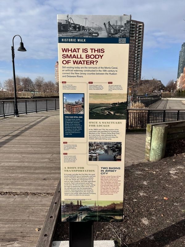
Still existing today are the remnants of the Morris Canal, an artificial waterway constructed in the 19th century to connect the New Jersey counties between the Hudson and Delaware Rivers.
You Can Still See
The Sugar House, located just off the canal at the corner of Washington and Essex Streets, is now residences but was once a warehouse of the American Sugar Refining Company. In the early 1900's, the company would refine more than 5,000 barrels of sugar a day.
Once a Sanctuary for Locals
In the 1960's and '70s, this section of the canal basin was populated by houseboats. Members of the "Greene Street Boat Club," as it was known, were attracted by the opportunity to live rent-free and enjoy this modest, self-made fishing camp.
A Boon for Transportation
At its peak, just after the Civil War, the canal shuttled 900,000 tons of anthracite coal from mines in Northern Pennsylvania to markets in the east. Boats also transported iron as well as crops, livestock, and other agricultural products. Each mule-powered canal boat could carry 70 tons of cargo at a time, taking five days to traverse the entire canal. Once the railroads took over the transportation industry—slashing transport time along the route to a mere eight hours—the canal was leased to the Lehigh Valley Railroad Company, which used it to extend its rail network.
Two Basins in Jersey City
Workers in Jersey City dug a 40-foot-wide dry channel, called the Little Basin (directly in front of you) to connect the canal to the Hackensack River. The Big Basin, just further south, was created two decades later to accommodate larger wharves and piers. The two now mark the edge of Liberty State Park. Today, efforts are underway to translate much of the canal path for recreational use, helping to realize a vision for the Morris Canal Greenway.
[Timeline:]
1824: The New Jersey state legislature charters the Morris Canal & Banking Company to fund the canal's construction.
1831: Construction begins on the canal to establish a route from Jersey City to Phillipsburg, New Jersey, on the Delaware River.
1836: The canal is extended from Newark to the Hudson River in Jersey City, completing 102 miles of waterway, with dozens of locks.
1923: Use of the Morris Canal ends, as railroads come to dominate travel. The following year a plan is adopted to drain and dismantle it.
2019: Jersey City receives a grant from the U.S. Environmental Protection Agency to identify sites along the canal route, as part of a greenway initiative spanning its full 102 miles.
Erected by
![What Is This Small Body of Water? Marker [Reverse]. Click for full size. What Is This Small Body of Water? Marker [Reverse] image. Click for full size.](Photos7/769/Photo769931.jpg?115202494400AM)
Photographed By Devry Becker Jones (CC0), January 14, 2024
2. What Is This Small Body of Water? Marker [Reverse]
Topics and series. This historical marker is listed in these topic lists: Industry & Commerce • Parks & Recreational Areas • Railroads & Streetcars • Waterways & Vessels. In addition, it is included in the Morris Canal series list. A significant historical year for this entry is 1824.
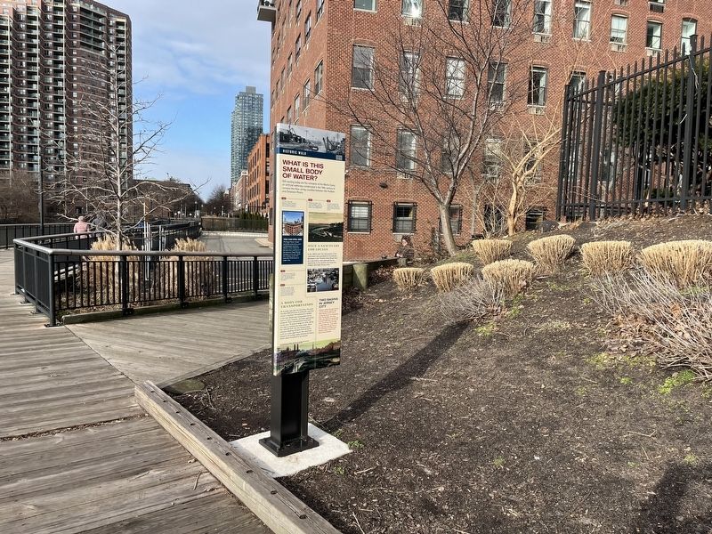
Location. 40° 42.737′ N, 74° 2.183′ W. Marker is in Jersey City, New Jersey, in Hudson County. It is in Colgate Center. Marker can be reached from Greene Street, 0.1 miles south of Essex Street, on the left when traveling south. Touch for map. Marker is at or near this postal address: 26 Greene St, Jersey City NJ 07302, United States of America. Touch for directions.
Other nearby markers. At least 8 other markers are within walking distance of this marker. General Nathanael Greene Park (within shouting distance of this marker); The Historic Trilogy (within shouting distance of this marker); How Is Jersey City the Gateway to Ellis Island? (about 300 feet away, measured in a direct line); The Morris Canal Big Basin (about 400 feet away); The Morris Canal Little Basin (about 400 feet away); The Morris Canal (about 400 feet away); Korean War Veterans of Hudson County (about 700 feet away); How Did the Colgate Clock Get Here? (about 800 feet away). Touch for a list and map of all markers in Jersey City.

Photographed By Devry Becker Jones (CC0), January 14, 2024
3. What Is This Small Body of Water? Marker
![What Is This Small Body of Water? Marker [Reverse]. Click for full size. What Is This Small Body of Water? Marker [Reverse] image. Click for full size.](Photos7/769/Photo769930.jpg?115202494000AM)
Photographed By Devry Becker Jones (CC0), January 14, 2024
4. What Is This Small Body of Water? Marker [Reverse]
Credits. This page was last revised on January 15, 2024. It was originally submitted on January 15, 2024, by Devry Becker Jones of Washington, District of Columbia. This page has been viewed 51 times since then. Photos: 1, 2, 3, 4. submitted on January 15, 2024, by Devry Becker Jones of Washington, District of Columbia.