Vinton in Benton County, Iowa — The American Midwest (Upper Plains)
Minne Estema Park
The "Sleeping Waters" of the Cedar River
In the beginning…
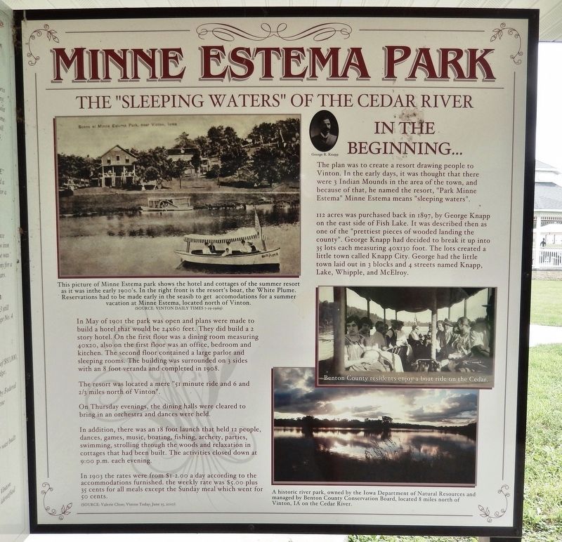
The plan was to create a resort drawing people to Vinton. In the early days, it was thought that there were 3 Indian Mounds in the area of the town, and because of that, he named the resort, "Park Minne Estema". Minne Estema means "sleeping waters".
112 acres was purchased back in 1897, by George Knapp on the east side of Fish Lake. It was described then as one of the "prettiest pieces of wooded landing the county". George Knapp had decided to break it up into 35 lots each measuring 40x130 foot. The lots created a little town called Knapp City. George had the little town laid out in 3 blocks and 4 streets named Knapp, Lake, Whipple, and McElroy.
In May of 1901 the park was open and plans were made to build a hotel that would be 24x60 feet. They did build a 2 story hotel. On the first floor was a dining room measuring 40x20, also on the first floor was an office, bedroom and kitchen. The second floor contained a large parlor and sleeping rooms. The building was surrounded on 3 sides with an 8 foot veranda and completed in 1908.
The resort was located a mere "51 minute ride and 6 and 2/3 miles north of Vinton".
On Thursday evenings, the dining halls were cleared to bring in an orchestra and dances were held.
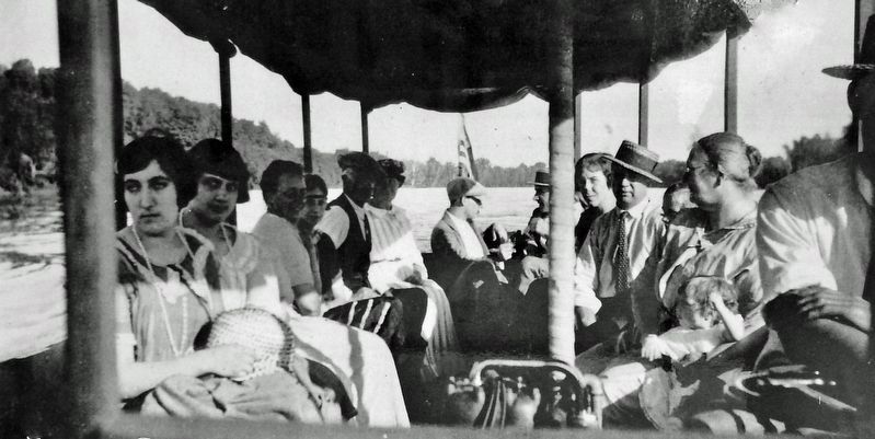
In addition, there was an 18 foot launch that held 12 people, dances, games, music, boating, fishing, archery, parties, swimming, strolling through the woods and relaxation in cottages that had been built. The activities closed down at 9:00 p.m. each evening.
In 1903 the rates were from $1-2.00 a day according to the accommodations furnished. The weekly rate was $5.00 plus 35 cents for all meals except the Sunday meal which went for 50 cents.
(Source: Valerie Close; Vinton Today; June 15, 2010)
[other photo captions]
• George R. Knapp
• A historic river park, owned by the Iowa Department of Natural Resources and managed by Benton County Conservation Board, located 8 miles north of Vinton, IA on the Cedar River.
Topics. This historical marker is listed in these topic lists: Entertainment • Parks & Recreational Areas • Waterways & Vessels. A significant historical month for this entry is May 1901.
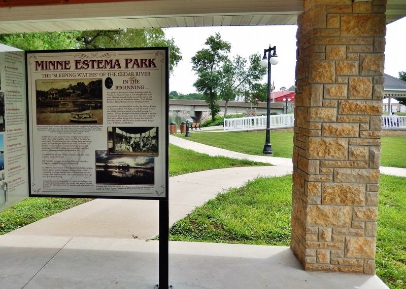
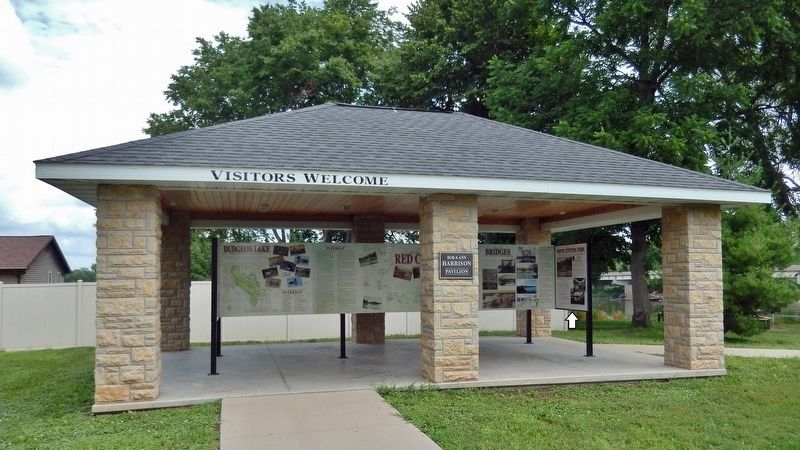
Location. 42° 10.211′ N, 92° 1.502′ W. Marker is in Vinton, Iowa, in Benton County. Marker can be reached from the intersection of A Avenue and West 1st Street, on the right when traveling north. The marker is located in the Cedar River interpretive kiosk at the Harrison Pavilion on the north side of Celebration Park. Touch for map. Marker is at or near this postal address: 105 West 2nd Street, Vinton IA 52349, United States of America. Touch for directions.
Other nearby markers. At least 8 other markers are within walking distance of this marker. Flooding of the Cedar River (here, next to this marker);
Source: Vinton Daily Times, 7/19/1969
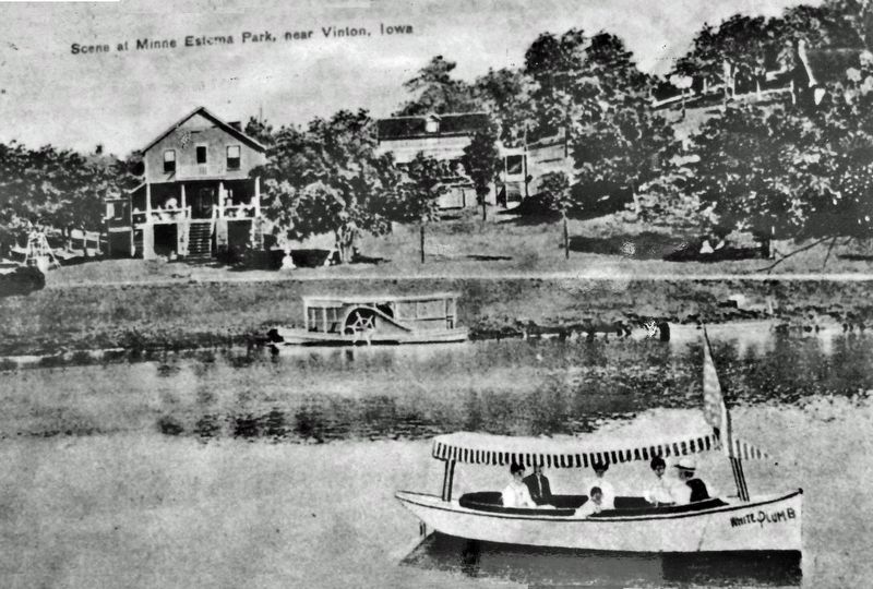
2. Marker detail: Minne Estema Park, early 1900’s
This picture of Minne Estema park shows the hotel and cottages of the summer resort as it was in the early 1900's. In the right front is the resort's boat, the White Plume. Reservations had to be made early in the season to get accommodations for a summer vacation at Minne Estema, located north of Vinton.
Also see . . .
1. Minne Estema. Excerpt:
The hotel had 15 rooms, one bath, a large dining room with music room opening off it, kitchen and living room A porch with many rocking chairs was on the side facing the Red Cedar River. Stables were built to accommodate horses and carriages of the guests. The Iowa Conservation Commission purchased the area in 1954, the 100th anniversary of George Knapp’s birth, from Esther Knapp. The area is now a park with shelter houses and playground equipment. Large limestone rocks can be found that were used in the hotel’s foundation.(Submitted on January 19, 2024, by Cosmos Mariner of Cape Canaveral, Florida.)
2. Minne Estema State Park. Excerpt:
Once home to a popular resort and riverboat stop, this hidden gem now offers camping, an open-air shelter, pit restroom, shoreline fishing, and high-water river access. In 1901, George R. Knapp built a cottage for his family and eventually built a second cottage and a hotel resort that included 15 rooms to accommodate relatives and friends. Stables were also built to accommodate horses and carriages of the guests. The ship “Export” would stop at Minne Estema going to and from Waterloo and Cedar Rapids.(Submitted on January 19, 2024, by Cosmos Mariner of Cape Canaveral, Florida.)
Credits. This page was last revised on January 19, 2024. It was originally submitted on January 18, 2024, by Cosmos Mariner of Cape Canaveral, Florida. This page has been viewed 49 times since then. Photos: 1, 2, 3. submitted on January 18, 2024, by Cosmos Mariner of Cape Canaveral, Florida. 4, 5. submitted on January 19, 2024, by Cosmos Mariner of Cape Canaveral, Florida.
