Rochelle in Madison County, Virginia — The American South (Mid-Atlantic)
Cavalry Engagement at Jack’s Shop
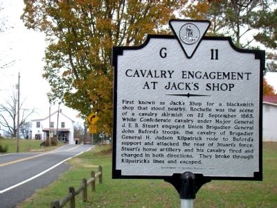
Photographed by J. J. Prats, October 31, 2009
1. Cavalry Engagement at Jack’s Shop Marker
Erected 1990 by Department of Historic Resources. (Marker Number G-11.)
Topics and series. This historical marker is listed in this topic list: War, US Civil. In addition, it is included in the Virginia Department of Historic Resources (DHR) series list. A significant historical date for this entry is September 22, 1863.
Location. 38° 17.379′ N, 78° 16.236′ W. Marker is in Rochelle, Virginia, in Madison County. It is on South Blue Ridge Turnpike just south of Beautiful Run Road (County Route 621), on the left when traveling south. Routes 231 and 621 share the pavement that passes by the marker. Touch for map. Marker is in this post office
this page online

Regionally, this marker is in Northern Virginia and in the Piedmont. It is also in the American South and specifically in the Upper South. Globally, it is in North America, the Western Hemisphere, the Western World, and the Anglosphere. Historically, it finds itself in what was once the territory of the Mississippian Culture, one of the original Thirteen Colonies, one of the Confederate States of America, and the Antebellum South.
Other nearby markers. At least 8 other markers are within 7 miles of this marker, measured as the crow flies: Battle of Jack’s Shop (approx. 1.3 miles away); Oliver Dinwiddie Tucker (approx. 3.9 miles away); Greene County / Madison County (approx. 4 miles away); Joseph Early Home (approx. 4 miles away); The Fallen Warriors Monument (approx. 6.3 miles away); Madison County Confederate Dead (approx. 6.3 miles away); Cpl. Clinton Greaves (1855-1906) (approx. 6.3 miles away); Madison County Courthouse (approx. 6.3 miles away).
More about this marker. This marker replaced an older marker with the same number that dated
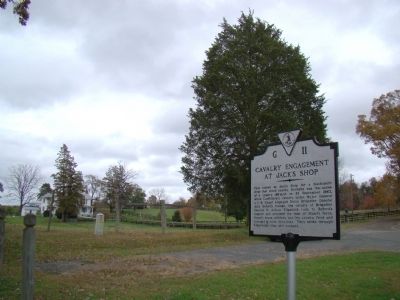
Photographed by J. J. Prats, October 31, 2009
2. Cavalry Engagement at Jack’s Shop Marker
Credits. This page was last revised on June 16, 2016. It was originally submitted on November 1, 2009, by J. J. Prats of Powell, Ohio. This page has been viewed 2,585 times since then and 102 times this year. Photos: 1, 2. submitted on November 1, 2009, by J. J. Prats of Powell, Ohio.
