Old Town in Alexandria, Virginia — The American South (Mid-Atlantic)
Shipbuilding at Point Lumley
City of Alexandria, est. 1749
— Alexandria Heritage Trail —
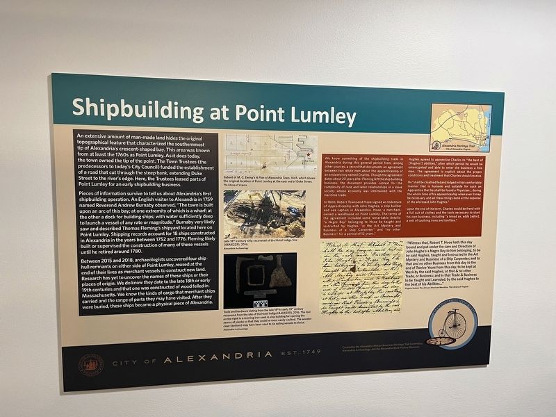
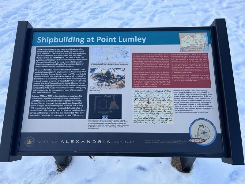
An extensive amount of man-made land hides the original topographical feature that characterized the southernmost tip of Alexandria's crescent-shaped bay. This area was known from at least the 1760s as Point Lumley. As it does today, the town owned the tip of the point. The Town Trustees (the predecessors to today's City Council) funded the establishment of a road that cut through the steep bank, extending Duke Street to the river's edge. Here, the Trustees leased parts of Point Lumley for an early shipbuilding business.
Pieces of information survive to tell us about Alexandria's first shipbuilding operation. An English visitor to Alexandria in 1759 named Reverend Andrew Burnaby observed, "The town is built upon an arc of this bay; at one extremity of which is a wharf; at the other a dock for building ships; with water sufficiently deep to launch a vessel of any rate or magnitude." Burnaby very likely saw and described Thomas Fleming's shipyard located here on Point Lumley. Shipping records account for 18 ships constructed in Alexandria in the years between 1752 and 1776. Fleming likely built or supervised the construction of many of these vessels until he retired around 1780.
Between 2015 and 2018, archaeologists uncovered four ship hull remnants on either side of Point Lumley, reused at the end of their lives as merchant vessels to construct new land. Research has yet to uncover the names of these ships or their places of origin. We do know they date to the late 18th or early 19th centuries and that one was constructed of wood felled in Massachusetts. We know the kinds of cargo that merchant ships carried and the range of ports they may have visited. After they were buried, these ships became a physical piece of Alexandria.
We know something of the shipbuilding trade in Alexandria during this general period from, among other sources, a record that documents an agreement between two white men about the apprenticeship of an enslaved boy named Charles. Though the agreement dates about 20 years after Fleming left the ship building business, the document provides context for the complexity of race and labor relationships in a slave society whose economy was intertwined with the maritime trade.
In 1800, Robert Townsend Hooe signed an Indenture of Apprenticeship with John Hughes, a ship builder and sea captain in Alexandria. Hooe, a merchant, owned a warehouse on Point Lumley. The terms of the agreement included some remarkable details: "a Negro Boy" belonging to Hooe by taught and instructed by Hughes "in the Art Mystery and Business of a Ship Carpenter" and "no other Business" for a period of 12 years."
Hughes agreed to apprentice Charles to "the best of
He "shall be clothed and fed and lodged in that comfortable manner that is humane and suitable for such an Apprentice that he shall be found a Physician… during the whole time of his apprenticeship when ever it may be necessary and all these things done at the expense of the aforesaid John Hughes."
Upon the End of the term, Charles would be freed with a full suit of clothes and the tools necessary to start his own business, including "a broad ax, adds [adze], a sett of caulking irons and tool box."
"Witness that, Robert T. Hooe hath this day bound and put under the care and Direction of John Hughe's a Negro Boy to him belonging, to be by said Hughes, taught and Instructed in the Art Mystery and Business of a Ship Carpenter; and to that and no other Business from this day to the end of Twelve Years from this day, to be kept at Work by the said Hughes, at that & no other Trade, or Business; and in that Trade & Business to be Taught and Learnded, by the said Hughes to the best of his Abilities…"
Virginia Untold: The African American Narrative, The Library of Virginia
[Captions:]
Subset

Photographed By Devry Becker Jones (CC0), January 20, 2024
3. Shipbuilding at Point Lumley Marker inside the Torpedo Factory Art Center Marker
Late 18th-century ship excavated at the Hotel Indigo Site (44AX229), 2016.
Tools and hardware dating from the late 18th to early 19th century recovered from the site of the Hotel Indigo (44AX229), 2016. The tool on the right is a reeming iron used in ship building for opening the seams of plans so that they could be more easily caulked. The wooden cleat (bottom) may have been used to tie sailing vessels to docks.
Erected by City of Alexandria, Virginia. (Marker Number 8.)
Topics and series. This historical marker is listed in these topic lists: African Americans • Anthropology & Archaeology • Industry & Commerce • Waterways & Vessels. In addition, it is included in the Virginia, The City of Alexandria series list. A significant historical year for this entry is 1759.
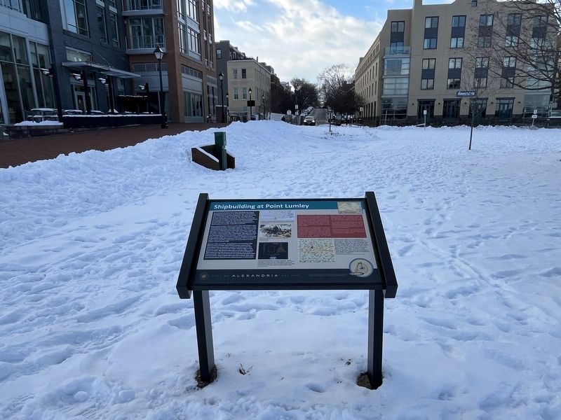
Location. 38° 48.108′ N, 77° 2.362′ W. Marker is in Alexandria, Virginia. It is in Old Town. Marker is on Duke Street east of The Strand, on the left when traveling east. Touch for map. Marker is at or near this postal address: 3 Duke Street, Alexandria VA 22314, United States of America. Touch for directions.
Other nearby markers. At least 8 other markers are within walking distance of this marker. Alexandria Waterfront (within shouting distance of this marker); Waterfront Archaeology (about 400 feet away, measured in a direct line); Industrialization of the Strand (about 400 feet away); ODBC (about 400 feet away); A Rich History on the Alexandria Waterfront (about 400 feet away); a different marker also named ODBC (about 400 feet away); The River Queen (about 500 feet away); Shipyard Park (about 600 feet away). Touch for a list and map of all markers in Alexandria.
Credits. This page was last revised on January 21, 2024. It was originally submitted on January 21, 2024, by Devry Becker Jones of Washington, District of Columbia. This page has been viewed 52 times since then. Photos: 1, 2, 3. submitted on January 21, 2024, by Devry Becker Jones of Washington, District of Columbia.

