Manassas, Virginia — The American South (Mid-Atlantic)
Wartime Manassas
Confederates Withdraw to Richmond
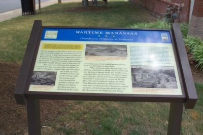
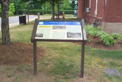
You are standing in the midst of what was a smoking ruin in March 1862. By mid-February, as the Union threat to Richmond mounted, Confederate President Jefferson Davis had ordered Gen. Joseph E. Johnston to withdraw his forces from northern Virginia to defend the capital. Johnston began the monumentally difficult task on February 23.
For some time, Johnston had begged the Confederate quartermaster office to reduce the volume of supplies shipped here, but they continued to pile up. Huge numbers of boxes and trunks of food, clothing, and personal items jammed the junction's sidings. The Orange and Alexandria Railroad laid a mile-long double track to accommodate all the loaded boxcars and also built several freight storage sheds.
When Johnston began the first large-scale military withdrawal of the war, mud-choked roads and lack of wagons forced him to rely on the railroads. The lack of boxcars, the limited capacity of the lines, and the panicking civilian population made it impossible to remove all the supplies. The last Confederate soldiers withdrew from Manassas Junction on March 9, burning more than a million pounds of provisions, tearing up track, and destroying railroad bridges over the Shenandoah and Rappahannock Rivers.
“A column of smoke indicates that Manassas was on fire. The large machine shops, the station houses, the commissary, and the quartermaster's store houses all in ashes. On the track stood the wreck of a locomotive, and not far down the remains of four freight cars which had been bombed. To the right five-hundred barrels of flour had been stove in, and two hundred barrels of vinegar and molasses had been allowed to try experiments in chemical combination. Some fifty pounds of pork and beef had been scattered around in the mud, and a few hundred yards down the track dense clouds of smoke were rising from the remains of a factory [for] rendering of tallow and boiling bones.” —Philadelphia Enquirer reporter, March 11, 1862
Erected by Virginia Civil War Trails.
Topics and series. This historical marker is listed in these topic lists: Railroads & Streetcars • War, US Civil. In addition, it is included in the Virginia Civil War Trails, and the Virginia, Wartime Manassas Walking Tour series lists. A significant historical month for this entry is February 1862.
Location. 38° 45.073′ N, 77° 28.228′ W. Marker is in Manassas, Virginia. Marker is at the intersection of Center Street (Virginia Route 28) and East Street, on the right when traveling east on Center Street. Touch for map. Marker is at or near this postal address: 9025 Center S, Manassas VA 20110, United States of America. Touch for directions.
Other nearby markers. At least 8 other markers are within walking distance of this marker. Harry J. Parrish (a few steps from this marker); Steam Locomotive Tire Fire Alarm – 1909 (a few steps from this marker); The Right to Vote (a few steps from this marker); Manassas 1906 (about 300 feet away, measured in a direct line); Defenses of Manassas (about 300 feet away); 9366 Main Street (about 400 feet away); Our Story Continues (about 400 feet away); Manassas Presbyterian Church (about 400 feet away). Touch for a list and map of all markers in Manassas.
More about this marker. One in the series of Wartime Manassas Virginia Civil War Trails Marker.
Related markers. Click here for a list of markers that are related to this marker. To better understand the relationship, study each marker in the order shown.
Also see . . .
1. Manassas, Va. Orange and Alexandria Railroad wrecked by retreating Confederates. Photograph used in the marker. (Submitted on August 22, 2006.)
2. Manassas Junction. Photograph of denuded area near tracks from Gardner's Photographic Sketchbook of the War (Submitted on August 24, 2006.)
Credits. This page was last revised on February 1, 2024. It was originally submitted on August 22, 2006, by Tom Fuchs of Greenbelt, Maryland. This page has been viewed 2,078 times since then and 29 times this year. Last updated on January 26, 2024. Photos: 1, 2. submitted on August 22, 2006, by Tom Fuchs of Greenbelt, Maryland. 3. submitted on September 3, 2007, by Craig Swain of Leesburg, Virginia. • Bernard Fisher was the editor who published this page.


