Near Oxford in Butler County, Ohio — The American Midwest (Great Lakes)
The Doty Settlement / The Pioneer Farmstead
Side A: The Doty Settlement
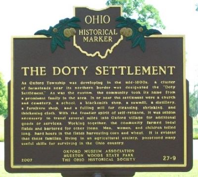
As Oxford Township was developing in the mid-1800s, a cluster of farmsteads near its northern border was designated the "Doty Settlement." As was the custom, the community took its name from a prominent family in the area. In or near the settlement were a church and cemetery, a school, a blacksmith shop, a sawmill, a distillery, a furniture shop, and a fulling mill for cleansing, shrinking, and thickening cloth. With the frontier spirit of self-reliance, it was seldom necessary to travel several miles into Oxford village for additional goods or services. Working together, the community farmed local fields and bartered for other items. Men, women, and children toiled long, hard hours in the fields harvesting corn and wheat. It is evident that these families, living in an agricultural society, possessed many useful skills for surviving in the Ohio country.
Side B: The Pioneer Farmstead
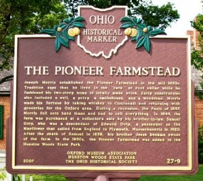
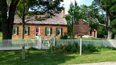
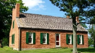
Joseph Morris established the Pioneer Farmstead in the mid-1830s. Tradition says that he lived in the "cave" or root cellar while he fashioned his two-story home of locally made brick. Early construction also included a well, a privy, a smokehouse, and a woodshed. Morris made his fortune by taking whiskey to Cincinnati and returning with groceries for the Oxford area. During a recession, the Panic of 1837, Morris fell onto hard times and had to sell everything. In 1844, the farm was purchased at a collector's sale by his brother-in-law, Samuel Doty, who was a descendant of Edward Doty, a passenger on the Mayflower that sailed from England to Plymouth, Massachusetts in 1620. After the death of Samuel in 1859, his brother Jesse became owner of the farm. In the 1950s, the Pioneer Farmstead was added to the Hueston Woods State Park.
Erected 2007 by Oxford Museum Association, Hueston Woods State Park, and The Ohio Historical Society. (Marker Number 27-9.)
Topics and series. This historical marker is listed in these topic lists: Agriculture • Industry & Commerce • Man-Made Features • Settlements & Settlers. In addition, it is included in the Ohio Historical Society / The Ohio History Connection series list. A significant historical year for this entry is 1837.
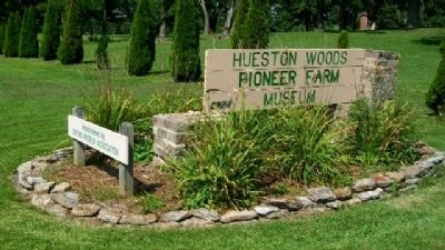
Location. 39° 33.618′ N, 84° 45.432′ W. Marker is near Oxford, Ohio, in Butler County. Marker is at the intersection of Brown Road and Doty Road, on the right when traveling north on Brown Road. Marker is at the Hueston Woods State Park Pioneer Farm Museum. Touch for map. Marker is at or near this postal address: 6924 Brown Road, Oxford OH 45056, United States of America. Touch for directions.
Other nearby markers. At least 8 other markers are within 4 miles of this marker, measured as the crow flies. The Restoration Movement / Doty Settlement Cemetery (approx. 0.2 miles away); The Black (Pugh's Mill) Covered Bridge (approx. 2.8 miles away); Historic Hopewell / Historic Hopewell Cemetery (approx. 3 miles away); Oxford (approx. 3.1 miles away); College Corner Veterans Memorial (approx. 3.1 miles away in Indiana); a different marker also named College Corner Veterans Memorial (approx. 3.2 miles away in Indiana); The Union School 1893-2004 (approx. 3.2 miles away); Wanted by the FBI / Captured by G-Men (approx. 3.3 miles away in Indiana). Touch for a list and map of all markers in Oxford.
Also see . . . The Doty Homestead. (Submitted on November 3, 2009, by William Fischer, Jr. of Scranton, Pennsylvania.)
Credits. This page was last revised on June 16, 2016. It was originally submitted on November 2, 2009, by William Fischer, Jr. of Scranton, Pennsylvania. This page has been viewed 3,211 times since then and 107 times this year. Photos: 1, 2, 3, 4, 5. submitted on November 2, 2009, by William Fischer, Jr. of Scranton, Pennsylvania.
