Tacony in Philadelphia in Philadelphia County, Pennsylvania — The American Northeast (Mid-Atlantic)
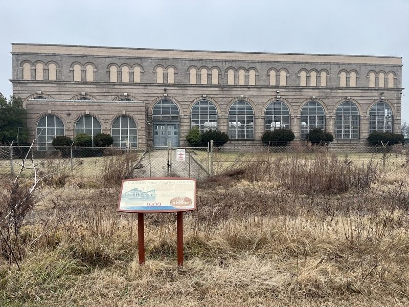
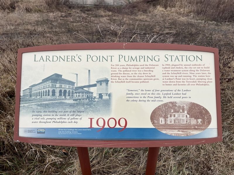
Lardner's Point Pumping Station
1909
For 200 years, Philadelphia used the Delaware River as a dump for sewage and industrial waste. The polluted river was a breeding ground for disease, so the city drew its drinking water from the cleaner Schuylkill River. But as the communities upstream grew, the Schuylkill itself became polluted.
In 1900, plagued by annual outbreaks of typhoid and cholera, the city set out to build a water treatment system along the Delaware and the Schuylkill rivers. Nine years later, the system was up and running. The station here at Lardner's Point was its hear, pumping clean water down from the Torresdale filtering plant to homes and factories all over Philadelphia.
In 1909, this building was part of the largest pumping station in the world. It still plays a vital role, pumping millions of gallons of water throughout Philadelphia each day.
"Somerset," the home of four generations of the Lardner family, once stood on this site. Lynford Lardner had connections to the Penn family. He held several posts in the colony during the mid-1700s.
[Caption:]
Of the four buildings that once stood here, only this building remains.
Erected by Philadelphia Parks & Recreation; Delaware River City Corp.
Topics. This historical marker is listed in these topic lists: Environment • Industry & Commerce • Natural Resources • Waterways & Vessels. A significant historical year for this entry is 1900.
Location. 40° 0.875′ N, 75° 2.82′ W. Marker is in Philadelphia, Pennsylvania, in Philadelphia County. It is in Tacony. Marker is on K&T Trail west of Levick Street, on the right when traveling west. Touch for map. Marker is at or near this postal address: 5202 Levick Street, Philadelphia PA 19135, United States of America. Touch for directions.
Other nearby markers. At least 8 other markers are within walking distance of this marker. Tacony-Palmyra Bridge (within shouting distance of this marker); Industry Along the River (within shouting distance of this marker); Bringing Back the River / One Site, Many Ecosystems (within shouting distance of this marker); Kensington and Tacony Railroad (within shouting distance of this marker); Tacony-Palmyra Ferry Company (about 300 feet away, measured in a direct line); Tidal Wetlands (about 300 feet away); Lardner's Point (about 300 feet away); Tacony / Wissinoming (about 300 feet away). Touch for a list and map of all markers in Philadelphia.

Photographed By Devry Becker Jones (CC0), January 26, 2024
2. Lardner's Point Pumping Station Marker
Credits. This page was last revised on January 30, 2024. It was originally submitted on January 30, 2024, by Devry Becker Jones of Washington, District of Columbia. This page has been viewed 46 times since then. Photos: 1, 2. submitted on January 30, 2024, by Devry Becker Jones of Washington, District of Columbia.
