Tacony in Philadelphia in Philadelphia County, Pennsylvania — The American Northeast (Mid-Atlantic)
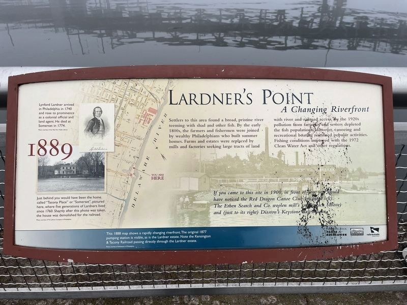
Lardner's Point
A Changing Riverfront
— 1889 —
Settlers to this area found a broad, pristine river teeming with shad and other fish. By the early 1800s, the farmers and fishermen were joined by wealthy Philadelphians who built summer homes. Farms and estates were replaced by mills and factories seeking large tracts of land with river and railroad access. By the 1920s pollution from factories and sewers depleted fish populations. However, canoeing and recreational boating remained popular activities. Fishing conditions improved with the 1972 Clean Water Act and other regulations.
If you came to this site in 1900, in front of you, you would have noticed the Red Dragon Canoe Club (pictured left) The Erben Search and Co. woolen mill's smokestack (above) and (just to its right) Disston's Keystone Saw Works.
[Captions:]
Lynford Lardner arrived in Philadelphia in 1740 and rose to prominence as a colonial official and land agent. He died at Somerset in 1774.
Just behind you would have been the home called "Tacony Place" or "Somerset", pictured here, where five generations of Lardners lived since 1760. Shortly after this photo was taken, the house was demolished for the railroad.
This 1888 map shows a rapidly changing riverfront. The original 1877 pumping station is visible, as is the Lardner estate. Note the Kensington & Tacony Railroad passing directly through the Lardner estate.
Erected by Philadelphia Parks & Recreation; Delaware River City Corp.; Rails-to-Trails Conservancy.
Topics. This historical marker is listed in these topic lists: Environment • Industry & Commerce • Settlements & Settlers • Waterways & Vessels. A significant historical year for this entry is 1972.
Location. 40° 0.857′ N, 75° 2.757′ W. Marker is in Philadelphia, Pennsylvania, in Philadelphia County. It is in Tacony. Marker can be reached from K&T Trail west of Levick Street, on the right when traveling east. Touch for map. Marker is at or near this postal address: 5202 Levick Street, Philadelphia PA 19135, United States of America. Touch for directions.
Other nearby markers. At least 8 other markers are within walking distance of this marker. Kensington and Tacony Railroad (within shouting distance of this marker); Tacony-Palmyra Ferry Company (within shouting distance of this marker); Tidal Wetlands (within shouting distance of this marker); Tacony-Palmyra Bridge (within shouting distance of this marker); Industry Along the River (within shouting distance of this marker); Tacony / Wissinoming (within shouting distance of this marker); Lardner's Point Pumping Station (about 300 feet away, measured in a direct
Credits. This page was last revised on January 30, 2024. It was originally submitted on January 30, 2024, by Devry Becker Jones of Washington, District of Columbia. This page has been viewed 40 times since then. Photos: 1, 2. submitted on January 30, 2024, by Devry Becker Jones of Washington, District of Columbia.

