Downtown East in Minneapolis in Hennepin County, Minnesota — The American Midwest (Upper Plains)
A Changing Landscape
— Mill Ruins Park —
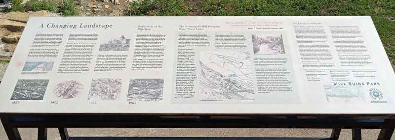
Mill Ruins Park embraces the flour-milling district that once lined the west bank of the Mississippi River at the heart of Minneapolis. Between 1858 and 1930, the milling district developed along the waterpower canal built here by the Minneapolis Mill Company. During this seventy-year period, Minneapolis became the nation's leading producer of flour, most of it manufactured in the twenty-five mills lining the canal.
Today, the Falls of St. Anthony, the power canal and tailraces, James J. Hill's Stone Arch Bridge, remnants of other early bridges, and the U.S. Army Corps of Engineers' Lock and Dam are among features that intersect within or near the park. The park is also framed by historic mill buildings now housing offices, a hotel, condominiums and apartments, and the Mill City Museum. The interior foundations of many of the mills that once lined the canal remain buried, awaiting further archaeological discovery.
The Greatest of All Great Opportunities of Minneapolis, from Plan of Minneapolis by Edward H. Bennett and Andrew W. Crawford.
Published by the Civic Commission, 1917.
Mill Ruins Park is the result of many years of planning for the future of the Minneapolis riverfront. In the 1880s, landscape architect H.W.S. Cleveland advanced the vision of a continuous public park along the river. In 1883, Cleveland proposed a system of parks and parkways for the City of Minneapolis and acknowledged that the Mississippi was "not only the grand natural feature which gives character to your city and constitutes the mainspring of its prosperity, but it is the object of vital interest and the center of attraction of intelligent visitors from every quarter of the globe." At the time, however, much of the riverfront was a bustling and successful industrial area underpinning the city's economy. The parkway idea was proposed again in 1917, when the Plan of Minneapolis by Edwin H. Bennett called for a downtown park lining both sides of the river.
The West Side Mills in 1905.
Following the demolition of most of the mills in the 1930s, the area was devoted primarily to warehousing and light manufacturing, which some former mill sites used for hydropower generation. The construction of the Upper Lock in 1960 closed the power canal, ending the waterpower era and beginning a new era of planning for riverfront revitalization. For the next thirty years, a gravel yard and parking lots occupied much of the area where the historic mills had stood.
Rediscovery of the Riverfront
Interest in the history of the Falls was sustained long after the flour mills closed. In 1968, the Fuji-Ya restaurant was built over the ruins of the Columbia Mill (1882), and people began to rediscover the area, with its view of the river and the Falls. In 1971, the St. Anthony Falls Historic District was listed on the National Register of Historic Places in recognition of the area's local and national significance. In 1983, archaeological excavations were begun to document the mill sites. New investors also became interested in the area, and, in 1987, the Crown Roller Mill, Standard Mill, and Ceresota Elevator were rehabilitated for new uses. The Minneapolis Park and Recreation Board acquired the Mill Ruins site for park development in 1988.
Today, Mill Ruins Park includes views of the changing landscape of the Falls, the source of power for the great milling district which once grew here. The power canal, mills, bridges, and the stories of their evolving technology are key parts of the landscape which can be experienced today.
1885 • 1925 • 1945 • 1965
The Minneapolis Mill Company Water Power Canal
There is, probably, no example in existence of so large an amount of power derived from so short a canal.James P. Frizell, hydraulic engineer, 1883
In 1857, the new Minneapolis Mill Company began a project which would build the city's reputation as the nation's leading flour producer. Following a model developed in Lowell, Massachusetts and other milling centers, the company built a canal and sold waterpower to milling companies and factories. The west side of the Mississippi– adjacent to the great energy source of the Falls of St. Anthony– provided an ideal site.
The power distribution system consisted of a dam, a "headrace" canal with inflow from the river regulated by a gatehouse, the main brick- and limestone-walled waterpower canal, and a "tailrace" canal which carried spent water back to the river. Each milling company built an individual headrace tunnel to draw water from the main canal into a flume leading to its turbines and an individual tailrace tunnel to return the spent flow to the main tailrace canal. The dam and the first 215 feet of the headrace and main canal were completed in 1858. Beginning at 5th Avenue South, the canal followed the route of present-day West River Parkway and was about 50 feet wide, widening beyond Portland Avenue to 66 feet. The water flow was controlled by gates in a gatehouse located between 5th and Portland Avenues. The canal was lengthened to 600 feet in 1867 and to 950 feet by 1885; it was also deepened at that time. Wood planking covered its length, and, in 1878, a railroad trestle was built above it to provide the mills with additional rail access
Utilizing the "New Process" manufacturing innovation to produce a high-grade flour from hard spring wheat, mill owners invested in new buildings and equipment. Between 1870 and 1880, sixteen new mills were constructed. By the 1880s, a total of about twenty-five flour mills, a woolen mill, a sawmill, and the city waterworks lined the canal in what was now the country's most densely-industrialized, direct-drive waterpower district.
By the 1930s, the decline of the flour-milling industry led to the demolition of many mills, although the canal and tailrace system continued to be used for hydroelectric power. In 1960, the water supply had its final cut-off with the construction of the U.S. Army Corps of Engineers' Upper Lock. The power-canal gatehouse was removed, while the canal and tailraces were left generally intact but backfilled with rubble. The route of the main canal was paved over and now lies under West River Parkway. The main tailrace was re-excavated in 2000-2001 as part of the development of Mill Ruins Park, carrying water for the first time in over forty years.
Atlas of the City of Minneapolis, C.M. Foote & Co., 1892.
Enlargement of the Minneapolis Mill Water Power Canal, 1890.
Mill Ruins Park abarca el distrito de molinos harineros que en un tiempo bordeaban la ribera occidental del Río Mississippi en el corazón de Minneapolis. El parque es el resultado de muchos años de plancamiento para el futuro de la zona ribereña de Minneapolis. Entre 1858 y 1930, el distrito se desarrolló a lo largo del canal de energía hidráulica construido aquí por la Minneapolis Mill Company en 1857. Durante este periodo de 70 años, Minneapolis se convirtió en el principal productor de harina de la nación, la mayor parte elaborada en los veinticinco molines que bordeaban el canal. La energía para impulsar estos molinos provenía de St. Anthony Falls, la cual estaba al lado y era la única catarata verdadera en el Mississippi.
El sistema de distribución de energía consistia de una represa, un "canal de alimentación" con el caudal de entrada del río regulado por una compuerta, el canal hiráulico principal y un "canal de descarga", que llevaba el agua de regreso al río. Cada compañía molinera construyó su propio subsistema para llevar agua del canal principal hacia sus turbinas y devolver el agua al canal de descarga. El canal seguía la ruta del actual West River Parkway y tenía aproximadamente sesenta pies de ancho. Estaba cubierto a todo lo largo por tablones de madera y sobre ellos se construyó un puente de caballetes para que los molinos tuvieran acceso adicional al ferrocarril.
Al comienzo, los métodos convencionales de molienda que fueron usados produjeron una harina gruesa y de baja calidad partiendo del trigo duro primaveral cosechado en Minnesota occidental. El desarrollo en la década de 1870 de un "Nuevo proceso" de molienda revolucionó el potencial comercial de la zona al producir harina de alta calidad partiendo de este trigo. Esto estimuló a los fabricantes a invertir en edificios y equipo nuevos. Al llegar a la década de 1880, el canal estaba bordeado por cerca de veinticinco molinos de harina, una fábrica de lana, un aserradero y las obras hidráulicas de la ciudad, en el distrito de energía hidráulica directa más densamente industrializado del país.
Para 1990 [sic] la energía hidráulica perdía importancia a medida que los molinos se convertín en fábricas que funcionaban con electricidad. La decadencia de los molinos empezó en la década de 1920, producto de cambios en las leyes arancelarias y del desarrollo de fuentes de energía hidroeléctrica en otras ciudades, que eran más baratas y más confiables. En 1930, Buffalo, Nueva York superó a Minneapolis en la producción de harina y Chicago y Kansas City también construyeron nuevos complejos de molienda. La mayoría de los molinos de Minneapolis quedaron parados.
Para la década de 1930 muchos de los molinos fueron demolidos, pero en general la infraestructura de energía hidráulica permaneció intacta bajo los escombros de demolición y el material de relleno. Hoy estas características históricas han sido excavadas y restauradas y mermiten percibir las historias del lugar que una vez hizo que Minneapolis fuera un líder mundial en la producción de harina.
Federal Highway Administration TEA-21 Program
City of Minneapolis
State of Minnesota
Minnesota Environment and Natural Resources Trust Fund
Legislative Commission on Minnesota Resources
Metropolitan Parks & Open Space Commission
Minneapolis Park & Recreation Board
Hennepin County
St. Anthony Falls Heritage Board
Topics. This historical marker is listed in these topic lists: Industry & Commerce • Parks & Recreational Areas • Waterways & Vessels. A significant historical year for this entry is 1858.
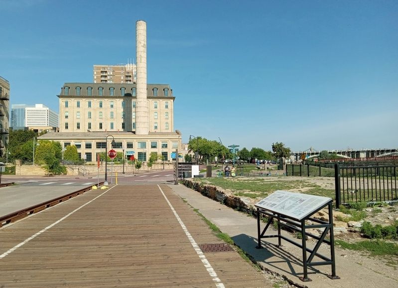
Location. 44° 58.797′ N, 93° 15.485′ W. Marker is in Minneapolis, Minnesota, in Hennepin County. It is in Downtown East. Marker is on W. River Parkway east of Portland Avenue, on the left when traveling east. Touch for map. Marker is at or near this postal address: 117 Portland Avenue S, Minneapolis MN 55401, United States of America. Touch for directions.
Other nearby markers. At least 8 other markers are within walking distance of this marker. Water: The waterpower harnessed from St. Anthony Falls gave life to the milling industry (within shouting distance of this marker); Mills and Millraces (within shouting distance of this marker); Minneapolis Underground (within shouting distance of this marker); Bricks and Mortar (within shouting distance of this marker); Bridges of the St. Anthony Falls Area (about 300 feet away, measured in a direct line); Historic Milling District (about 300 feet away); What is Urban Archaeology? (about 300 feet away); A Milling District Timeline (about 400 feet away). Touch for a list and map of all markers in Minneapolis.
Credits. This page was last revised on February 7, 2024. It was originally submitted on February 3, 2024, by McGhiever of Minneapolis, Minnesota. This page has been viewed 83 times since then. Photos: 1, 2. submitted on February 3, 2024, by McGhiever of Minneapolis, Minnesota. • J. Makali Bruton was the editor who published this page.

