DuPont Environmental Education Center near Wilmington in New Castle County, Delaware — The American Northeast (Mid-Atlantic)
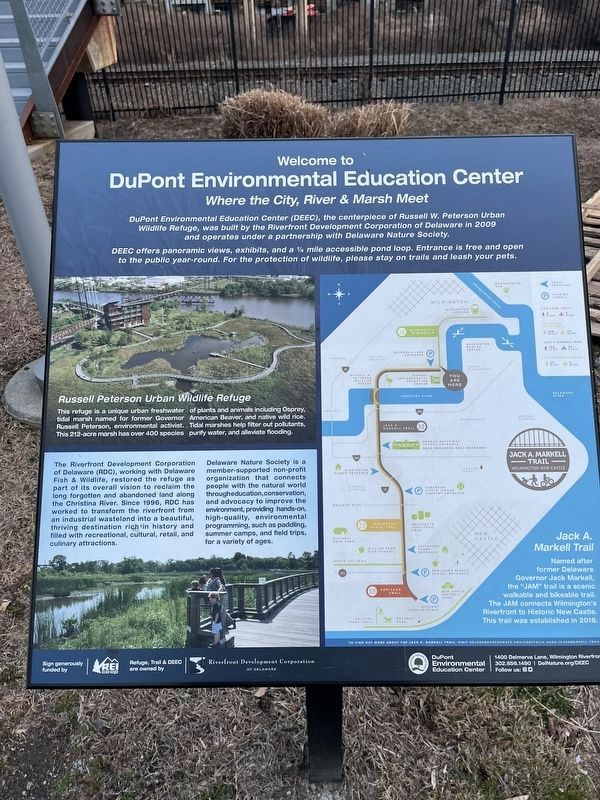
Welcome to DuPont Environmental Education Center
Where the City, River & Marsh Meet

Photographed By Devry Becker Jones (CC0), February 10, 2024
1. Welcome to DuPont Environmental Education Center Marker
DuPont Environmental Education Center (DEEC), the centerpiece of Russell W. Peterson Urban Wildlife Refuge, was built by the Riverfront Development Corporation of Delaware in 2009 and operates under a partnership with Delaware Nature Society.
DEEC offers panoramic views, exhibits, and a ¼ mile accessible pond loop. Entrance is free and open to the public year-round. For the protection of wildlife, please stay on trails and leash your pets.
Russell Peterson Urban Wildlife Refuge
This refuge is unique urban freshwater tidal marsh named for former Governor Russell Peterson, environmental activist. This 212-acre marsh has over 400 species of plants and animals including Osprey, American Beaver, and wild rice. Tidal marshes help filter pollutants, purify water, and alleviate flooding.
The Riverfront Development Corporation of Delaware, working with Delaware Fish & Wildlife, restored the refuge as part of its overall vision to reclaim the long forgotten and abandoned land along the Christina River. Since 1996, RDC has worked to transform the riverfront from industrial wasteland into a thriving destination rich in history and filled with recreational, cultural, retail, and culinary attractions.
Delaware Nature Society connects people with the natural world through education, conservation, and advocacy to help improve the environment, providing high-quality, interactive environmental programming, such as paddling, summer camps, and field trips, for a variety of ages.
Jack A. Markell Trail
Named after former Delaware Governor Jack Markell, the "JAM" trail is a scenic walkable and bikeable trail. The JAM connects Wilmington's Riverfront to Historic New Castle. This trail was established in 2018.
Erected by REI Co-op; Riverfront Development Corporation of Delaware; DuPont Environmental Education Center.
Topics. This historical marker is listed in these topic lists: Education • Environment • Industry & Commerce • Parks & Recreational Areas. A significant historical year for this entry is 2009.
Location. 39° 43.432′ N, 75° 33.692′ W. Marker is near Wilmington, Delaware, in New Castle County. It is in DuPont Environmental Education Center. Marker is on Delmarva Lane, 0.4 miles south of Judy Johnson Drive, on the left when traveling south. Touch for map. Marker is at or near this postal address: 1400 Delmarva Ln, Wilmington DE 19801, United States of America. Touch for directions.
Other nearby markers. At least 8 other markers are within walking distance of this marker. DuPont Environmental Education Center (here, next to this marker); Russell W. Peterson (about 300 feet away, measured in a direct line); Russell W. Peterson Urban Wildlife Refuge

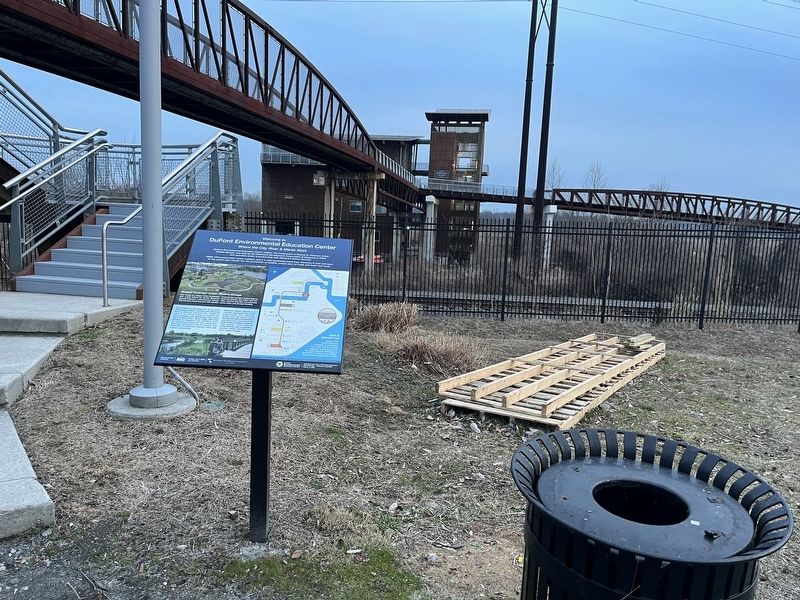
Photographed By Devry Becker Jones (CC0), February 10, 2024
2. Welcome to DuPont Environmental Education Center Marker
Related marker. Click here for another marker that is related to this marker. A marker with nearly identical information can be found nearby on the elevated trail.
Credits. This page was last revised on February 11, 2024. It was originally submitted on February 11, 2024, by Devry Becker Jones of Washington, District of Columbia. This page has been viewed 64 times since then. Photos: 1, 2. submitted on February 11, 2024, by Devry Becker Jones of Washington, District of Columbia.