Coos Bay in Coos County, Oregon — The American West (Northwest)
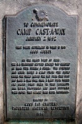
To Commemorate Camp Cast-A-Way
January 2, 1852
| — | First white settlement in what is now Coos County | — |
Photographed by Larry Wilson, August 1, 2008
1. Camp Cast-A-Way Marker
On the beach west of here the U.S. Transport Captain Lincoln was beached at high tide during a storm. The soldiers and crew built a camp from the sails under the trees across the bay from this spot and made a flag pole from a mast from which Old Glory first flew in this locality. All lives, provisions and army supplies were saved. They camped here until midsummer.
Erected 1956 by Coos Bay Chapter Daughters of the American Revolution (DAR).
Topics and series. This historical marker is listed in these topic lists: Settlements & Settlers • Waterways & Vessels. In addition, it is included in the Daughters of the American Revolution (DAR) series list. A significant historical date for this entry is January 2, 1852.
Location. 43° 22.892′ N, 124° 17.003′ W. Marker is in Coos Bay, Oregon, in Coos County. It is on South Empire Boulevard south of Wisconsin Avenue, on the right when traveling north. Touch for map. Marker is in this post office area: Coos Bay OR 97420, United States of America. Touch for directions.

Regionally, this marker is in Southern Oregon and specifically on the Oregon Coast. It is also on the American Pacific Coast, in the Pacific Northwest, and in the Lewis & Clark Corridor. Globally, it is in North America, on the Ring of Fire, on the Pacific Rim, in the Western Hemisphere, in the Western World, and in the Anglosphere.
Other nearby markers. At least 8 other markers are within 4 miles of this marker, measured as the crow flies: Lynching in America / Lynching in Coos County (approx. 3.6 miles away); Steve Roland Prefontaine (approx. 3.7 miles away); In Memory of Curtis Sause (1913-2001) (approx. 3.7 miles away); 340 Year Old Tree (approx. 3.7 miles away); Bay View Brewery / Guildesheim's 2nd Hand Hide & Junk Store (approx. 3.7 miles away); Welcome to the Oregon Coast (approx. 3.7 miles
this page online
Also see . . . Camp Castaway. Wikipedia entry (Submitted on January 12, 2022, by Larry Gertner of New York, New York.)
Photographed by Larry Wilson, August 1, 2008
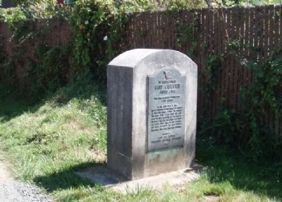
2. Camp Cast-A-Way Marker
Credits. This page was last revised on December 13, 2024. It was originally submitted on April 25, 2014, by Larry Wilson of Wareham, Massachusetts. This page has been viewed 763 times since then and 37 times this year. Last updated on February 13, 2024, by Carolyn Sanders of Plano, Texas. Photos: 1, 2. submitted on April 25, 2014, by Larry Wilson of Wareham, Massachusetts. • Devry Becker Jones was the editor who published this page.
